I recently posted about day 3 of our Northern Presidential traverse. We summited Mt. Washington as the finale of my pursuit of summiting the NH 48. However, thanks to terrible weather that day and the day before, we got a ride down to the base. We thought we could ride the cog back up another day and finish the hike. However, that doesn’t count for the patch. The ascent and descent need to be in a single hike. Much to my dismay.
After a summer of hiking in terrible weather, Rainbow and I would wait for a nice day in the forecast. My only concern was that it was already September, and winter conditions would be coming quickly to the summit of Mt. Washington. Day light hours get shorter and shorter and I knew this hike would take us a good amount of time. Finally a break in the forecast. Despite a hurricane headed our way, Friday’s forecast looked as good as you can hope for on Mt. Washington.
The plan was to camp nearby the night before, so we could get a nice early start, with a couple more hours of sleep. Then we would drive to the Cog’s Base Station and their hiker parking. While I don’t really want to support the cog, $10 meant we would shave off about a mile and a half, and not worry as much about our cars being broken into (a sad reality at some trailheads). We would ascend via Ammonoosuc Ravine trail (which we took for Mt. Monroe) to the Lakes of the Clouds hut (which we just stayed in a few weeks ago), then summit Washington, and return via Jewell trail.
We both tried out camping in our cars, which worked out really well, and meant less time packing up in the morning. We drove to Base Station, and were greeted with an actual view of Mt. Washington. So often the summit is in the clouds, it was a relief to see the forecast was correct.

We paid for our parking, and headed out.

The trail has a short spur from the station to Ammonoosuc Ravine trail, after that, it was familiar territory. When we last hiked it, it was very foggy and misty. Happily, it was dry this time. Ammo is a nice hike up to the Gem Pool.

We stopped for a break and some readjustments (re-tying my shoe and removing a rock). After the Gem Pool, the trail gets much steeper.

It’s always hard to judge steepness in a photo, but I’ll always try to capture it anyway.


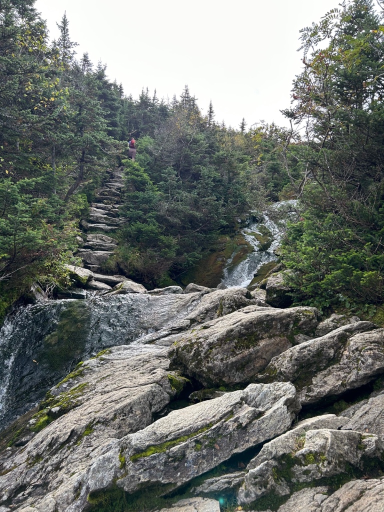
Lots of granite slabs and water crossings. This time, knowing I’d done them all twice before (ascent and descent), I was a lot more comfortable. Note in the bottom right photo, the trail going up some rock steps and another hiker going into the trees. Once you aren’t terrified of what’s to come, it’s really a lovely trail.


Again, it was nice to hike a trail we had already hiked. We knew what to expect, and we knew we could do whatever was ahead. We also had a better feel for when we’d get to the hut. We arrived at the hut and stopped in for a quick break. Always take advantage of a toilet, a place to wash your hands, and an actual bench on a hike. After our break, we headed out for the last portion of the ascent.
Now, we’d done this part as well, but it was just a few weeks ago and part of our Presi traverse. It had been windy and rainy. We couldn’t see more than a few feet ahead of us. The rocks were all wet. Not at all a good time and definitely no good views.

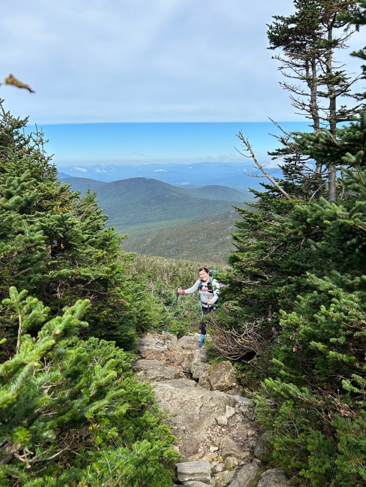
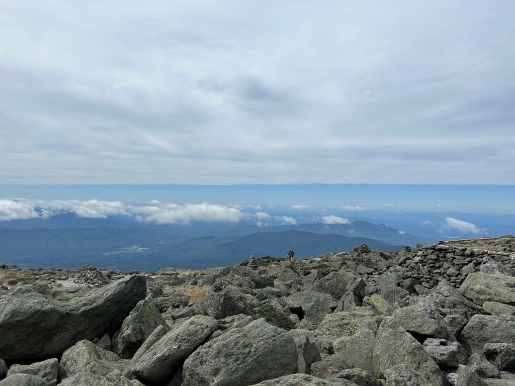
We had a different experience altogether. Views for miles and dry rocks. The sun tried to poke out occasionally. It was a bit windy, but not terrible, and actually felt good when you’re warm from hiking.


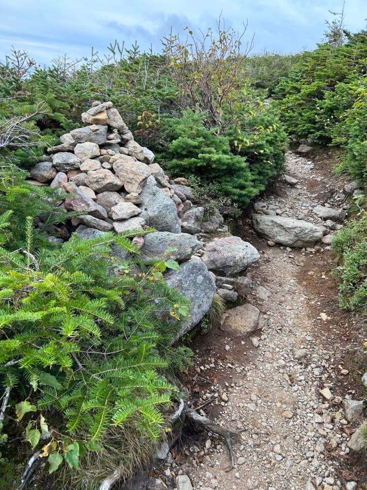
This is the trail. Marked by cairns. I’ve zoomed in and circled them on the right. While they’re easy to see when you’re standing by one, they can be harder to see in the distance. This was why I was so worried on our last hike that we would be hiking in the dark. There’s no way a headlamp would illuminate far enough away to be able to see where the next cairn is located.

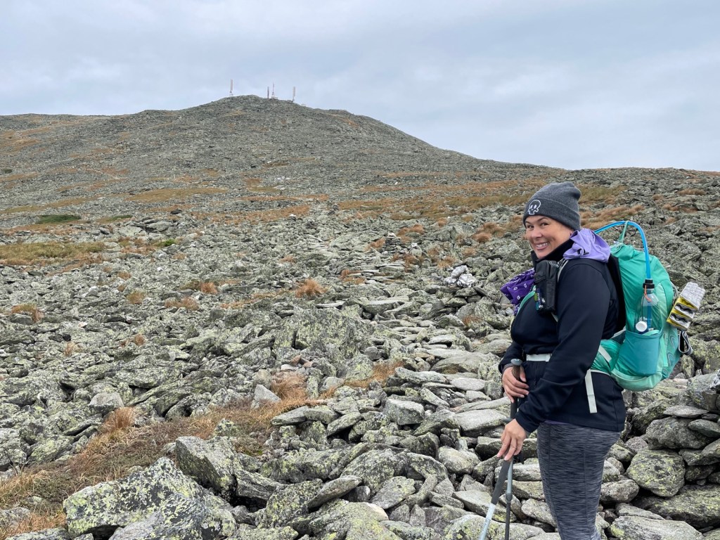


Me: Let’s keep moving, we want to be at the summit by 1PM. Also me: oooh, orange lichen!


It was a nice enough day, that I can see how people can be fooled into thinking it’s easy to climb Mt. Washington. We saw a family coming down, who clearly had driven or taken the cog up, and were exploring. They didn’t have any packs or water or anything. I could completely imagine them seeing how nice it was up there and thinking, we should come back and hike it sometime. Not realizing it’s how different and dangerous it can be. Or how much more the hike requires that just what they see at the summit.


Summit! Again! Much nicer weather conditions. Although they were doing some sort of construction, so there was machinery all over, and we kept hearing beeping as we ascended. Ah well, it’s not like we were expecting peace and quiet at one of the biggest tourist attractions in the area.
Another quick break (food, bathroom, sock change since I got one wet in one of the water crossings) and on to the important part, descending on foot. Also, these would be new trails to us.


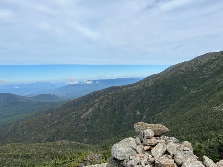
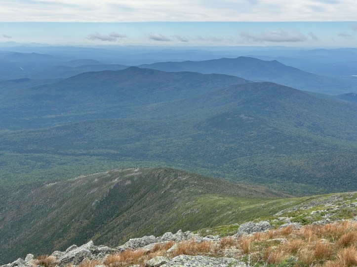
It’s wild to think that just a few weeks ago, we hiked over those mountains. I think it’s even harder to comprehend for us, because we didn’t have these views. We weren’t atop Jefferson lookin over to Adams or vice versa. We were on those summits and could barely see 20 feet away. Seeing them now, and knowing we walked over those. In a single day. Wild. If you zoom, you can sometimes see the trail as a sand colored line snaking over the summits.
Luckily, it was a short stretch. However, I’m not sure what was ahead was much better. It wasn’t scary in terms of heights, but it was quite a stretch of terrible footing. Just constantly watching how and where you step, with rocks moving under your feet. I was not a fan.

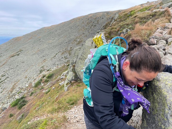
I stopped to gulp down some gummy bears, and Rainbow made me take this photo. It was actually sort of cool looking. It was a cairn, but one of the bottom rocks made it look like a throne. Of course, I was cranky and took a terrible photo. Sorry, Rainbow.
We finally got to the treeline. The terrain returned to normal White Mountains rocks and roots. We took the Base Station connector trail which ends with a water crossing JUST at Base Station. A water crossing with no good way across. So we both ended up with submerged feet and squished our way back to the parking lot.
I was worried about getting down before dark.

We made it with time to spare.
And somehow, could still see Mt. Washington.

Finish selfie…

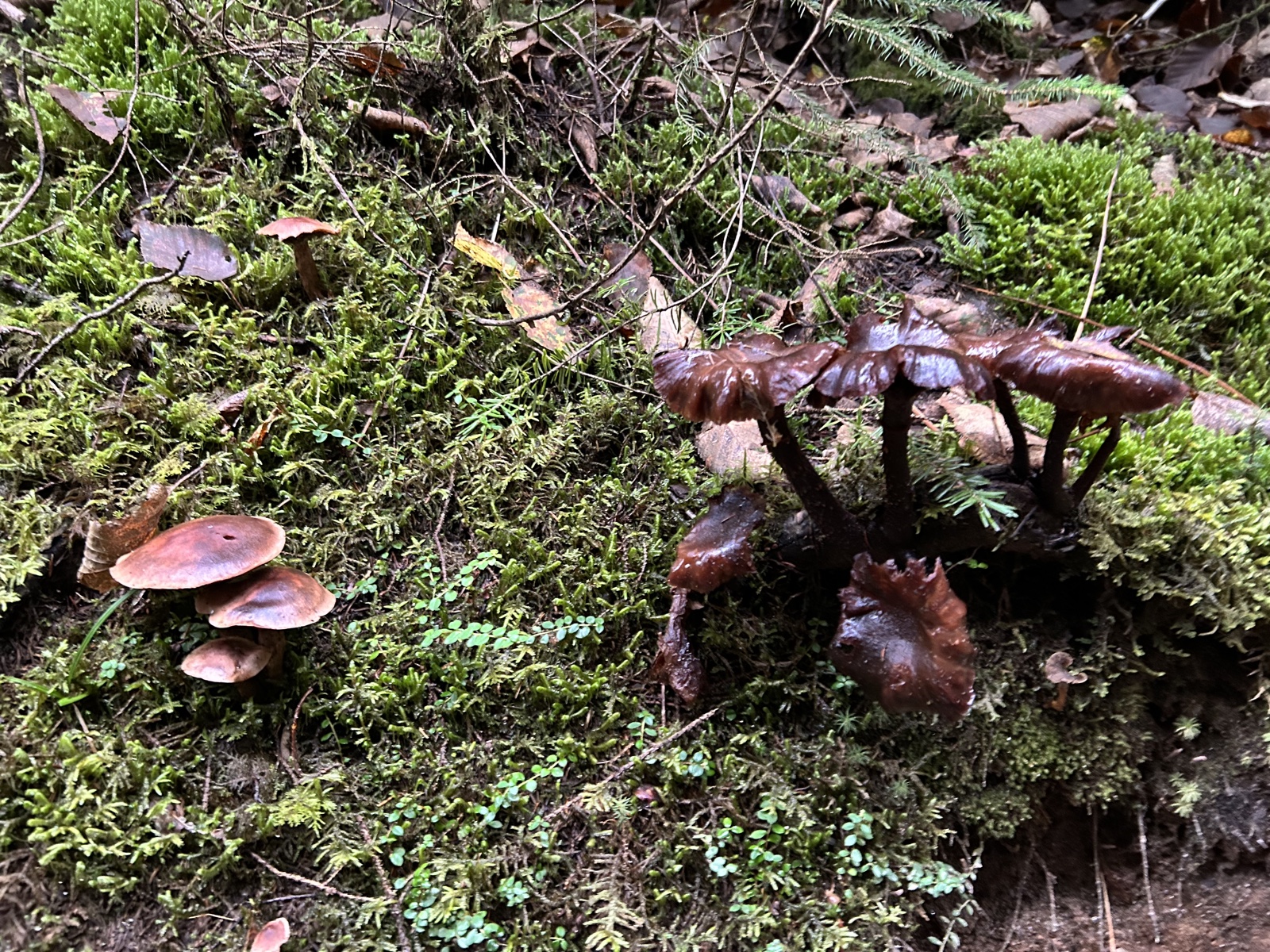
And no hike post is complete without some bonus mushroom photos

So having made it back, I’m done. 48 4000-footers complete.
- Distance: 8.6 miles
- Elevation gain: 3,900 feet
- Total time: 11 hours, 30 minutes
- Moving time: 9 hours, 16 minutes
