I attempted Wildcat D back in August of 2019 and had to bail less than 500 feet in distance away from the summit. I “redeemed” myself July of 2023 and made it to the summit, only to have the worst dehydration I’ve ever had and nearly calling SOS on the descent. So third time’s a charm?
Rainbow needed Wildcat D for her NH48, so I agreed to hike with her. Having had my fill of the Wildcat Ridge Trail, I suggested we take Polecat, which is actually a ski trail.
For comparison, the Wildcat Ridge Trail is 1.8 miles with 2,100 feet of gain. That 1.8 miles includes huge boulder steps and steep granite slabs, and is an “elective” for the Terrifying 25 list. Polecat, a ski trail, is about a half mile longer with roughly the same amount of gain. However, the ski trail in summer is mostly a gravel/rock access road and some steep grassy hills. So Polecat is easier from a conditions perspective, but still no slouch with a large amount of elevation gain over a short distance.


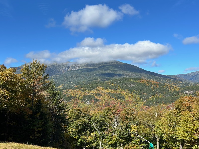
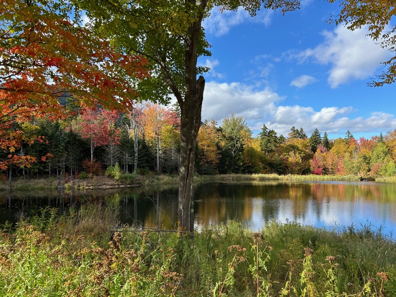
So we planned to meet at Wildcat Mountai Ski Resort at 10AM. Right off the bat, the views in the parking lot were spectacular! The leaves are just starting to turn.
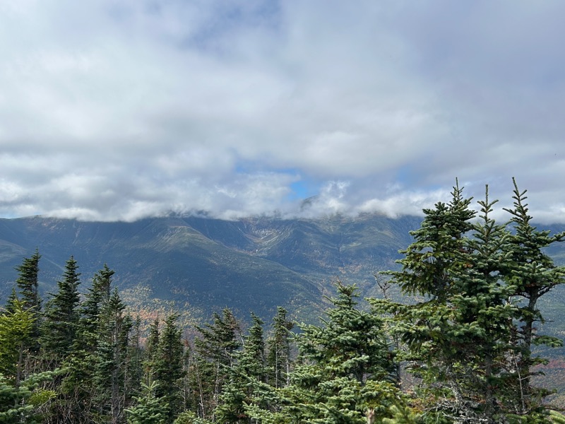
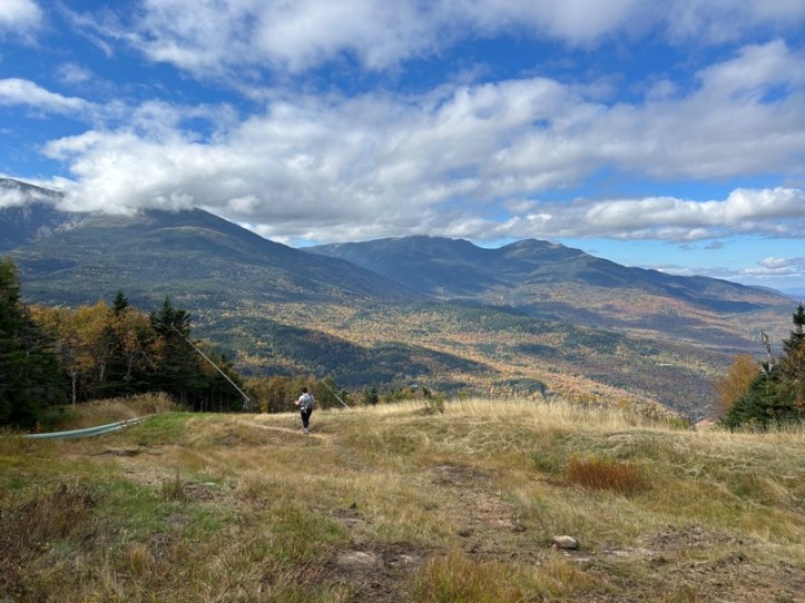
Being a ski trail, the trail is very open, which meant fantastic views the entire way. Unfortunately, the clouds never quite lifted off the top of Mt. Washington, but that didn’t stop us both from taking a ton of photos.
You can see one of the sprayers they use to make snow in winter in the left-hand photo.

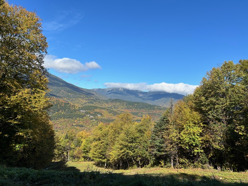
So many foliage photos. 🙂


While it may not be the best trail as far as ground conditions, it really was great to just stop and turnaround at any moment and see a great view. We needed those stops to catch our breath with the elevation gain, too.

Rainbow taking a photo of the awesome views

Speaking of Rainbow taking photos, she took this one which shows some of the steepness of the trail. We came up the trail on the right side of the photo. She’s standing in the turn and we continued up the trail on the left.

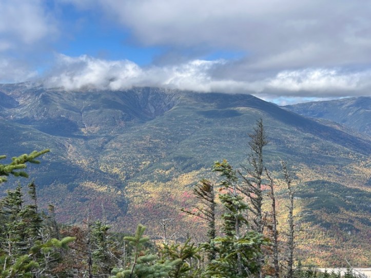
On the left in the clouds, Boott Spur and Washington. On the right, Adams and Madison.
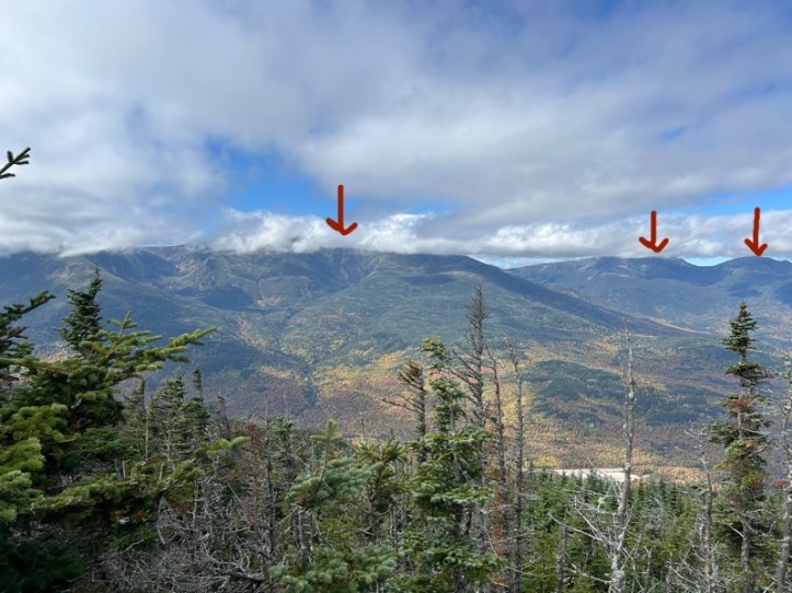
It’s incredibly cool to think that Rainbow and I have hiked from the far right arrow to the middle to the left arrow one day last year.
As I said, we took a lot of photos. One, it was beautiful. Two, we really needed those breaks to get our breathing and heart rates back to normal.
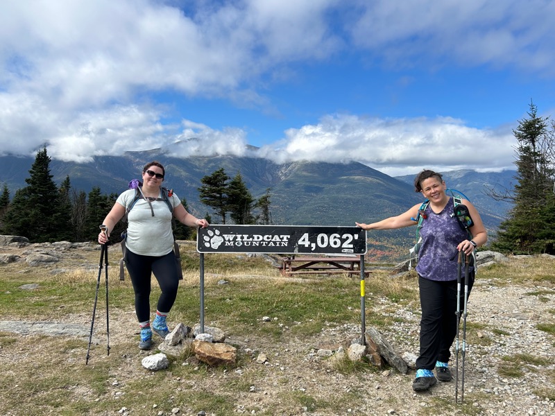
We made it to the “summit”, aka where the chair lift ends and there is a sign, a picnic table, and a ski patrol building. Also where I had made it with Right Turn, and I cried, and we bailed. There is still a bit more to go to the actual summit of Wildcat D. Oddly, there was a very home made looking sign stuck on a ski pole that said “Easier way to the summit”. We took it, and it may have been the only “hike” feeling part of the whole day. There is a viewing platform at the summit, where took the customary summit selfie.

A quick walk back down to the lift area, where we stopped for a break at the picnic table. There were a few people who had taken the lift up. We chatted with a gentleman who had come up Wildcat Ridge Trail to take photos and he ended up taking the lift back down. We saw a few other people throughout the day, though not as many as I expected given the great weather and start of foliage season.


Notice I said lift in this post, but also gondola. Well, when Right Turn and I were here and we bailed, we took a GONDOLA down. As we summitted this time, it was chair lifts. There happened to be someone at the ski patrol building and I asked about it. Apparently, they just auctioned off the gondolas and had replaced them with chair lifts a few years ago. The photo on the right is one of the remaining gondolas they have down by the resort.

The one view of the day towards Conway. Lots of mountains in this photo, including Kearsarge North and the Doubleheads.
We began our descent back down Polecat. At one point, a much older gentleman was pretty quickly hiking up the mountain. Not too much later, he passed us on the descent. At least he was nice enough to offer to take our photo. Nothing like being passed by someone who is likely 20 years older than you.


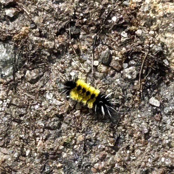
We saw some flowers and several caterpillars (though not as many as on Moosilauke!). Also I really need to put on my glasses when taking photos so I can be sure they’re in focus.
The way down meant we didn’t even have to turn around to enjoy the view.
That’s Rainbow enjoying a tiny flat part of the trial.


So many pics trying to capture the beauty!


And back to the base!

I drew on this trail map to show the black line is roughly what we took. The red line is Wildcat Ridge Trail. Ha!
- Total distance: 5.3 miles (unofficial since there is no official trail)
- Total elevation gain: 2,072 feet (unofficial)
- Total time: 5 hours, 12 minutes
- Moving time: 3 hours, 42 minutes
I should add here, that I expected this to take us 6 hours at least. Knowing how steep it would be and how I struggled in the past on this mountain. Happy to say we killed it! Just over five hours, including all rest breaks.
