Sub caption to this post: “Trail names, snakes, and a log roll contest”.
Back in March, you’ll recall we attempted Mt. Cabot and it wasn’t great.
We decided this weekend, we would do the Cabot loop (Mt. Cabot, The Bulge, and The Horn). Because the loop is more than 11 miles, we decided to break it up with an overnight!
Distance: 11.6
Total Hiking Time: 13:15
Ascent: 3,300 (more than two Empire State Buildings)
Day 1 plan: Park at Unknown Pond Trailhead, ascend via the York Pond Trail, see the Cabot Cabin, summit Cabot, hit The Bulge, hit The Horn, and descend to the Unknown Pond tentsite and camp. Over 7 miles and 3,000 feet of elevation gain.
Day 2 plan: Descend the last 3 miles to the parking lot and our cars.
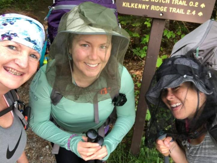
As you can see from the photo, we were prepared for bugs. Hats, headnets, permethrined clothes and gear.


Lots of pretty flowers on the trail. I’m not sure what the purple ones are on the left. On the right, lady slippers! We also saw lots of trillium.


Just before the summit, there is a the Mt. Cabot Cabin. It’s first come, first served and you can stay the night, however I’d heard it wasn’t the nicest place to stay and the tentsite would be a lot better. While the view was nice from the front porch, I have to agree, camping was the better choice.

After some steep, rocky climbs, we got the summit. A few feet from the summit sign, is this cairn, supposedly the true summit. No view from the summit, so we kept on.
We had hoped to stop at the spring just after the summit and re-fill our water, but we missed it. No problem, there would be water at Unknown Pond. It was rough getting up to the summit, and I was looking forward to some “ridge” miles. Unfortunately, that wasn’t to be. We descended quite a bit, before ascending again to get to The Bulge. The Bulge is 3,950 feet high, so just 50 feet short of a 4,000 footer. It also is wooded and has zero views.
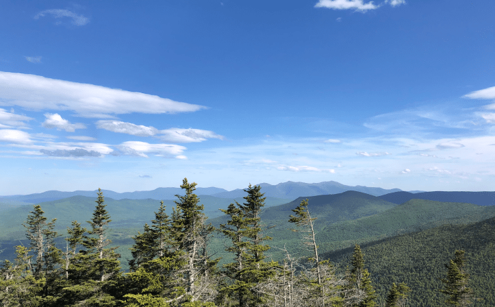
After that more descent, and more ascent! We finally got to the spur trail for The Horn. The Horn is a 52 WAV summit, with a “short, fairly difficult scramble”. It was a bit scary for me as I don’t love scrambles.

However, the views were worth it.
After that, we SUPPOSEDLY had a mile to get to Unknown Pond tentsite. It however felt like the longest mile of our lives. The phrase “suck a bag of dicks” was uttered more than once. I smashed my shin on a branch. We were all exhausted. We all knew we were beating the clock to get to the tentsite in time to set up before it got dark, and before it started to rain.
Two of us had also run out of water. It also wasn’t just a pleasant descent down to a pond. It was rocky and rooty, and had plenty of ascents as well as descents.
We were finally close to the tentsite and saw a sign for WATER, which was just a spot to access the pond. The pond was covered in pollen. We all pulled out our filters. Fun times, MINE DIDN’T WORK. Thankfully, I was there with two other ladies and there filters worked just fine.
Just as we were filling our water, the rain started. We hustled up to the tentsite and started setting up. I hadn’t put up my hammock in a while and was exhausted, hungry, and thirsty, so it took me a lot longer than it should have. The other ladies helped me out, we all set up, ate, and were off to bed!
So two trailnames were bestowed on this trip. Trail names can be based on physical traits, where your from, what you do, the color of the shorts you wear every day on the trail. One of us already has a trail name, “Right Turn”. She was so named because she has a tendency to go the wrong way on the trail.
My trail name is now “Sorry”. Both because I frequently say “sorry” to my hiking companions and because I am often (mostly) a pretty sorry sight.
I dubbed my friend “Rainbow”. Her pack is purple, her water bottle is bright orange. She has lots of colors on her gear. The sun kept hitting her and it looked like a rainbow. Plus she’s always sunny and bright, even in the worst conditions.
Day 2 was fairly uneventful. It hadn’t rained too much during the night, and seemed to be done for the day. Speaking of rain, the trail was soooooooo muddy.

Don’t worry, my shoe got cleaned when I lost the log roll contest. Okay, there wasn’t a contest, but there were several brook crossings and at the very last one, two of us went ankle-deep in the brook. The log looked sturdy. It wasn’t.
We saw lots of moose poop on the trail.

Other than that, we didn’t see too many critters. Oh, except a snake. Rainbow was first and tells Right Turn that there is a snake. Right Turn tells me there is a snake.
Me: “Where? On the right or the left?”, as I approach the heavily vegetated spot (i.e. hard to see a snake) where they said the snake was.
Right Turn: “On the right. Come forward a few more steps. Right there.”, pointing to MY LEFT.
I love these ladies. I had a great time, even when I was miserable. Looking forward to our next adventure!

