Rainbow, Right Turn, and I finally had a chance to hike together and we decided to hike Mt Jackson and Mt Webster. Jackson was a repeat 4000-footer for Right Turn and myself, but was a new one for Rainbow. Webster was a new 52 With A View peak for all of us. So no increase in my NH48, but #12 for my 52WAV.
Since many people have taken up hiking during this pandemic, we figured the trails would be crowded. We wanted to get an early start, so we decided to camp at Dry River Campground the night before. I also had some new backpacking gear that I wanted to try out with the safety of my car and friends before a real backpacking trip. The three of us hadn’t gotten together in a long time, so it was lovely to catch up around a campfire (6 feet apart and/or masked).
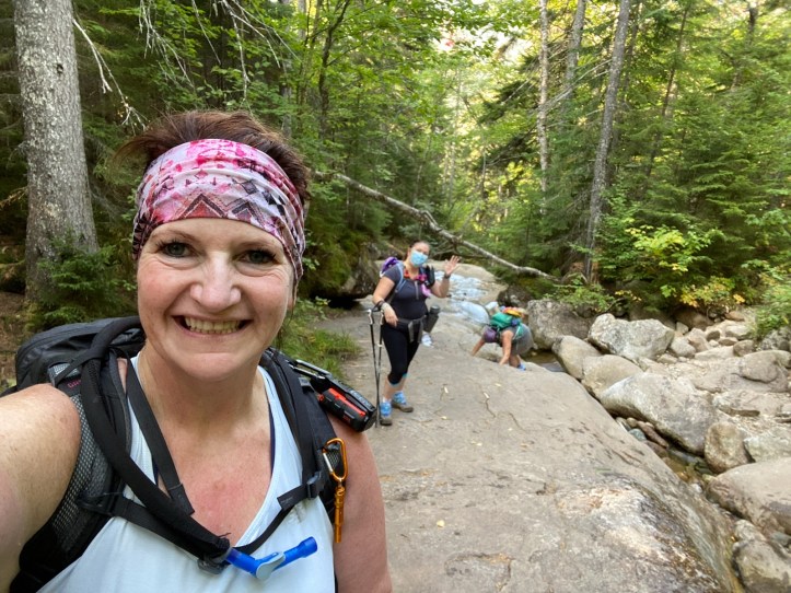
We got to the trailhead around 8 and happily there were only a few cars. The route we were taking is a “lollipop”, meaning the first 1.4 miles and the last 1.4 miles of trail are the same. At 1.4 there is a junction, we’d go left up to Jackson, over from Jackson to Webster, then down back to the junction and out. I had previously hiked up to Jackson via the same trails, just not the over to Webster and down.
Jackson was only my 3rd 4000 footer, two years ago. I took my son and it was rough. It took a lot longer than I had calculated. I’ve attributed that to hiking with my son and the weather. I now realize, it’s the trail. From my previous post about Jackson, “To start, I’ll say, it was rocky”.
So I expected this hike to take about 6 1/2 hours. It took us 9.

I wore a mask for most of the hike, and we always donned them we saw approaching hikers.
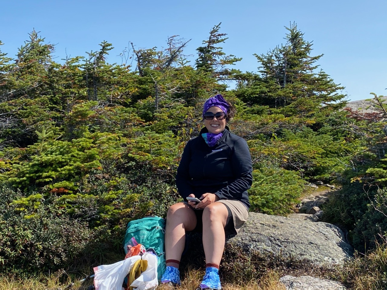
At some point, Rainbow was looking through her pack for something and found she was lugging around a bike lock. When you’re a hiker and you’re constantly looking for ways to lighten your pack, a bike lock isn’t the answer. Well at least she provided some trail laughter.
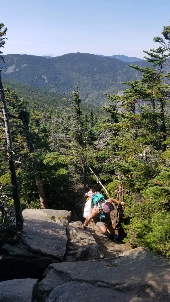
The trail itself is rocky, but near the summit of Jackson there are a few points that are hand and feet “climbs”. Not actual rock climbing, but definitely not just a step up. I remember being terrified of this when I climbed it with my son, it was much easier this time.

So yeah, what’s up with the trash bag? Well, I’d heard with all the new hikers during the pandemic that there was lots of trash being left behind. I brought a sturdy trashbag and my work gloves. I’m happy to report we didn’t really see much, a few penguin napkins, an old tin can, and some weird foam insulation. Picked ’em up, and packed ’em out.
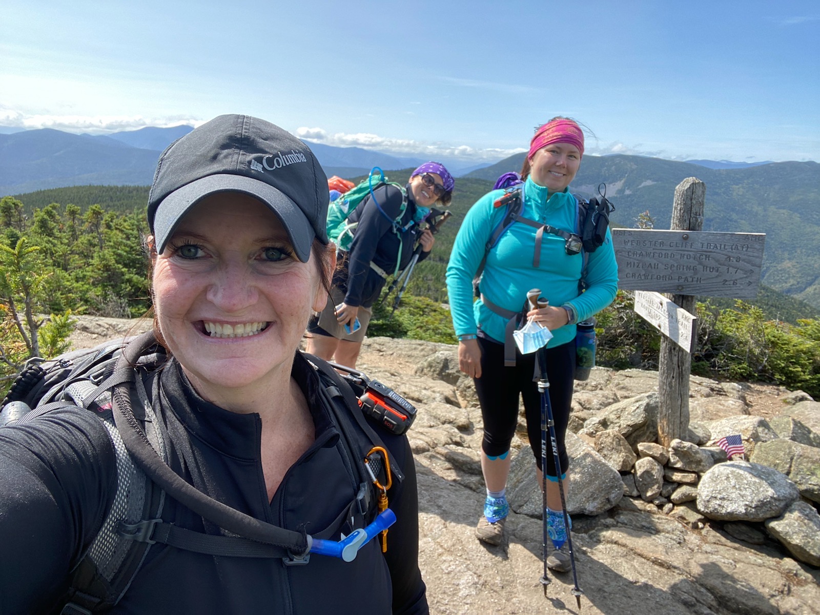

Summit! (Left and upper right, photo credit: Right Turn)
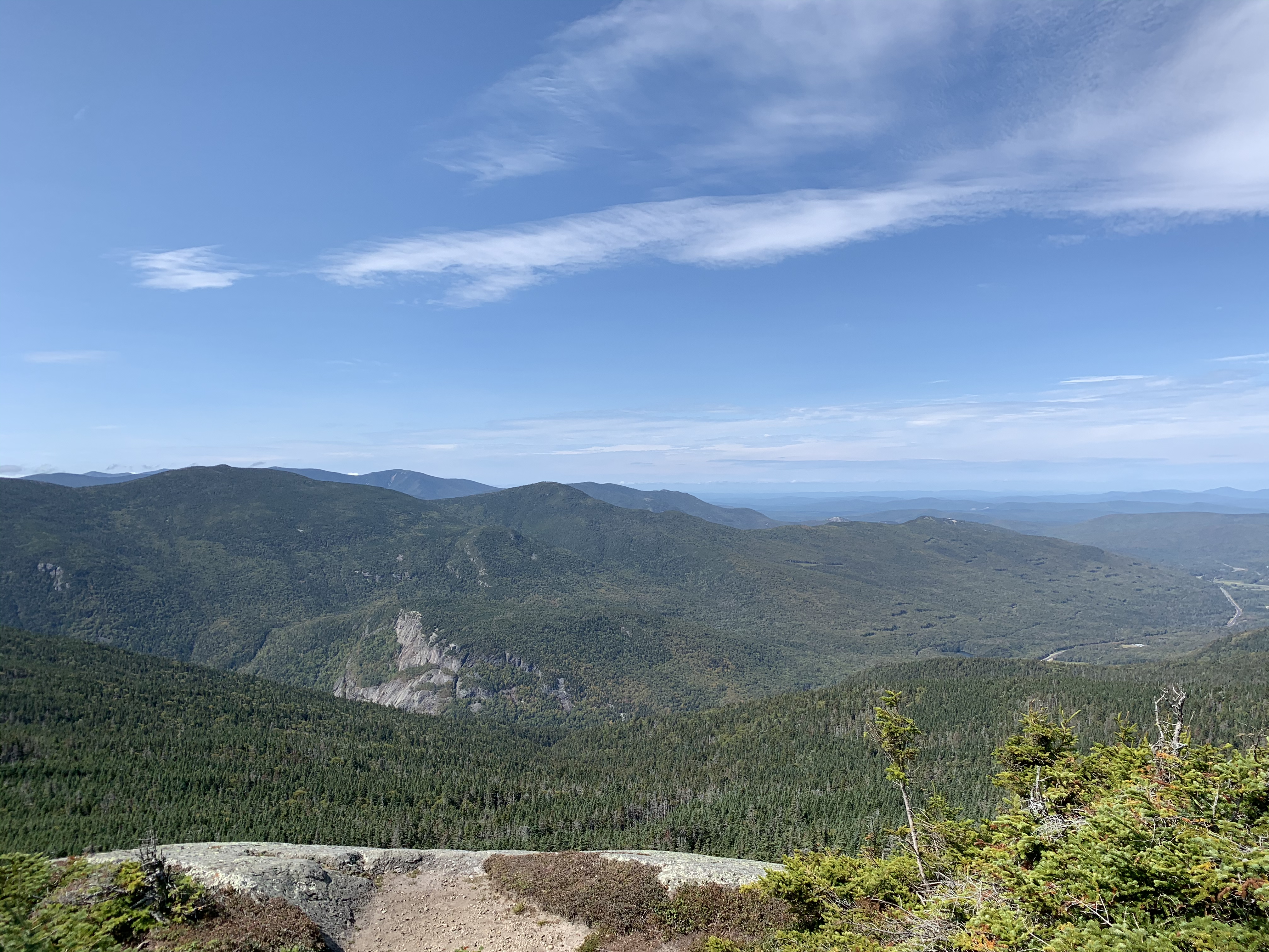


View from and at the summit. Then over to Webster. Going up to the summit of Jackson has some “scrambles” and descending off Jackson is no different. Although I think there seem to be more of them when going on the trail over to Webster. And going down scrambles is scarier than up them. Many spots found me sitting down and butt scooting down them. Rainbow was in front. Then I turned to Right Turn and said, “do you mind if I go next? Then you’ll be behind me and at least someone will see me die”. It’s good to have witnesses, you know?
Another hiker came upon us and remarked that we were descending “the smart and intelligent way”. I responded that that sounded much nicer than the “chickenshit” way.
At one point, we found an illegal camp site (see here for the rules of where you can legally back country camp). I didn’t have the tools to “naturalize” the area, but I did break up and hide the fire ring someone had made. Please remember to leave no trace and be aware of all back country rules. There have been several fires lately due to illegal/unattended camp fires.
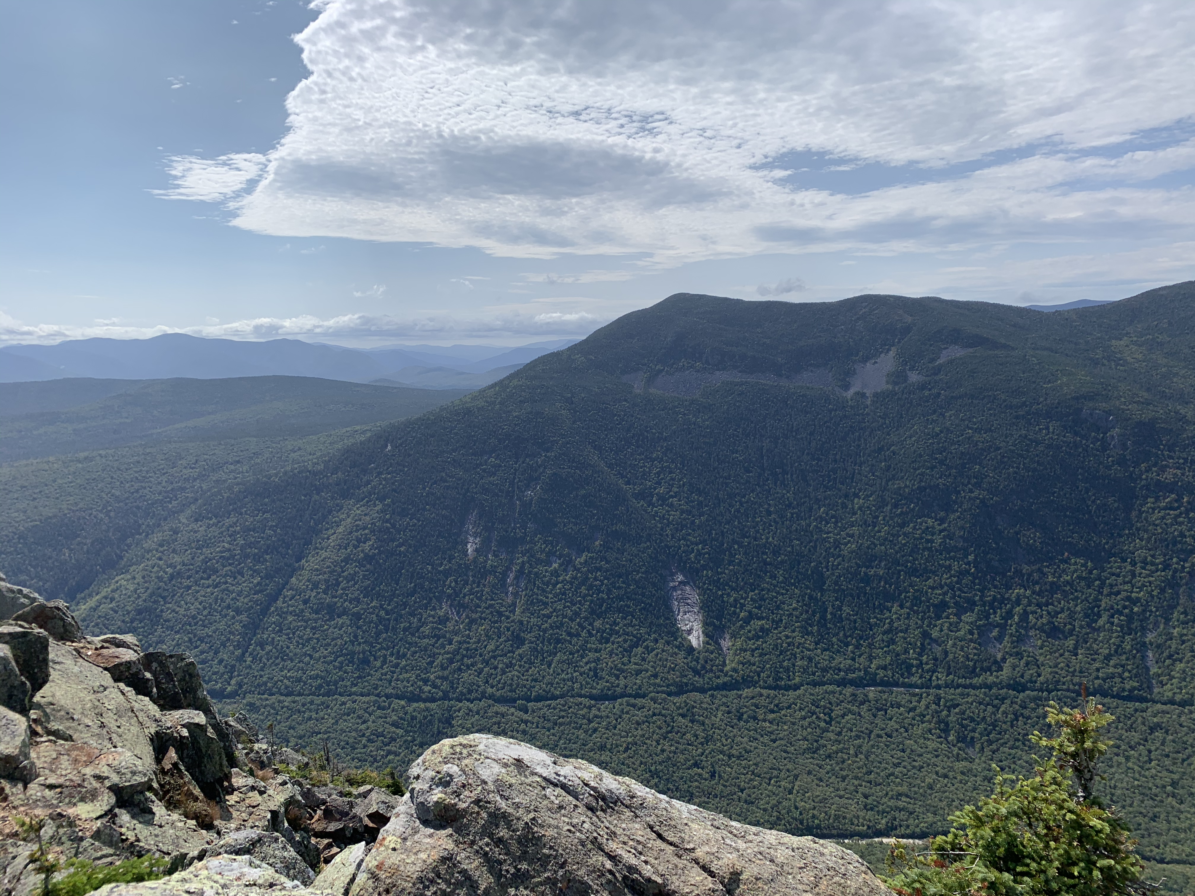


The views from Webster were great. I think we all agreed we liked Webster more than Jackson. There were fewer people, slightly better views, and no scramble to get to the top!
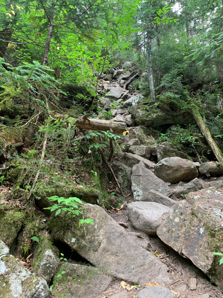
An example of the trail. We descended this, and I turned around to take a pic. The problem with “rough footing” or “rocky footing” as the books describe trails like this, is that I slow way down. Each step I look for where to step, test it to see if the rock will move or not, have to judge if the step will be too deep or the surface too slippery, especially on the decent.
We were however rewarded with this lovely cascade and pool, by Silver Cascade Brook.

And finally at the end of a long 9 hours (but still enjoyable!), a very welcome site!

Hike stats:
- Distance: 6.5 miles
- Elevation gain: 2400
- Total time: 8 hours, 59 minutes
- Moving time: 6 hours, 26 minutes

[…] a View: Mt. Jackson and Mt. Webster. I first hiked Mt. Jackson in 2018 with my son. Then again in 2020 with Rainbow and Right Turn, and we included Webster. I knew the views would be great, and it was just a bit more difficult […]
LikeLike