Quote of the day: “I brought extra, and Kathy IS extra”
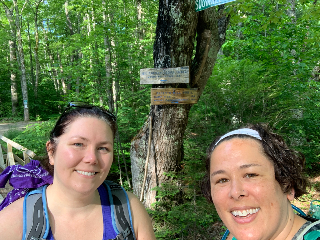
Rainbow and I were planned to hike. Right Turn wouldn’t be joining us, so we figured we’d do a 4000 footer or a 52WAV that Right Turn had done and we hadn’t. We’re also training up for the big hike in August, so it needed decent distance and elevation. So we chose Mount Whiteface. Mount Whiteface is a 4000 footer and the trail we would take (Blueberry Ledge Trail) is 8.4 miles with 3,050 feet of elevation gain.
This would also be good training for the August hike in other ways. Now the failed hike from two years ago took part on the Wildcat Ridge Trail. As already said, I found it terrifying. And hey, guess what, there’s a patch for that, The Terrifying 25. 25 scary trails that you need to hike PLUS 5 electives. There are 14 elective hikes to choose from. Wildcat Ridge Trail is an ELECTIVE. It’s not even one of the 25. Blueberry Ledge Trail is also an elective. And has some scary scrambles. This put me in a bit of a panic as I was afraid this trail would be just like Wildcat Ridge Trail. Right Turn had hiked it and said it wasn’t as bad and I’d be fine. Rainbow helpfully said she would be there to help me across the ledge. (Which was hilariously close to talking me off the ledge).
So Rainbow and I started off to conquer my fears and train for our August hike. One more way this was excellent training for our August hike was the weather. It was really hot and sticky and sunny. Sadly, since it’s still June, we also had a TON of bugs.
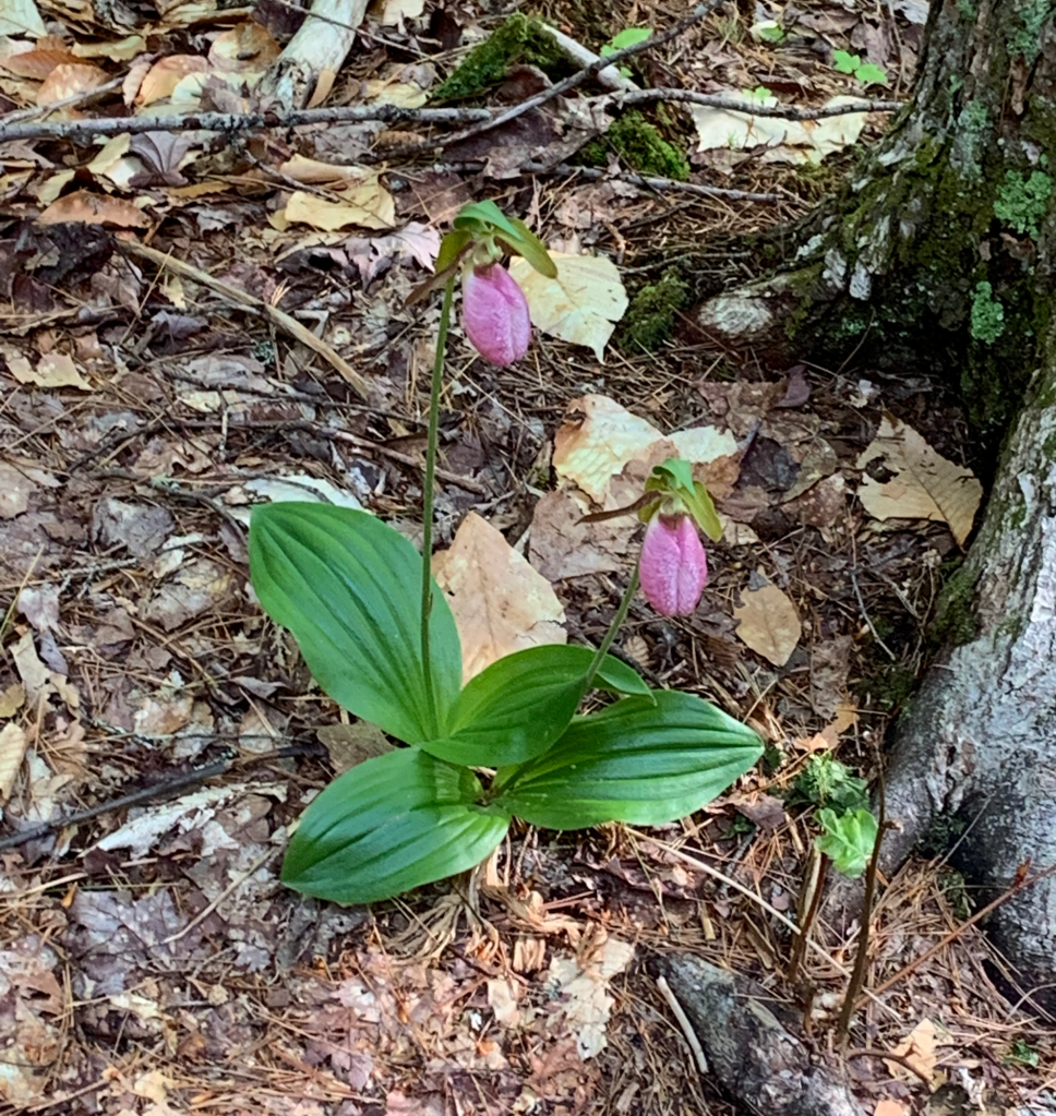
The hike starts off nicely. Fairly flat with nice trail conditions. And we saw lady slippers!
The first mile and a half is pleasant. It starts to get a bit steeper, then it gets spicy. And then, the scrambles. Now I had read that there are three scrambles and the first one is the worst. I might debate whether or not there are strictly only three, but I completely agree that the first one was the worst. I also read that there used to be a few wooden stairs bolted to the granite slab, however those are gone now. Also true, you could still see the bolt holes (seen below in the top right photo of the side view), but no stairs to be found. They only would have gotten you up the bottom third of the scramble anyway. I also read to stick to the left and ascend that way. We found that to be good advice, that also worked much of the way up. Frequently “to the left, to the left” was the way to go.
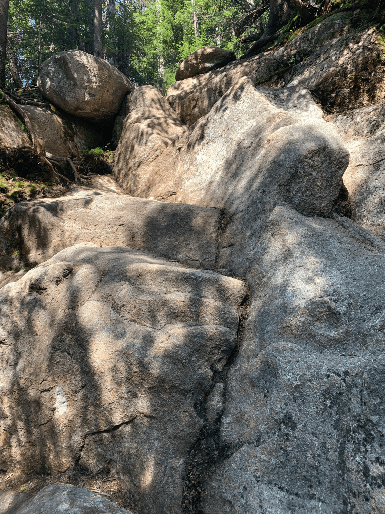
View of the first scramble from the bottom 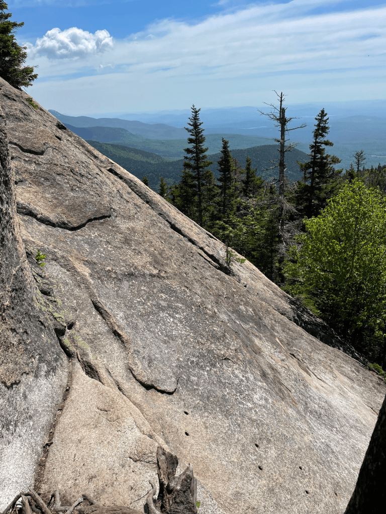
Side view of the first scramble 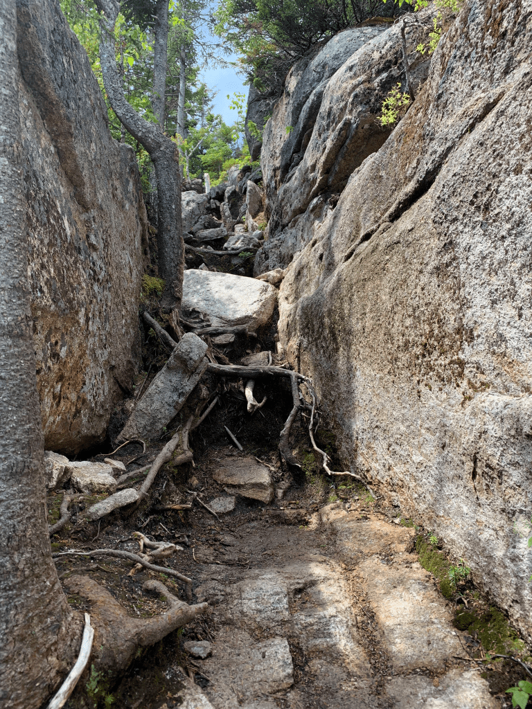
Another bit we had to pull ourselves up 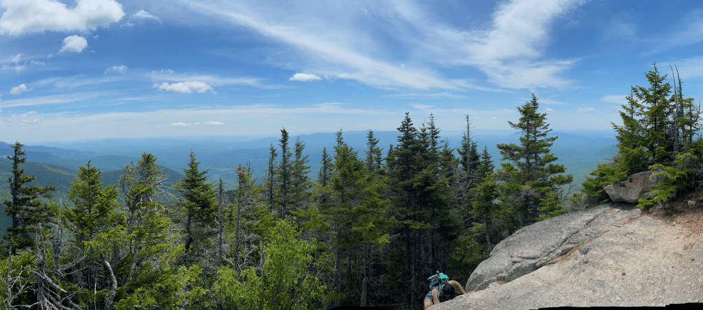
Me coming up over the top of a scramble
Top right and bottom right photo credit to Rainbow
We finally conquered the ledges and stopped for lunch.
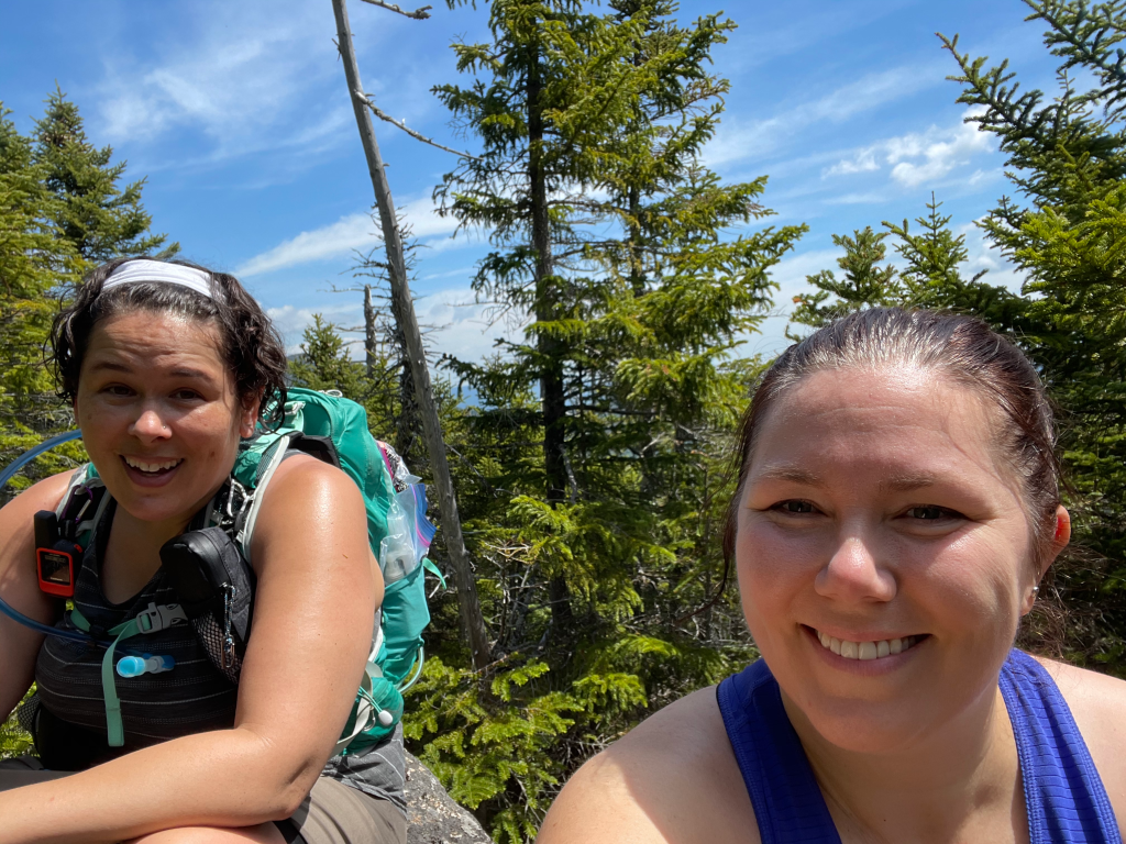
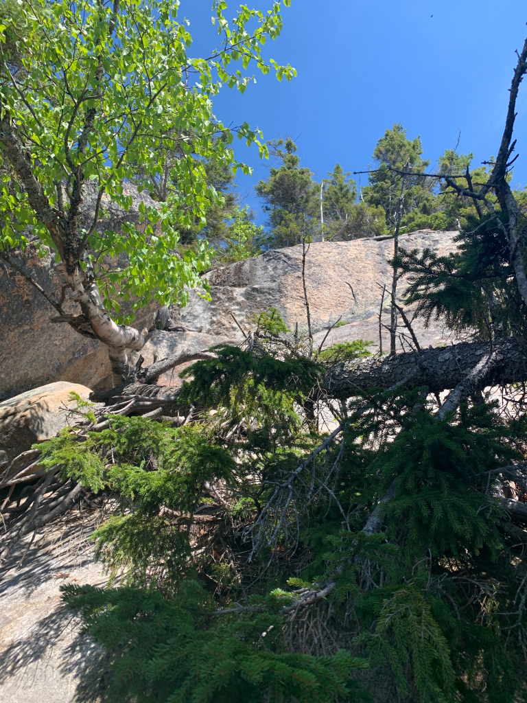
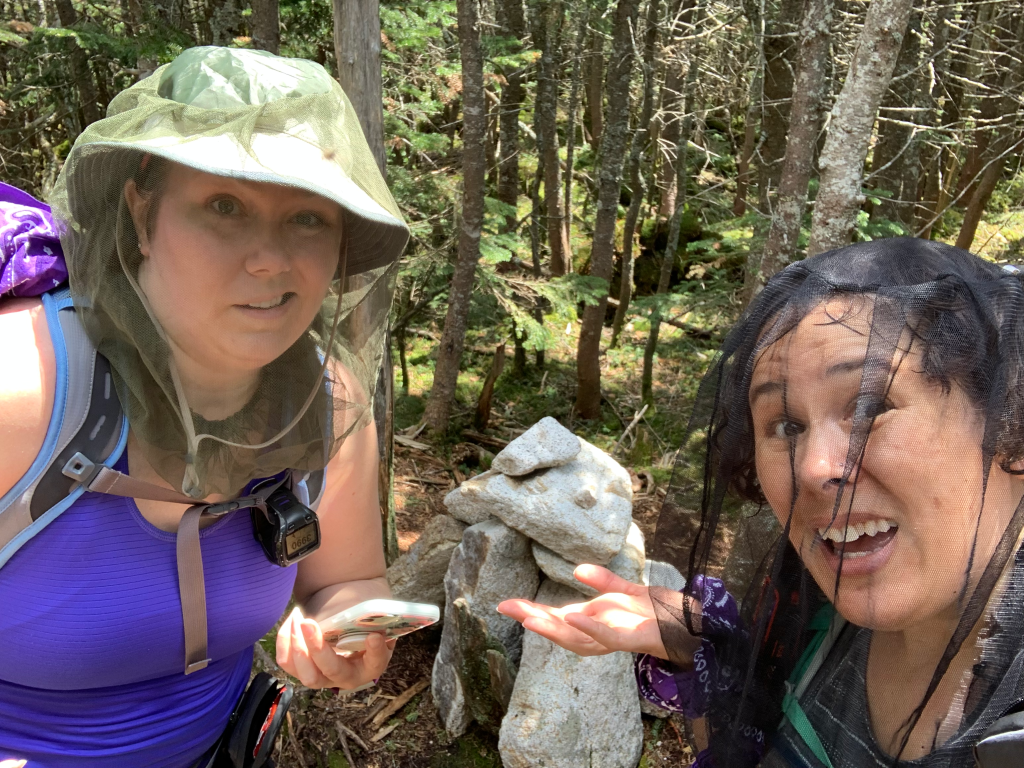
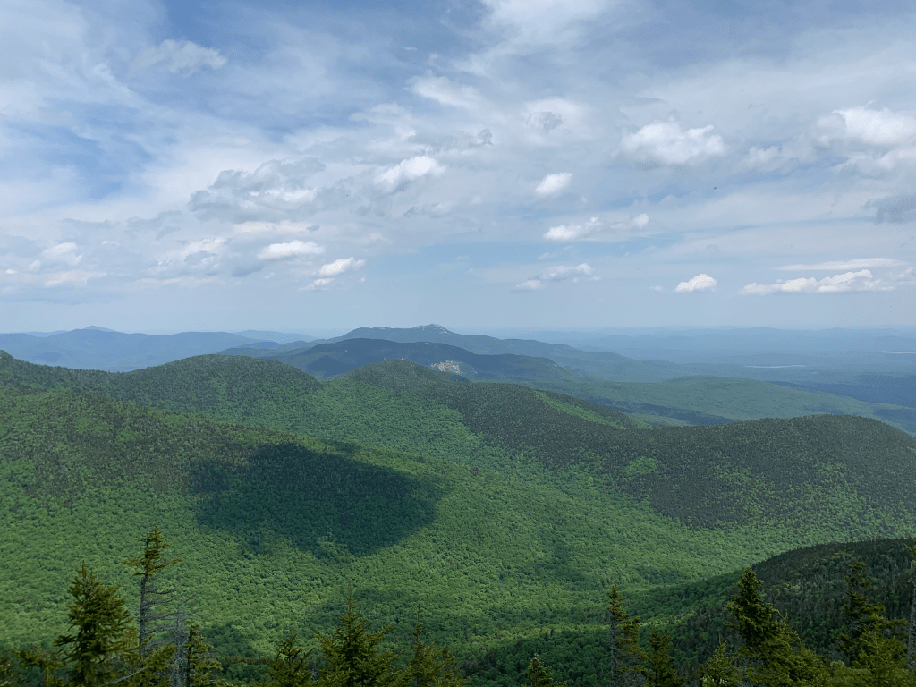
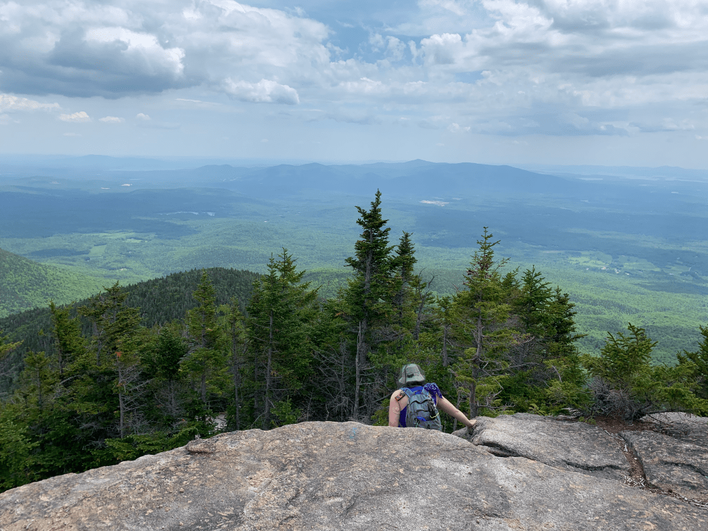
We continued on to the summit. First, you come to what SEEMS like the summit, but isn’t actually. It’s a nice open area with a view. We stopped there for a bit. Then headed off into the woods for the true summit. I knew where the map said it was. I knew where my map app said it was. We walked past where BOTH of those places indicated the summit and saw this random white cairn and assumed that must be it. So… summit selfie?
Now that we had summited, we had to get back down those scrambles. Happily they weren’t as bad as I feared going down. My triceps will be feeling it tomorrow as there was a lot of lowering myself down and butt scooting, but we made it in one piece.
As I mentioned, it was hot and humid and sunny. And for the first time, I ran out of water. I usually bring 2 liters with me, and almost always have leftover water. I had thought for a moment this morning that I should bring more, but water is the heaviest thing you can bring, so I opted to stick with the 2. Big mistake. The last 2-3 miles were difficult. I was hot, tired, and sunburned. Just KNOWING I was out of water made me want more water. It was pretty much all I could think of on the descent. I knew I’d be fine, and I had more water in the car, but it still sucked. I always have a water filter on me, however there wasn’t any water on the trail. NONE. Several dried up water crossings. Lots of water bars across the trail, mocking me. Loads of wet and mossy rocks, but none with actual running water. Amusingly, the last half mile or so, it started to rain. Which also seemed to be mocking me. Water water everywhere and not enough to drink!
The only water on the trail is right at the trailhead, the Woncalot River. We did manage to stop right across from the parking lot, and dip in a bandana to help cool off and remove all the gross bugs and bug spray we had accumulated.
Then of course, the best part of any hike, the post-hike burger and beer (which also counted for the views and brews patch!).

Hike stats:
- Distance: 8.4 miles
- Elevation gain: 3,050 feet
- Total time: 8 hours, 37 minutes
- Moving time: 6 hours, 29 minutes
