“Grapes are for closers”
I took the day off to hike. I wanted to hike a 4000-footer, but I was going to be solo, so I didn’t anything with sketchy ledges or scrambles. I chose Mt. Carrigain. It’s a long hike, with a non-easy amount of elevation gain, but straightforward. I’d be taking Signal Ridge Trail, which I’d seen a few photos of. Some people consider Carrigain to be their favorite of the NH48. “Ridge Trail” to me, means generally flat, often with great views. I was looking forward to this hike.
Up at 4AM and at the trailhead at 8AM. It was already in the 70s and incredibly humid.

Please note, that I’m at the trail head on Sawyer River Road. The sign indicates that Mt. Carrigain is 5 miles away. Also note that Carrigain is spelled incorrectly. The mountain is Mt. Carrigain. Also that someone has defaced the sign, which is unfortunate.
Now my understanding of this hike is that it would be a couple of pleasant, flat miles, then a couple of regular “hiking in the Whites” miles, and a ridge trail hike. Then the summit, which also has a fire tower. While on paper, that may be technically true, it was not how my experience felt.
Did I mention that it was disgustingly humid? The kind of day where you feel like you’re swimming rather than walking. Where you wish you had gills to better process the air. It has also rained every day for the last 12 days, and while it was finally sunny/partly cloudy, everything was wet. The ground was wet, the rocks were wet, the trees were wet, and the air was wet. Everything. Was. Wet.
So even though the first two miles were “flat-ish” (roughly 600 feet of elevation gain), I was still instantly covered in sweat. As was everyone else I saw.


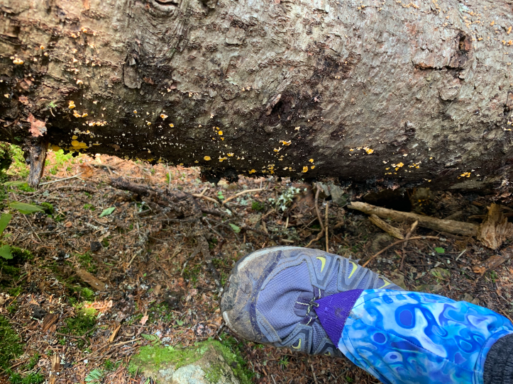
There is a water crossing, which I was concerned about after all the rain. However, it was easily “rock hoppable”, and had this cool looking mist (again, because the air was so friggin wet).
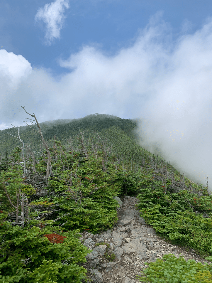
Around the 2 1/2 mile mark, the trail begins to truly ascend. There are a couple of switchbacks, but for the most part you are just climbing up the ridge. Think of a walking up the tail of a giant stegosaurus. You’re on the spine/ridge, but rising up from the ground versus the high flat ridge of a table like I was expecting.

That’s it, that’s your view for what feels like forever. Straight and rocky and up.
I did stop at this adorable little spring to refill my water. Which was good because I was drinking a ton, because as I may have mentioned, it was hot and muggy and I was sweating a lot.
Did I mention it was humid? It was so humid, that there were moments when even the animals were quiet. I’m convinced even the birds thought it was too hot to chirp.
I was so tired and over this whole ascent thing. And began to fantasize about just throwing myself off the side of the trail. Like how far would I go? Would I die or just break things? I have a GPS tracker, so at least they’d be able to find my body. It all seemed better than continuing up this mountain.
It was also around this time that I desperately wanted to stop and take a break and eat something. But I told myself to push on. Get to the open ridge and then you can snack. My mantra became “Grapes are for closers”.
Now, as I begrudgingly ascended, everyone who came down the mountain was sure to tell me, “the view is worth it”. Seriously, every single person that was coming down said, “the view is worth it”.
I had been leapfrogging a family all day, but when I had stopped to refill my water, they had pulled ahead. I now saw the mom, kid, and dog coming down. “The view is so worth it! You’re 20 steps away! Oh and there is a false summit, we decided to come down, but my significant other is going up to the actual summit”.
Let’s review this statement. 1) Who goes through 4.5 miles of hell just to skip the actual summit?! 2) 20 steps away you say? I counted. It was 240. 3) Another round of “the view is worth it”.
Is it? IS IT?!

This was what greeted me when I finally popped out of the trees onto the open part of the ridge. Well, at least I had grapes.
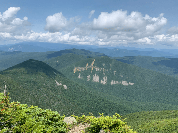
It actually started to rain a bit? Or maybe it was just the clouds? Or the air was so wet that I was hallucinating? Luckily my mood improved as I finished my grapes and the clouds started to part, so I could see the open ridge and the summit of Carrigain ahead of me.
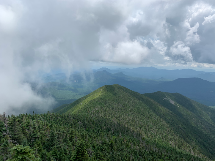
So the actual open amount of ridge was devastatingly short, but as the clouds cleared, it was enjoyable. I headed towards the summit.
As you can see from the pic, I still had a bit of a climb ahead of me. But with dogged determination, I arrived. Now, I frequently change my clothes at the summit, but there didn’t seem much point. I was soaked almost immediately, and would be again. I did however, whip off my boots and socks, and threw on my water shoes (brought along in case the water crossing was too high), so I could go up the fire tower in foot comfort.


As this was my 23 4000-footer, I decided to do one of those cheesy photos.

Let’s break this down, because it make me laugh. 1) My shirt is a much lighter color grey. It was however completely soaked through. 2) I’m normally wearing a hiking skirt over those shorts, but I had sweat so much that the skirt was DRIPPING on my legs. So I had taken it off and laid it on a rock below the fire tower, hoping it might dry (it didn’t). 3) See that wet wood mark on the railing to my left? That’s from me. I had just been leaning there. 4) Check out those sweet sock marks on my legs. Sexy, right? 4) I keep a bandana on my wrist to occasionally wipe sweat off my face, that was my fourth of the day. 5) My bangs were straight at the start of the hike. 6) I really need to work on my posing skills.


Now as I was about to begin my descent, there was a sign.

Notice anything? Yes, Carrigain is spelled correctly. But ALSO, it now says 5.3 miles back to the start. The sign to get here said 5.0 miles. Sigh.
On my death march to get to the summit, I didn’t see the well that I was told was at the summit. Leftover from when there was a fire warden’s cabin. I peeped it off to the left on my way back down, and was glad I had filled up from a spring (which I filtered), since my imagination is too vivid for me to have used this well.

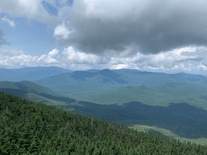
The clouds had completely cleared from the open ridge area on my return.
Then the drudgery of the descent began. Now generally, one hopes/thinks the descent will be faster than the ascent. This is often not the case for me because I am very cautious and watch my footing. It was definitely not the case for me on a hike like this because again, the heat. (What? Kathy, you never said it was hot and humid). I just had no fast in me. No matter how much I wanted to go fast and get this over with.
In fact, I had several moments that I had to say to myself, “You can’t cry when you’re hiking solo.” I really just wanted to sit down and sob, but I knew that would be all kinds of awkward for anyone that came upon me, so I sucked it up and just kept going. and going. and going.
I also wondered to myself, “If you complain alone in the forest, and no one is there to hear it, did you actually complain?”
Finally, I got to the water crossing and ripped off my boots and socks to put on my water shoes. That icy cold water felt delightful on my feet and I wished I could just walk back to my car via the river.
I did finally get back to my car. 10 hours and 44 seconds after I left it. 10.6 miles. 3,350 feet of elevation gain. 3 liters of water. Too many sweat-soaked bandanas to count.
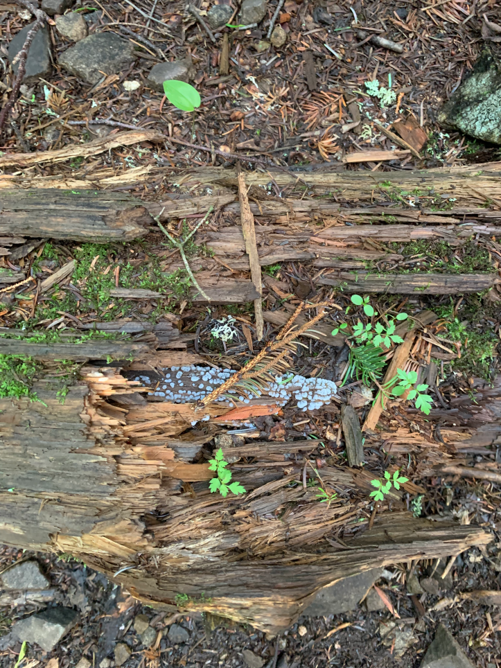
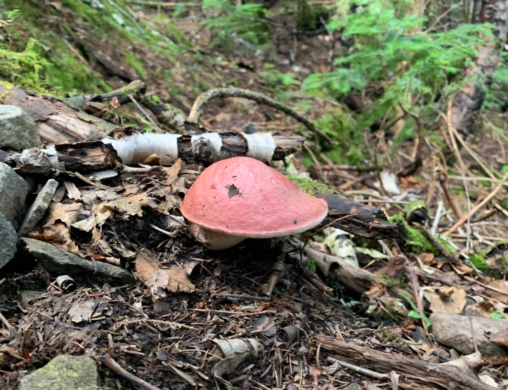
Bonus mushroom pics…