Of the 64 blog posts I’ve written about hikes I’ve taken, at least seven included major changes in plans. One was gear related (forgot my snowshoes). Three were injury/physical situation related (myself or others). Three were weather related.
Now I can hike in most weather. I’ve hiked in rain, in 8 degrees Fahrenheit, snow, ice, etc. But sometimes you don’t want to hike in bad weather. And sometimes, it’s downright dangerous.
So. The plan. Rainbow and I were going to hike partway to Mt Isolation and camp at a tentsite, then the next day summit Isolation and return to the trailhead. The week leading up to this weekend has been in the 80s. Clear and sunny. However, the forecast for the weekend showed a huge drop in temperatures. And at elevation, it was even colder. With snow. And wind.
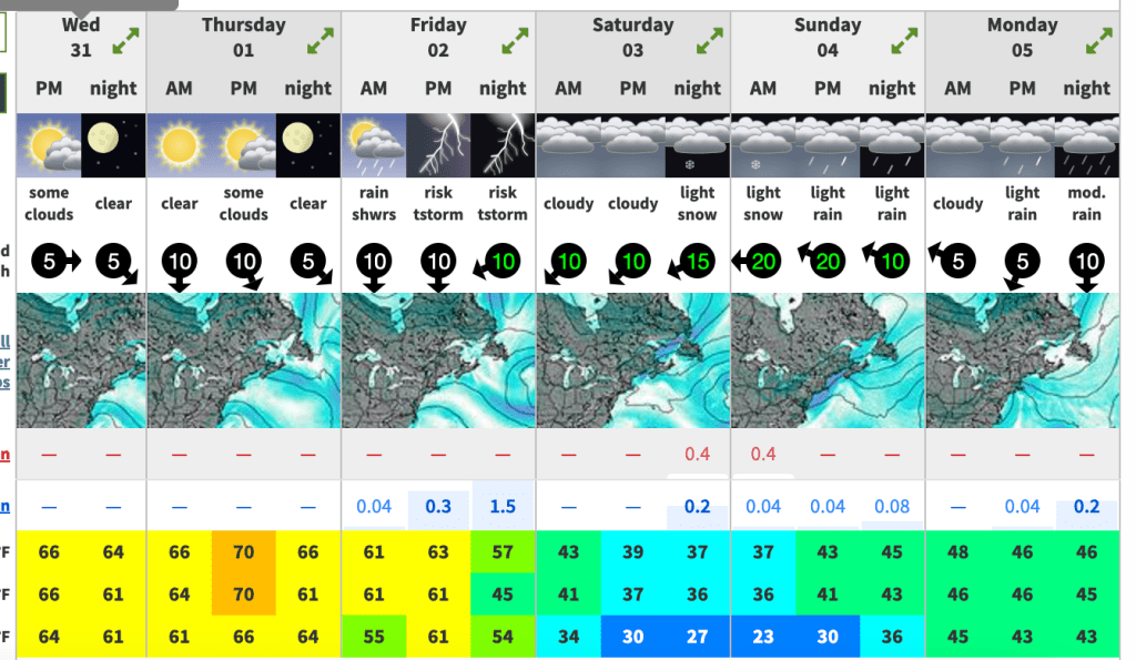
Yes, you’re reading that correctly. Thursday, at 4000 feet elevation, 70 degrees. When we were going to be backpacking? 36 degrees and snowing. We continued to watch the forecast and make a decision as we got closer. As of Friday afternoon, the precipitation had gone from the forecast and it would be cold, but seemingly bearably cold. Saturday morning, we woke up to this forecast…

Possible snow up to an inch. Windchill 10-20 degrees. 65 MPH winds. Um. No thanks.
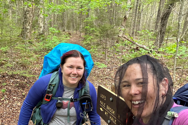
The plan was originally for me to drive to Rainbow’s house and pick her up on our way to Isolation. I texted her, said I was on my way. We figured we could discuss the plan when I got there. We pretty quickly decided that we wouldn’t be overnighting on a mountain. And it was going to be cold and rainy. Rain eliminates quite a few hikes, either because of treacherous footing or because you don’t want to miss an amazing view if it’s covered in clouds. Mt Hale is famously a “no view” 4000-footer. It’s also a great hike for rainy days since it doesn’t have any granite slabs or scrambles or exposed areas. We’ve both already done it, but at least we could get out and get some hiking in.
So, to recap, it was recently very warm (bugs), and was now cold and rainy. So yeah, bugnets and ponchos, baby.

Just for extra fun, we decided to use our packs still packed with everything for an overnight, “for training”.
As I said the last time I hiked Mt Hale, “I’ve realized all trails in the White Mountains start out at the trailhead as nice, wide, flat, dirt or pine needle trails. Then about 100 yards in, HAHAHA FU, HAVE SOME ROCKS.” 100% accurate.
While we struggled up the mountain with our full packs (and climbing the same elevation gain in half the distance than our planned hike), we did enjoy some lovely flora and fauna.


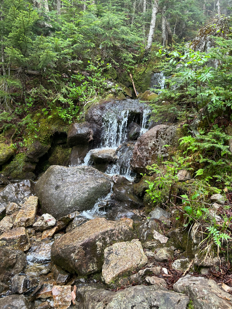


Top row: lady slippers, looking up at the canopy, a small waterfall
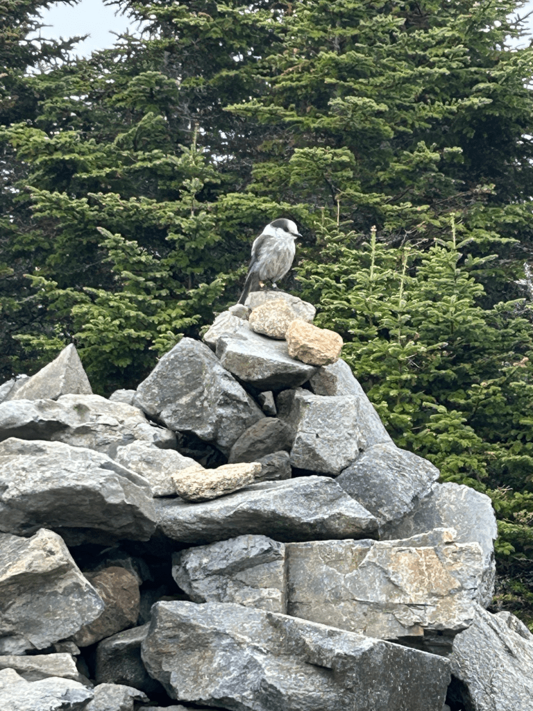
Bottom row: trillium, a very fat grey jay, and mushrooms?
Rainbow VERY EXCITEDLY GASPED “Ooh Kathy! Orange mushrooms”. Upon closer inspection, it was a gross and moldy orange peel (complete with sticker!) someone had thrown in the woods.
At one point, Rainbow asked “Do you need a snack? Because you hate life now”. I joked that I had said “fuck” a lot more frequently. My “fucks per hour” or FPH had increased considerably. Rainbow knows me well and knew it meant I needed a snack.
After what seemed an eternity, we made it to the summit. While we were there, we saw a gentleman under a makeshift tarp tapping out MORSE CODE. Apparently he’s part of a club that goes to the tops of mountains and sends out a signal to see how far it can go, and he was communicating with France and Germany!
Here’s our lovely summit selfie (with morse code guy in the back).

A quick lunch, and it was time to descend.
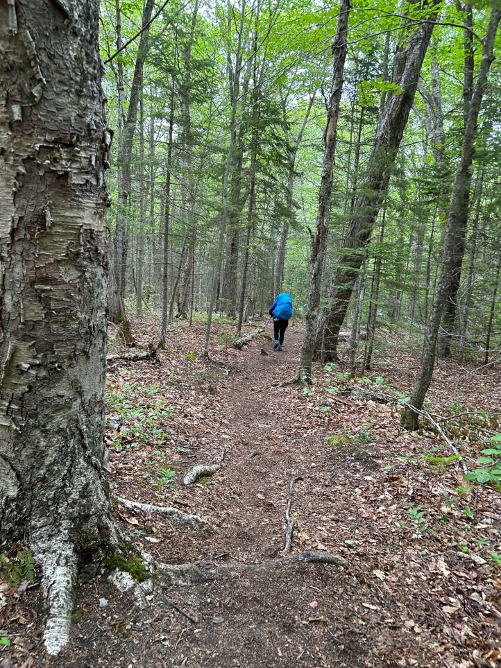
Just about as we got back to the trailhead, I snapped this pic of Rainbow. Note the big backpacking pack, and the flat trail (again, just near the trailhead).
And here we are back at the trailhead.
- Distance: 4.4 miles
- Elevation gain: 2,176 feet
- Total time: 6 hours, 17 minutes
- Moving time: 4 hours, 51 minutes

[…] and I had planned to do Isolation the first weekend of June. Thanks to snow and wind, we had a change of plans. Since I’m trying to complete the 48 this summer, I really wanted to get Isolation […]
LikeLike