I don’t even know where to start with this one.
Long hike = long post.
tl; dr: lots of shit went wrong before and during, but it’s done
Leading up to the hike
Rainbow and I had planned to do Isolation the first weekend of June. Thanks to snow and wind, we had a change of plans. Since I’m trying to complete the 48 this summer, I really wanted to get Isolation re-scheduled. However, we’ve had SO. MUCH. RAIN. Apparently on average, June gets 1.5″ of rain. This year, 5.8″.
My original plan was to hike to Isolation via the Rocky Branch trail. However, the Rocky Branch trail has five water crossings. Some of them potentially dangerous in high water. Even in the best of times, the trail itself is frequently under water. Also, since we were rescheduling, it meant Rainbow wouldn’t be able to go. I’m not a fan of water crossings to begin with, let alone dangerous ones, especially alone.
While there are a few ways to get there, none of them are easy. I was considering Glen Boulder trail. It’s supposed to be great views, but much harder and has a “fairly difficult scramble”. My choices were wet trail and possibly drown versus “dry” trail and possibly fall off a rock. (I joke, mostly, but also not really). I asked a hiking group that I’m in about the scramble and decided I’d hike in. If I couldn’t do the scramble, I’d turn around and hike something else.
I took off Friday through Tuesday (July 4th) and hoped for two days with no rain. The forecast jumped around and I kept stressing about it all and whether I’d even get to hike. I had 423 options planned. Wednesday, the forecast looked ok enough for Friday to Saturday. Friday afternoon had a small chance of showers, as did Saturday afternoon. No lightning either day.
Thursday night I packed up. Friday morning I woke up at 5AM and checked the forecast, chances of rain on both Friday and Saturday had decreased!
I hopped in the car and drove the two hours to the trailhead. Shortly before getting there, I saw a BEAR! Crossing the road, it stopped and looked at me and kept going. I’ve only seen a bear one other time in New Hampshire, many years ago, also crossing a road. While it was cool, combined with the ranger warning on our last hike, and several sightings I’ve seen in hiking groups, it made me a bit nervous to run into one on my hike.
One more thing to worry about, car break-ins. Many people have reported their car getting broken into while on a hike. Windows smashed. I don’t keep valuables in my car and have started leaving it unlocked. My biggest concern is that they’d smash the back window, which is part of the convertible top and would require the entire top to be replaced.
The hike – Day 1
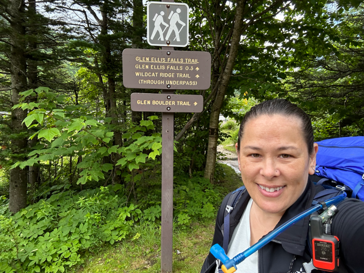
Ready to start at the trailhead at 8:30AM. The plan was to hike roughly 5 miles and 3200 feet of elevation gain to the tentsite. I hoped to be able to do the scramble, and to get across the open ridge and set up my camp before any rain. Sunset would be 12 hours later at 8:30PM.
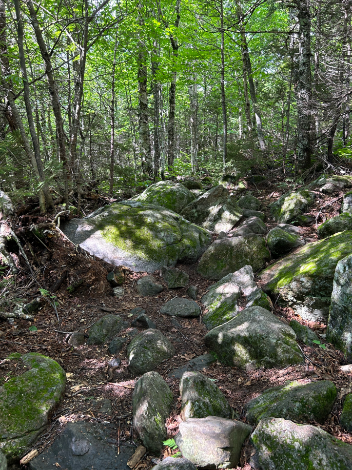
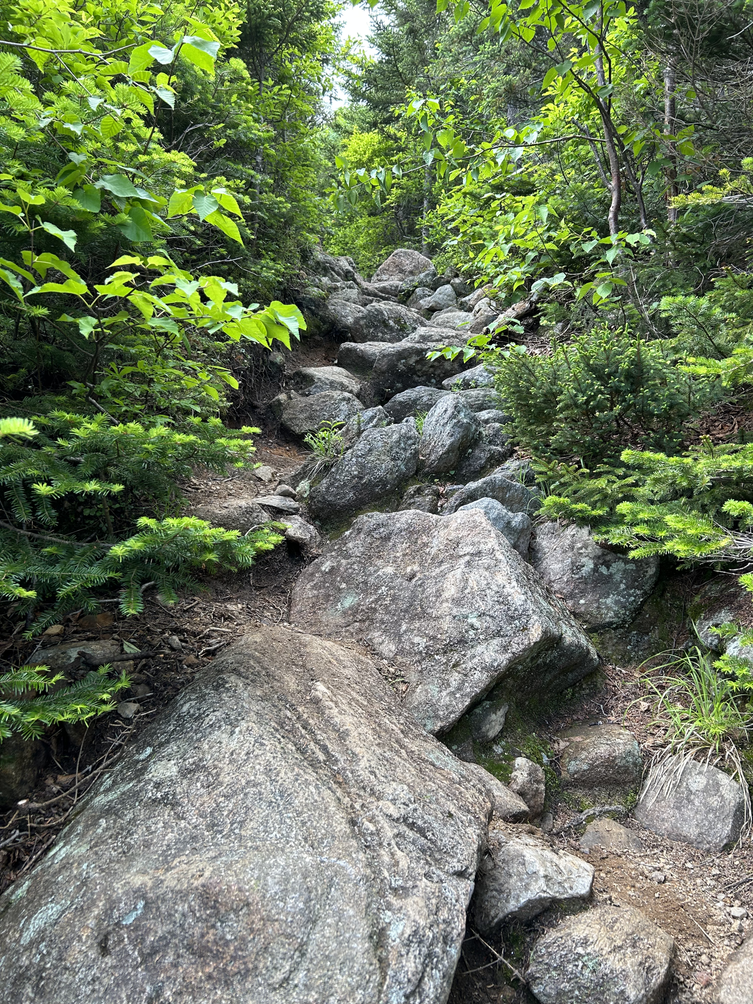
Yep, we start off with elevation gain and rocks. Standard New Hampshire hike. At this point, I’ll admit to frequently having what I call trail amnesia. Only certain things stick out in your mind. I often do out and back hikes only to be on the “back” and not remember ANY of what I’m seeing. So much that I have to check the map to confirm that I did in fact hike this way coming out. It was no different on this hike. Except maybe worse. I think I was very focused (worried) on the “fairly difficult scramble” that mostly everything leading up to that was wiped from my memory.

The trail did come up to this lovely stream that looked perfect for stopping in on my way back. Spoiler alert: I did NOT stop on my way back since I wanted to just be done.
While not the part of the trail I worried about, it certainly wasn’t easy. Roughly 1.5 miles, gaining 1700 feet of elevation, on rocky rough terrain. Took me three hours.

Despite seeing a few cars at the trailhead, to this point I hadn’t seen any people. Now partly, it was Friday, so there are generally fewer people on the trails. The forecast wasn’t great, but it was terrible either. I would have thought after all the rain, that people would have jumped on the chance to get out. I had hoped to see someone at or near the scramble, just in case. As luck would have it, just as I approached, a couple was coming down. I asked if they wouldn’t mind just waiting to see if I got up ok. They were very kind and suggested where I could place my poles while I pulled myself up. It’s kind of a two-part scramble. The first part is maybe 8 feet high and you need to pull yourself up. There are a few hand and foot spots. I would have loved to be 6″ taller, it would have been very helpful. Once you’re up that, there’s a little ledge where you can compose yourself. The second part is more steep granite slabby (which I hate) and longer.
I got up the first part and the nice couple went on their way. As I was composing myself on the composure ledge (trademark), a dad and two kids came up the trail. Of course they were like goats who promptly and quickly passed me.
There was one part where I took my pack off, the balance of it was making it harder. So I took off my pack placed it where I was going, then moved there. As I went to put my pack back on, I noticed a strap had broken.
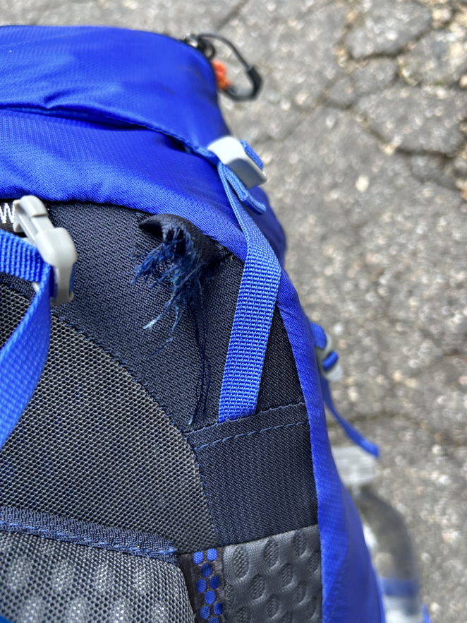
That sheared off bit is where a strap goes from the top of the pack to the top of the padded arm strap to tighten it and keep it from swinging around. I contemplated my choices. I wasn’t even a quarter of the way into my trip, how much would the pack bother me? Should I quit and go home? I just got through half of the “scary” part, do I keep going? I MacGyver’d that shit and kept going.
Once I finished the second part of the scramble, I looked up to see in the distance…

I got to the boulder and saw the dad and kids having their lunch break. Lots of people take cute photos with Glen Boulder, like this one from Redline Guiding
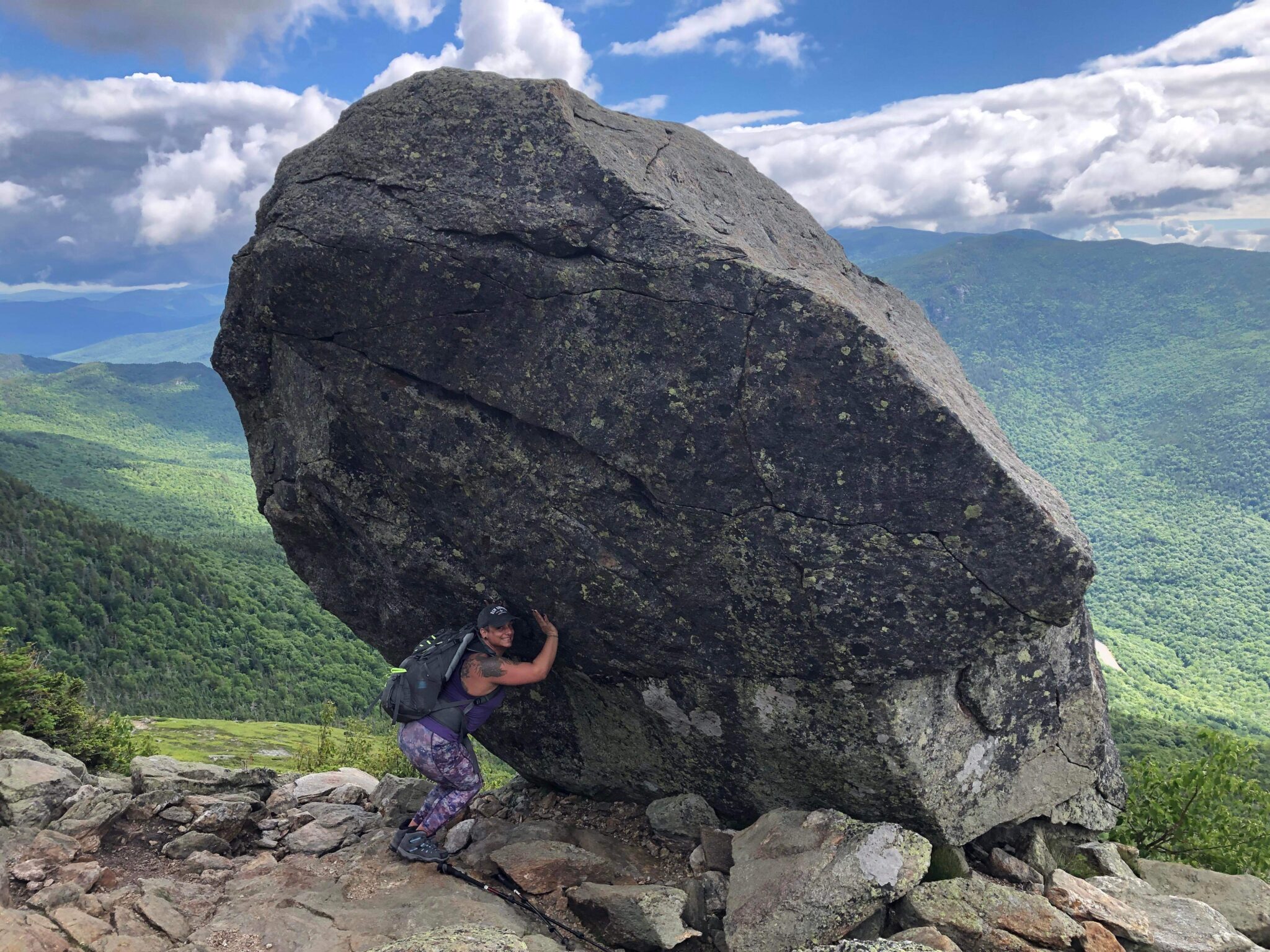
Not me, I’m tired and still trying to shake off the scramble, as well as being worried about the clouds and if that means rain and lightning. So I take this…

I had been warned the Glen Boulder route was dry. I knew there was no water at the tentsite I was headed to. It was also insanely humid. I was sweating buckets. I knew there was a spring about 2 miles into the hike, and about a half mile after Glen Boulder. It’s a little offshoot trail. These are always longer than you want them to be (and somehow ALWAYS lose elevation you just worked so hard to gain) and yet not too long. I drank up some of my existing water, filtered new water, and refilled my bottles.

I actually wore watch on this trip. I set a recurring one hour timer to remind me to drink, eat, and take my electrolytes, since Rainbow wouldn’t be there to remind me to eat when I’m cranky! Of course the stupid watch somehow changed the time two hours ahead, so I panicked about the time and getting to camp before dark. It took me a while to realize it was just set incorrectly. And no, I didn’t set it back to the real time, it was easier to just subtract two hours.
The trail continued in and out of scrub, and then up the side of Boot Spur.

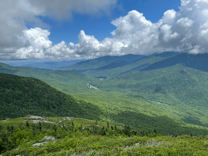
That’s the same road (on the right) from my earlier photo. As you can tell, I’m now higher up.
It was actually nice to hav some cloud cover, so I didn’t bake on the exposed areas. Although the clouds made me worry about rain, and I rushed more than I needed to. The trail continues up to the junction with Davis Path at 5,145 feet. Boot Spur tops out at 5,492 feet, but doesn’t “count” as a 4000 footer for the patch because stands “less than 200 feet (60 m) above the col on the ridge from Washington, making it a secondary summit of that peak”. So you know, I hiked to 5,145 feet and it doesn’t count for squat.


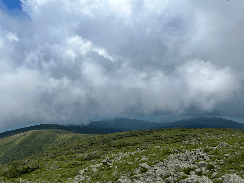
Upper left: looking back the way I’d come. Upper middle: a sign that from far away just said “WILDERNESS” (no shit), but closer up indicated a boundary. Upper right: junction sign. Bottom: on the left is where I came from and on the right, where I was headed.
I saw a few more people on my up to that point. Said to someone “this is the most beautiful place I’ve ever trudged”. I think I saw 10-12 people the entire day. I would only see one person for the rest of the day. She passed me on her way to Isolation, then came toward me on her way back. I asked if she made it, and she said no. Based on what she said, I think she either turned down one of the wrong trails and realized that and came back OR she just got close but wasn’t sure, so she turned around. She made the right decision given that it was getting late and she still had to get back to the trailhead, but that really sucks to be so close and not summit.
From the junction, the trail now descends off of Boot Spur. Descending 1400 feet to the tent site.

I finally arrived at the tent site. Before you get too excited, these tent sites, are literally just WMNF sanctioned spaces for camping. There are no amenities. This one doesn’t even have water nearby. There is another tent site located almost a mile down another trail, which supposedly does have a brook nearby. However, I was tired and had water (also had hopes that there may be water closer with all the rain), so I stopped and set up camp.

I found that my Garmin wasn’t sending messages from camp. Knowing my loved ones would want to know I had safely made it, and knowing I still had thee hours of daylight left, and hoping I might spot a water source, I figured I’d go summit Isolation.
Fun fact, when you start your day seeing a bear, you think everything in the woods is a bear. Twig snap? Bear. Root ball of a blown down tree? Bear. Your own pack making a noise? Bear. When you don’t see anyone anywhere? Bear or murderer. (Neither bears nor murderers were seen during my trip, that I know of).
Out and back to Mt Isolation, just under 2 miles. Lots of ups and downs, with a final steep bit just before the summit. The ACTUAL summit required me to get over a very large puddle and I was so tired, I almost said fuck it. But I had to do it. It would nag at me forever that I didn’t get to the ACTUAL summit.


I had the summit, and I think most of the mountain to myself. It was … odd? On the one hand it was freeing and quiet and beautiful. On the other hand, I worried about bears and murderers and if there was a lightning storm coming that everyone knew about except me.
After that, I headed back to camp. I forced myself to eat, though I wasn’t feeling it at all. Despite drinking a lot of water, I still felt thirsty and my food seemed impossible to swallow. I definitely should have had more food, water, and electrolytes as I was laying in my hammock and had the worst charlie horses I’ve ever had in my life. Both legs took turns completely and painfully seizing up. I drank more water and took more electrolytes and went to sleep.
The hike – Day 2
I promise this part is shorter.
I woke up and slowly packed up camp while I had my breakfast. I still didn’t feel like eating, so I’d take a bite, pack up stuff, take another bite, pack up more stuff. At about 8AM (or 10AM per my watch haha), I was ready to go.
Having summited Isolation the night before, I consoled myself with the thought that today was shorter and therefore easier. I also knew I’d seen water on the trail, as well as the spring, so that was less of a concern than it was the day before when it was all unknown. My big concerns of the day were weather (no cell reception meant I couldn’t see an updated forecast and I didn’t want lightning on the exposed trail or wind/rain on the scramble) and the scramble.
Back up, up, up to Boot Spur.

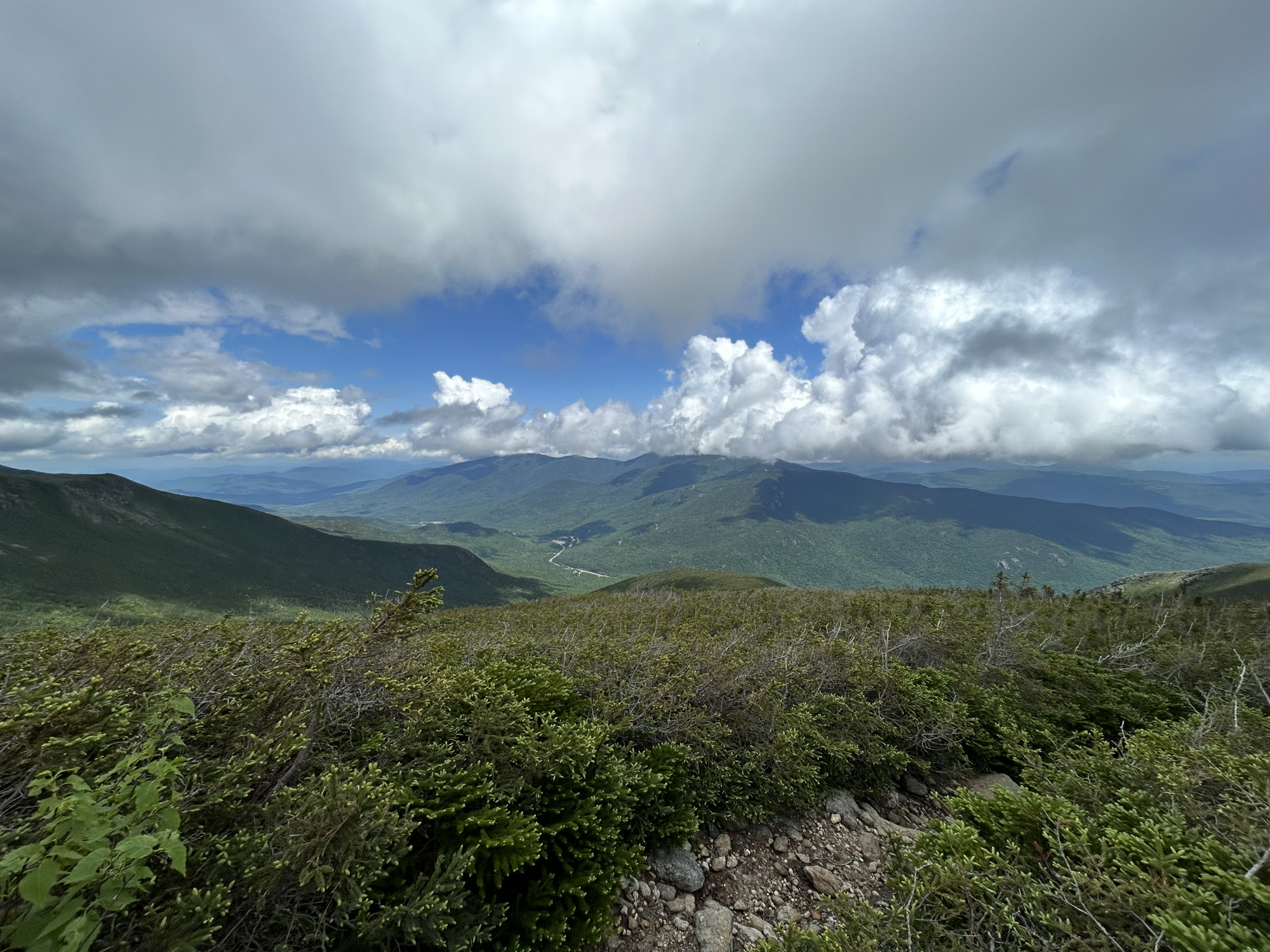
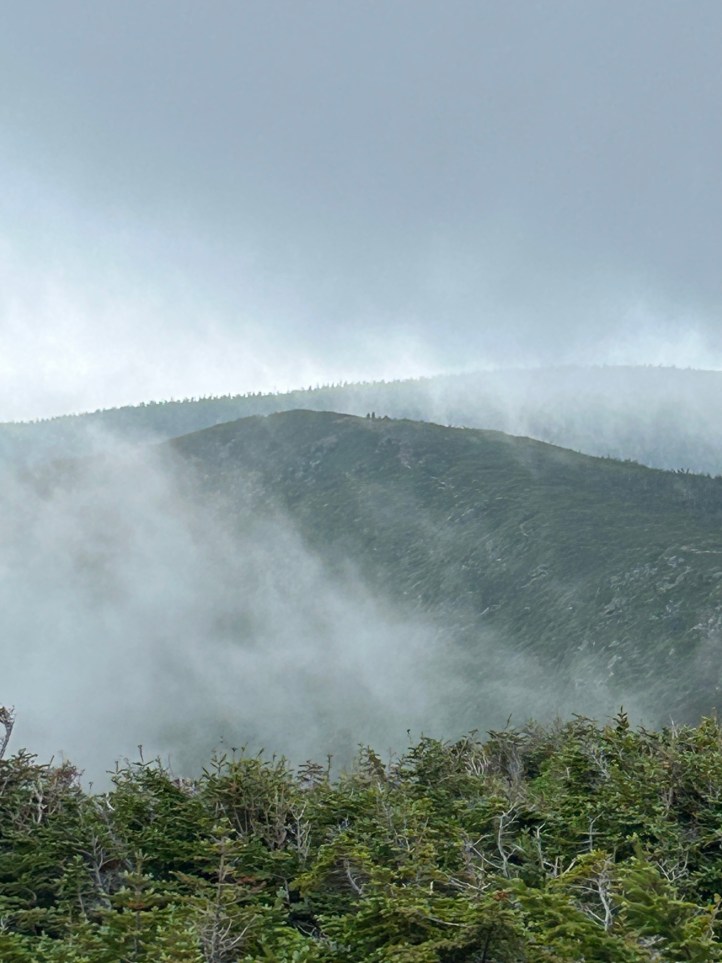
Back across the exposed trail to Glen Boulder. The fog/clouds from my summit were still there in the morning, eliminating much of the views.
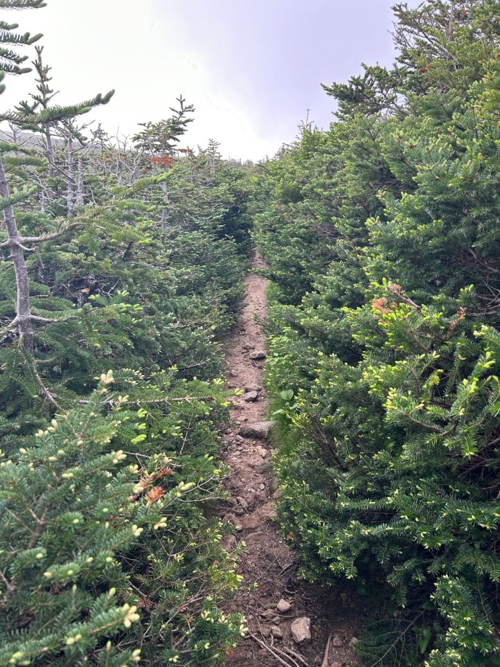
The open exposed trail was broken up by short bits of scrub. The trail through the scrub was SO narrow. The branches scraped at my arms and legs and tried to push things out of my pack. Luckily, there weren’t many people because you’d have to backtrack to pass each other.
I made it to the spring again. Took a good long break, and refilled all my water.
I finally made it to Glen Boulder. During the hike there, I had decided I would sit and have a snack. I would wait to see if anyone was at the scramble and I’d ask them to stay while I did it. Moments after I sat down, a couple came down the trail going the same direction as me (they were coming from Boot Spur). I asked if I could join them on the scramble bit since I was nervous about it. They quickly and kindly said yes. They were so gentle and sweet to me without being condescending, it was amazing. True to my trail name, I said Sorry many times. She told me she was Canadian and it was also Canada Day, so it was totally appropriate even though not necessary.
I told her I might cry and she said not to worry, it happens. She even brings a “cry bag” with her so she can sit and have a good cry if she needs it (the cry bag has Reese’s peanut butter cups in it).
Her partner went first. Then she went. She showed me where to go and gave reassuring commentary as I went. First part done (the slabby bit). Then it was the climbing bit. I got partway down and I just didn’t see how I could could do the last bit. I froze. I started to cry. I told myself to stop crying. Of COURSE this was the moment when the family, and the woman and her dog were all returning from Isolation. And were now waiting for my crying self to get out of the way so they could get by.
The couple helping me were so kind and gentle and encouraging, and I pulled myself together and did it. She helped me move over to a rock, so I could sit down. I thanked them profusely and said goodbye. I had a snack, and some water, and cried a bit more.
The good news is that I now only had 1 1/2 miles left. The bad news is that they weren’t easy miles. However, I knew they do-able miles. They were under cover of trees, nothing scary or bad, just steep and difficult. I can do difficult things. It took me three hours.
Now that I’ve hiked Isolation, we 100% made the correct call to postpone it in high winds and cold. The fact that it’s so isolated (appropriately named) makes bad things worse. It definitely added to my worry that I couldn’t just “bail”. My choices were: just go back the way I’d come which wasn’t easy, take Rocky Branch which had potentially dangerous water crossings, or head over to Washington via a trail I’d done no research on. While I normally love solo hiking, this was one where I very much missed my hiking friends.
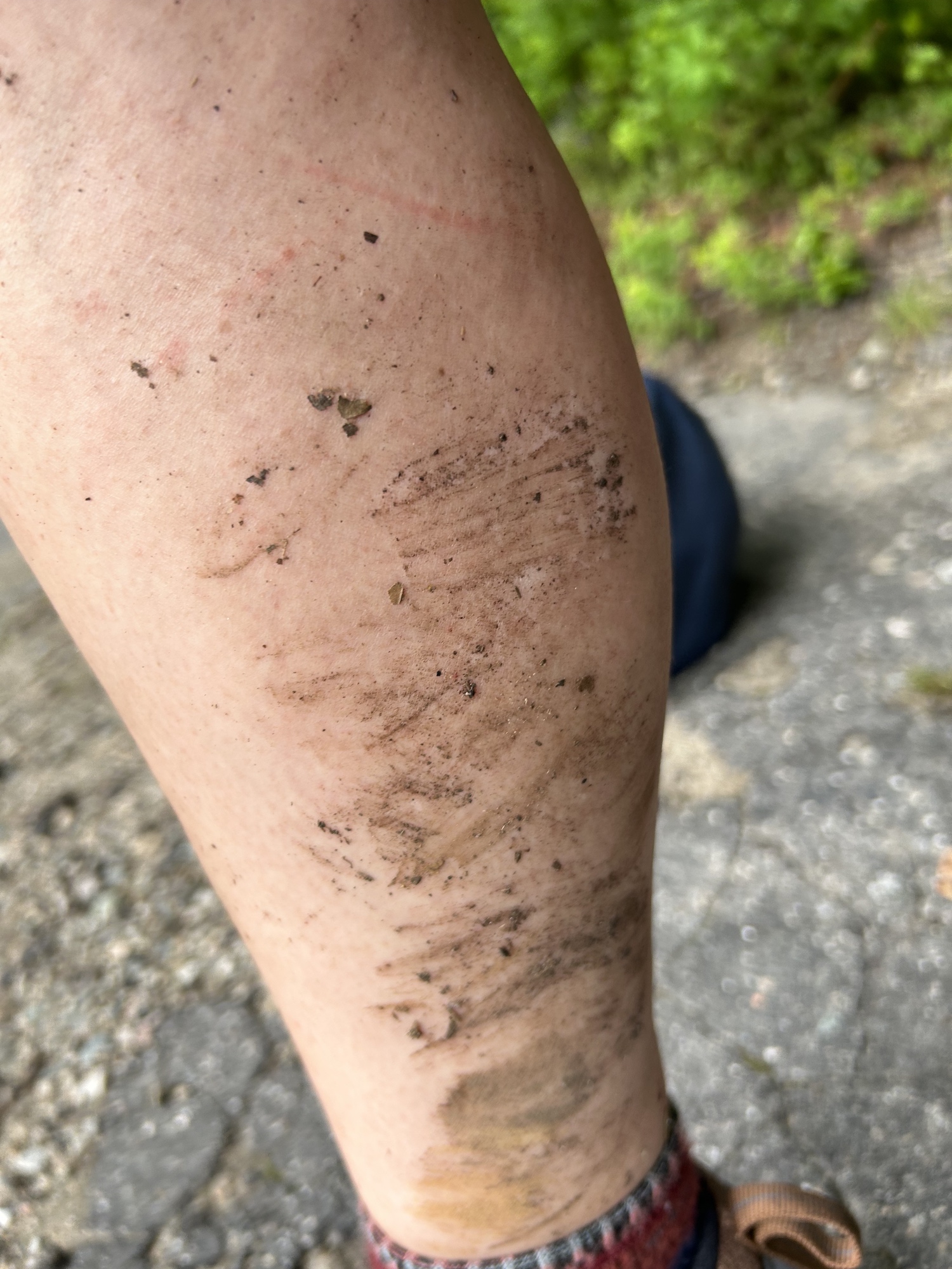
There was a lot of mud. I definitely dunked my feet quite a few times. Tons of bugs. Not helped by the fact that my bug spray sprayer broke, so I had to pour it into my hands and smear it around. I ended up getting a sunburn somehow. All in all, ended up burned, beaten and scratched (by branches), bitten, muddy, and exhausted.
- Distance: 12 miles
- Elevation gain: 5,050 feet
- Total time: 20 hours, 37 minutes (hiking) / 33 hours, 30 minutes (total)
- Moving time: 13 hours, 26 minutes

[…] I knew going alone I would stress about it the entire time. And especially after the scramble on Glen Boulder, I didn’t want to be solo. So I hired a […]
LikeLike