The prequel – https://kathyeager.com/2019/08/12/theres-no-crying-in-hiking/
Part 1 – https://kathyeager.com/2023/07/16/the-wildcats-part-1-redemption/
Part 1A – https://kathyeager.com/2023/07/16/the-wildcats-part-1a-a-love-letter-to-my-gym/
Part 2 – https://kathyeager.com/2023/07/17/the-wildcats-part-2-its-all-downhill/
I woke up the next morning and I was feeling defeated (problem #1). I figured breakfast at the hut first, then I’d decide what to do. Again, the original plan was to summit Carter Dome, South Carter, and Middle Carter then stay at Imp tent site, hiking out the next day and hitting Moriah.
At breakfast, everyone again asked me how I was doing, much to my embarrassment. I answered that physically I was feeling much better, but mentally defeated. A section hiker (I think her name was Kentucky), who has done most sections of the AT and done them TWICE, once in each direction, asked me if it was my first hike. Ouch.
Since there really isn’t any cell phone reception, the huts give you a higher summits forecast that gets radio’d to them. The forecast called for sunny and clear until the afternoon with rain and thunderstorms and high gusting winds. (problem #2)
Leaving the hut is the Carter-Moriah trail, leading me to my planned trip, or the 19 Mile Brook trail, which would take me to the road. Could I continue? Did I want to? On the other hand, would I regret leaving? My legs and arms were sore from the cramping, but would they warm up once I started hiking? Or would they get worse?
Either way, I needed to pack up my stuff and get moving. If you read my post about hiking Isolation, you know that my pack BROKE on that trip. I have a short torso and it had taken me a long time (and several packs) to find one that was lightweight and fit me. With this trip coming up, I just wanted to replace the broken pack with the same pack. I didn’t want to go on a trip, trying out a new pack. Unfortunately it’s discontinued (gee, I wonder why), but I managed miraculously to find one on REI’s used gear site and have it shipped to me in time for this trip.
Well, guess what I saw as I packed up. Yep, the same exact thing was happening. The straps were all fraying at the connection points. Problem #3. Three strikes and you’re out. I could have overcome (probably) one problem, maybe even two. But a bad mental state, bad weather, and a bad pack? No, it’s time to leave. So 19 Mile Brook trail it was.
As I was getting ready, Rook (who I mentioned in part 2, the thru hiker getting water) asked if I was going out. I said I was, and he asked if he could hike with me. I let him know I was slow and he said he had injured his ankle the day before on the descent and he wanted to hike out for a rest day the next day, he didn’t mind slow at all. I was happy to have the company after the day before and said I could give him a ride once we got back to my car.
So the new plan, hike out about 4 miles down 19 Mile Brook Trail with Rook. At the trailhead, there is an AMC shuttle that could take us back to Joe Dodge Lodge, just a short walk to where my car was parked.
I asked at the hut about water crossings, with a name like 19 Mile Brook Trail, I figured there might be a few. The croo member said there were some but that they were do-able. So I filled ALL THREE LITERS of my water, bought a bunch of electrolytes and blox from the hut, and we were off!
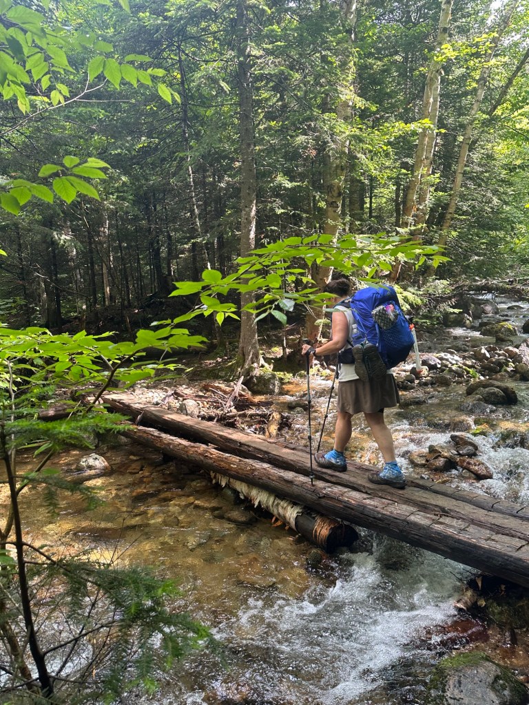
It’s a nice trail, not too long, not too steep. We took our time. The croo person had mentioned that one of the crossings was “kinda sketch with a log across it”.
Not my favorite, but it was do-able.
And Rook took this photo of me on another crossing, happily with THREE logs instead of one.
After that it was a pretty uneventful hike out.
Oh, the story doesn’t end there. That would be too easy, right?
We got to the trailhead around 1PM. The next shuttle wouldn’t be by until 3. *sad trombone sound*
We decided to walk, it’s a road walk, how hard could it be? After a bit we checked the map. Over four miles, in the heat, on a busy road. Ugh. I started sticking out my thumb. No one stopped. Not even the car with “HIKEMTN” as a plate. We passed the Glen House and asked a few folks if they’d give me a ride south a couple miles. No takers. So we kept walking. Eventually we saw a pull off with lots of cars, and a bunch of kids coming up from swimming in the river. I asked if they’d give me a ride and they said YES! Turns out they’re fellow hikers, planning to do Washington the next day. One of them worked at/near Baxter and just hiked Katahdin. As we approached my car, they freaked out. “THAT’s YOUR car?!”. Apparently, they’d seen my car (parked in the same exact spot two weeks prior) and talked about it. It was clearly meant to be. I thanked them profusely and wished great karma upon them, jumped in the car and raced back to grab Rook. We headed straight for McDonalds and enjoyed the most delicious coke of our lives. 🙂
On the way out, I had messaged my MOST AMAZING BOYFRIEND and asked if he could possibly arrange a hotel for me in the area. This was Friday. I had a hotel already arranged for Saturday when I had planned to finish the traverse. I figured I could stay in the area, and maybe do a day hike Saturday if I felt up to it. Well, the most amazing boyfriend was the most amazing boyfriend, and got my hotel to extend my stay one day early and keep me in the same room. So after dropping Rook at the local hostel, I headed for my hotel.
First up, a shower. Then laundry as the thought of hiking the next day in my gross hiking clothes made me want to never hike again. Met up with Right Turn for dinner and to tell her the tale. AND went to REI to buy a new (DIFFERENT) pack. Planned on potentially hiking just Moriah on Saturday. Of course, I woke up still feeling sore and defeated and naturally, the forecast called for … hmmm… what could it be? Rain and thunderstorms! I enjoyed a nice coffee at the local shop while the sun was still shining, and sat on the veranda of the hotel and enjoyed the lovely weather.
Additionally the veranda offered a cool view of the mountains I was just on.
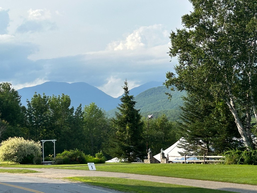
To the left of the notch, is Wildcat Mountain. That’s the steep decline I descended. The hut is at the bottom of that V. And if I had continued on to Carter Dome as planned, I would have had to ascend the right side of the V. Given the weather above, I think I made the right choice.

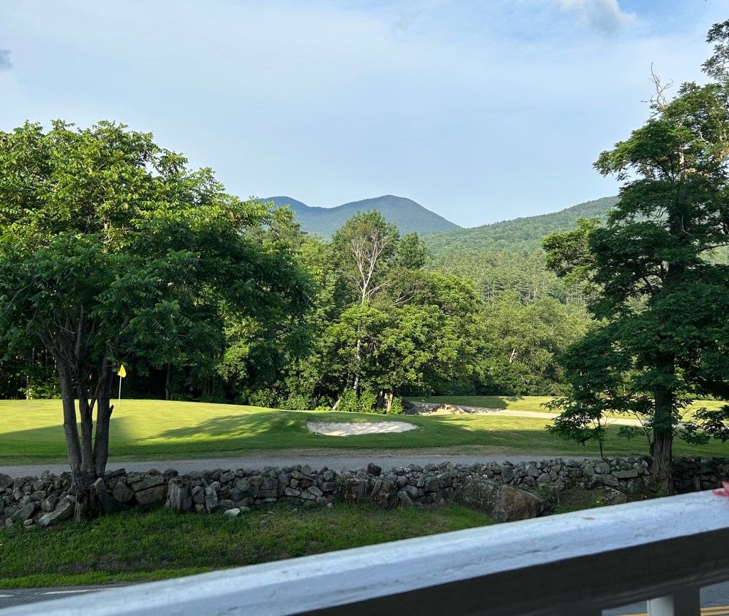
Also visible from the veranda, the Doubleheads, which I hiked previously and had a lovely day.
The MOST AMAZING BOYFRIEND came up and met me Saturday night, while we tried to make the best of a shitty trip. Fun fact, as we drove home Sunday, there was a fucking TORNADO WARNING. And horrible driving rain the entire ride home.
So. To recap. Original plan (for the second try), a three day traverse to get 6 4000-footers. Instead, a two day trip getting 2 4000-footers. Ultimate redemption followed by hideous defeat. And fuck all this stupid rain. Lastly, my most amazing boyfriend is the most amazing boyfriend.
Stats
Day 1:
- Distance: 5.1 miles
- Elevation gain: 3,250 feet of elevation gain
- Total time: 12 hours, 48 minutes!
- Moving time: 5 hours, 37 minutes
Day 2:
- Distance: ~6 miles (I forgot to turn off my track when I got in the car)
- Elevation gain: 680 feet of elevation gain (2,023 descent)
- Total time: 4 hours, 50 minutes
- Moving time: 4 hours, 3 minutes

Glad you didn’t end up being a newspaper article after that one leg… that sounded really scary.
– Tom Duff
LikeLike
Or worse on an episode of North Woods Law!
LikeLiked by 1 person