I fell asleep disappointed. The forecast wasn’t looking good to continue across the ridge exposed to wind and potentially lightning. I ran over the possible scenarios. 1) We could continue as planned, which didn’t seem a good idea with 80 MPH gusts. 2) We could go back down the way we came, Valley Way and either hike up Ammonoosic Trail (Ammo) to Lakes of the Clouds hut (skipping two of the peaks we were meant to summit), so we could still do Washington on Day 3. Or 3) We could go down the way we came and see if we could switch our Lakes of the Clouds hut reservation to a “lowland” lodge, like the Highland Center or Joe Dodge and regroup from there. I hated all of the choices.
I did not want to hike in dangerous conditions, so option 1 with the current forecast was out. Option 2 would be a LOT of hiking, and I didn’t really love Ammo trail when we took it up to Monroe. There were several wet slabs that would be getting wetter by the minute. Plus we’d be skipping two peaks. Option 3 also skipped two peaks and I really didn’t want to go back down Valley way, but option 3 seemed the most likely as I fell asleep.
One of the groups of people we met were from AMC of Worcester. One of the group leaders was in our bunk room, so it was nice to pick her brain about options. She seemed to be considering option 2 for their group.
We woke up to a slightly improved forecast. The 80MPH wind gusts had dropped down to *just* 65! The chance of thunderstorms seemed smaller as well. It seemed that most everyone who had previously planned to go to Lakes of the Clouds was still going to go to Lakes of the Clouds. There was still rain in the forecast, and it was in fact pouring down buckets during breakfast.
It’s at this time that I should mention while Rainbow were in the hotel Wednesday night, she mentioned she had two pairs of rain pants, and I could borrow one pair. Every time I have hiked in rain, I’ve worn my usual shorts with a skirt, sleeveless shirt, and a cheap rain poncho. Actual rain gear makes me sweat and my legs dry faster than pants would. So I rejected her offer of pants. Besides this time I actually brought my rain jacket! I was already being SO PREPARED.
So yeah. Pouring rain. Wind. Exposed. Dropping temperatures. Me, in a skirt. I actually discussed it with the AMC leader to make sure I wasn’t making a big mistake. While the temps were going to be cooler than they were the day before, they weren’t freezing. My other choice was my leggings that I use to sleep in, but I figured they would just get wet and stay wet. The wind on the wet leggings would be worse than the wind on my bare legs. I always run very hot when I’m hiking anyway. Lastly, I had a cheap rain poncho with me as well, and I figured I could fashion it into a rain skirt, if I needed.
Not to be reckless, our plan was to try and summit Adams. It was 0.9 miles from the hut. It was also a tough climb, so if we could do that, and felt comfortable with that, we could continue on. Otherwise, we would turn around and go back down Valley Way. Again we chatted with some others, who felt that was a smart plan. Additionally they said the climb up Adams would be the hardest, so if we could do that, we’d be fine.

A slight break in the rain after breakfast, and we were off! (Photo credit Rainbow)


A look back to the hut and Madison. And the views down into the clouds, err valley. These would be the last views we would have of the day.
The summit of Adams is a boulder field. Much more bouldering than hiking. Lots of hands a feet, rather than just feet. The boulders are big and small. Sometimes close to each other, sometimes with gaps (that swallow your poles if you’re not careful!). Some are solid, some move when you step on them. Luckily, they were all pretty grippy. For me, it was a lot of just looking where I was putting my hands and feet and then looking up to make sure I was heading towards the next cairn.

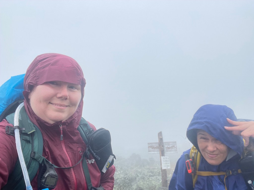
Mt. Adams summit selfie, #46! Photo credit Rainbow. At this point, it was slightly windy and foggy, but still dry. Note, my jacket is unzipped for ventilation and we’re mostly still able to smile.
We decided we would keep going.
Up and over Adams, the other side is less steep, which was nice. Though the trail runs along the “edge”. In that case, the fog may have been in my favor, so I couldn’t see just how scary the drop off was. On the other hand, it seemed like if I couldn’t see the dropoff, I might not know to stay away from it?
0.2 miles from the summit of Adams, is Thunderstorm Junction. Wouldn’t you know it, not far from there, what did we hear? The very last thing on earth that we wanted to hear while on an exposed ridge with no where to go. Thunder. Luckily, not far ahead was a small group of short trees. While not ideal, it was better than being the tallest thing around. We hunched down next to the trees and waited a few minutes. Much to our relief, we didn’t hear any more thunder. It was however pouring down rain. I could feel it running down my legs and into my shoes.


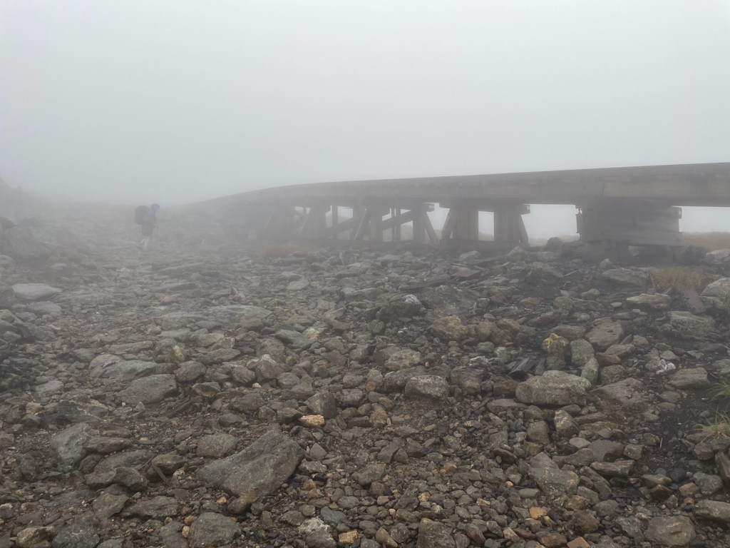
The fog/clouds increased. The wind increased. The rain eased up some, though we were still wet thanks to the fog/clouds. These three photos were all taken by Rainbow, because I didn’t bother to take out my phone. While it wasn’t a huge amount of elevation, the hike was still tough. Lots and lots of rocks. All rocks, all the time. And then we were stressing about thunderstorms returning. Visibility was obviously terrible, and we were frequently just hiking cairn to cairn.
We got to the Jefferson loop trail, which feels like it just goes straight up. We were back to bouldering, but now on increasingly wet rocks. Jefferson is yet another giant pile of rocks.
Here we are really enjoying the weather. I believe this is the selfie we took right by the summit of Jefferson (#47!). We had stoped for a quick break to briefly eat. While I was fine when moving, the moment I stopped, I started to get cold. We had come about 3 miles in six hours, and still had 4 miles to go to get to the hut. I couldn’t afford to get cold now. We didn’t take many breaks. The few breaks we took were very short. We definitely didn’t eat as much as we should, but we needed to keep moving.
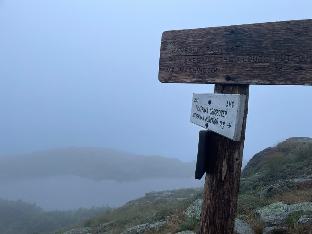
Several trails join or depart along the ridge. As we didn’t have any views and the trail seemed to be the same in the fog, we would happily (or at least as happy as we could be while being miserable) call out “JUNCTION!” or “I SEE A SIGN!”. We trudged along.
At some point, the wind began picking up. Water had gone down the sleeves of my rain jacket, so the clammy jacket on my wet bare arms was getting pretty cold. In a slightly sheltered spot (very few and far between on this hike), I put on my long sleeve wool shirt (that I have for sleeping) under the rain jacket. That helped and I felt warm within seconds. My legs were still bare and wet, but actually didn’t feel cold. I did of course worry for a second that they were just numb, but no, I was hiking and keeping warm that way.
I began to get nervous that we wouldn’t get to the hut by dinner (6PM). Then I began to get nervous we wouldn’t get to the hut before dark (7:30 PM). While we are prepared to hike in the dark, and have hiked in the dark before, this was not the place for it. With the fog and the rock fields that were the trail, we were just hiking cairn to cairn. But cairns are too far apart for a headlamp to pick up. We had to hike as quickly as we could, while still being safe. The rocks were getting slippery. As I mentioned before they would move under your feet. Rainbow slipped a couple of times, which naturally makes you much more cautious and slows you down. Finally we got to Westside Trail, which “shortcuts” to the Lakes of the Clouds hut, skipping the summit of Washington. It also goes under the cog rail.
Again, photo credit Rainbow.
We kept on as quickly, but safely as possible and finally came to Crawford Path. Crawford Path would take us down to the Lakes of the Clouds hut. It was 6:30 PM and we had 0.8 miles to go. The trail had also become a river of rain water. Finally we popped over the ridge that I knew must be looking down into the col where the Lakes of the Clouds would be. At first I thought it was just a cloud, but then … LAKE!
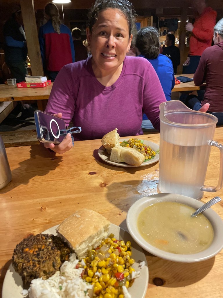
We walked into the hut just around 7:30 PM, while it was still barely light out. Relieved, we walked up to the desk. The croo member greeted us and checked us in, told us what bunk room we were in. None of that mattered until they said, “don’t worry, we’ll get some dinner for you”. We went to our bunk room (dripping water everywhere, sorry everyone!). Took off our packs and changed into our camp shoes. I didn’t even change my clothes I was so hungry.
Several people congratulated us on making it. It was nice to know they were thinking about us and knew we were out there. In case anything had gone wrong, we had our Garmins, but it’s nice to know other people would be on the look out. In defense of our slowness, there was a dad and son duo that got into the hut maybe an hour before us, who left Madison about the same time. And I overheard another group saying it took them 5 hours to go three miles. Maybe boulder fields, fog, rain, wind, and thunderstorms are the great hiking speed equalizer.
Side note, I’ve now stayed at Mizpah Spring hut, Galehead hut, Carter Notch hut, Madison Spring hut, and Lakes of the Clouds. I’m only 2/5 on getting there on time for dinner. HA!
A very long, wet, demoralizing day. But hey #46 and 47 done!
- Distance: 6.6 miles
- Elevation gain: 2,600 feet
- Total time: 11 hours, 13 minutes
- Moving time: 8 hours, 18 minutes

[…] Day 2 […]
LikeLike
[…] Day 2 […]
LikeLike