Another gym squad hike! They’ve been bitten by the NH 48 bug, so I planned another 4000-footer, with a bonus 52 With a View: Mt. Jackson and Mt. Webster. I first hiked Mt. Jackson in 2018 with my son. Then again in 2020 with Rainbow and Right Turn, and we included Webster. I knew the views would be great, and it was just a bit more difficult than the last one.
A quick side note on planning. The weather forecast kept changing (as usual). While I kept an eye on it, I came up with three options, depending on which way the weather went. Hiking in the Whites most often means variable weather, and necessitates making alternate plans to your alternate plans. Lucky for us, the weather forecast was looking good, so we were able to go with Option 1!
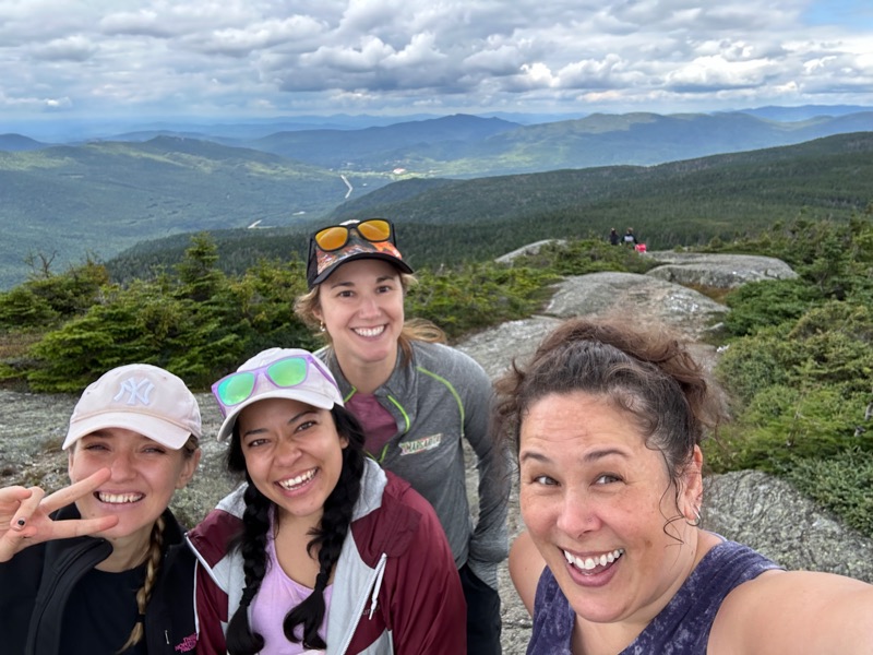
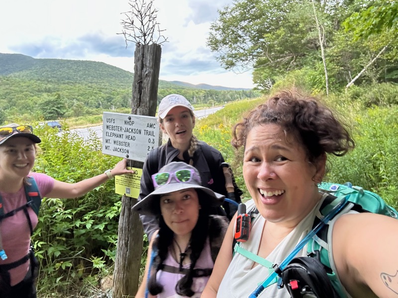
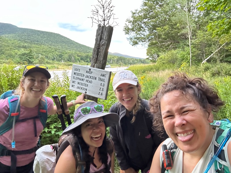
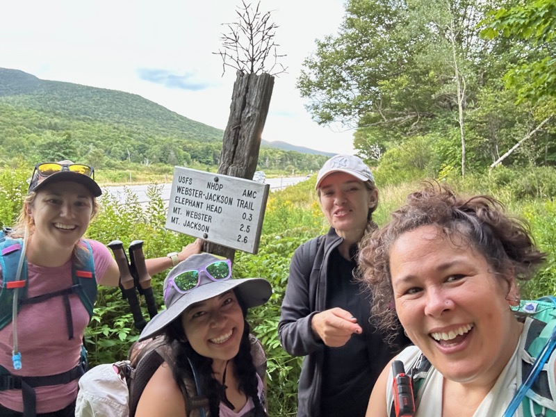
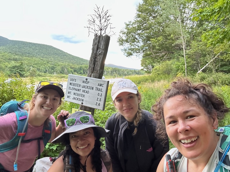
We hit the trailhead at 9AM (having left the house at 6AM). The crew for the day was Marina, Beth (who you may recognize from my Switzerland posts!), Alicia, and myself.

As we approached, Marina saw some people above on Elephant Rock. She asked if we could go there, I said no, as I knew it would be a 0.4 mile detour and time we would wish we hadn’t done at the end of the day. Mean hike guide. 🙂
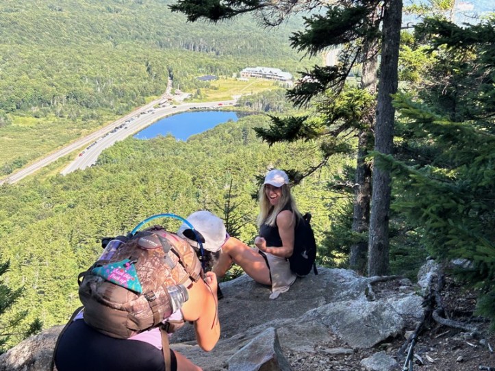
We did take the much shorter detour to Bugle Cliff, however. Here’s a behind the scenes of our photo shoot.
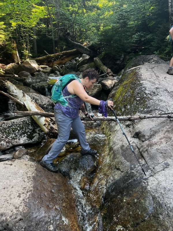
I did warn the ladies that this trail would be muddier than we’d done in the past, and there were water crossings. The water crossings were all pretty tame and the squad did great. Including me, even though I don’t like them.
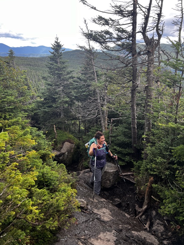
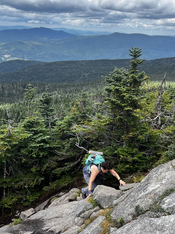
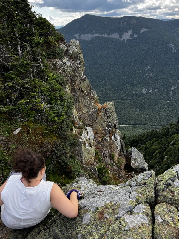
At around 10:30, we hit the junction. We took the left fork that would take us up to Mt. Jackson. We had stopped in the Highland Center before our hike and a volunteer there asked us our plans. When I said Mt. Jackson, she was sure to warn us about the scrambles near the top. I, of course, knew what was coming. It was actually really cool hiking with four of us, the ladies took a lot of photos, which help show the steepness/scrambliness of it all.
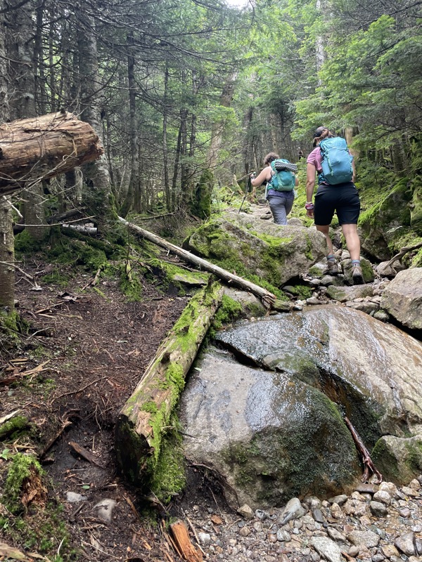
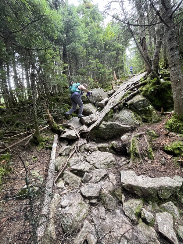
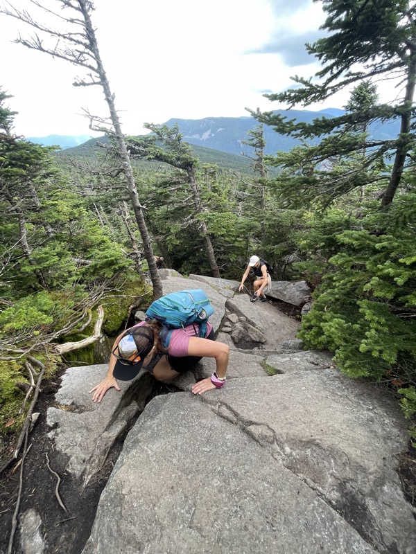
Photo credit: Alicia
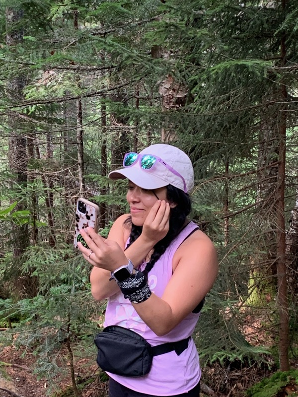
Of course with all the photos, it’s important to look your best.
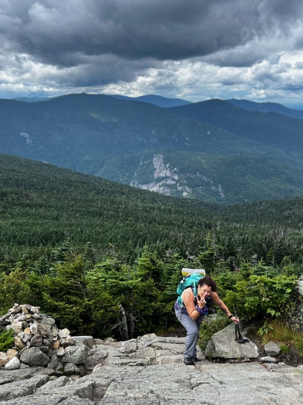
For the final scrambles I had my own personal photographer, which I was clearly appreciative of. Photo credit: Marina
The forecast had said some sun, some clouds. Slight chance of rain around 2PM. It was warmer and muggier at lower elevation, but was very nice as we reached the summit. It was a bit cloudy, but the sun would peak out occasionally. We reached the summit around 12:30, perfect for a break and some lunch.
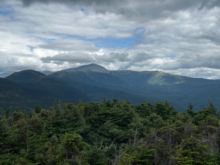
The view south is also where we would head next, including a small section of the Appalachian Trail, a first for Thoreau and Awestruck.
Wait a minute you say, who are Thoreau and Awestruck? In addition to a great hike, two trail names were given out and accepted. Alicia asked about and took photos of moss and mushrooms. She even petted the moss. 🙂 Being quite the Naturalist, I dubbed her “Thoreau”. And Marina, starting with our first hike on Welch Dickey, is always so enamored with all of it. “Guys! Look at this! What is that?! Look at that rock!”, so she is now “Awestruck!”.

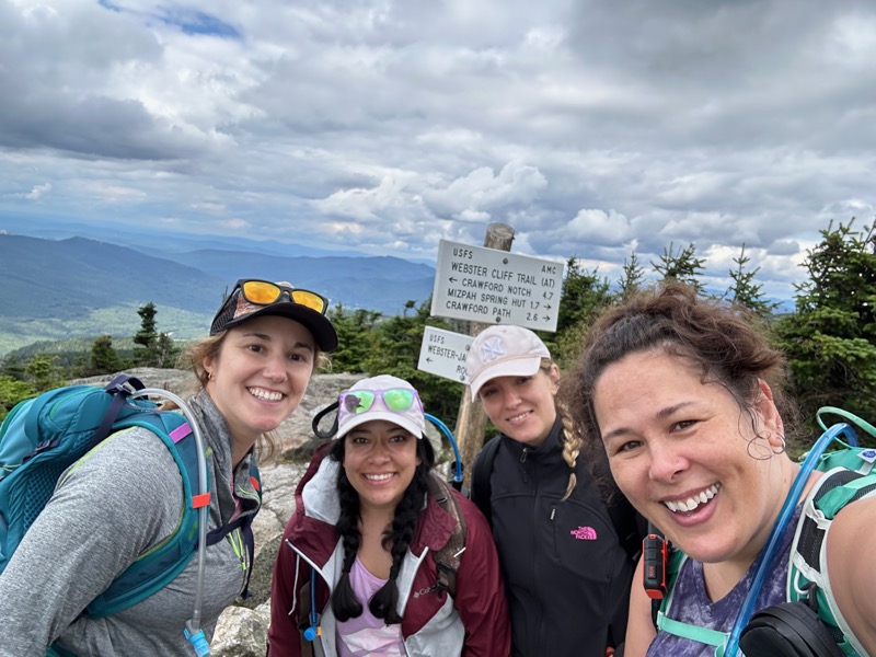
Summit photos from Mt. Jackson. NH 4000-footer #2 for Thoreau and Awestruck. Possibly a new one for Beth (but maybe not), who hiked a lot several years ago and didn’t track them. In her words, “It can be number 1 of the 4000 footers I’ve tracked”.
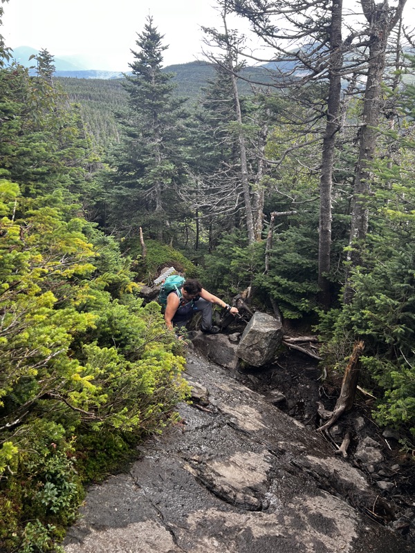
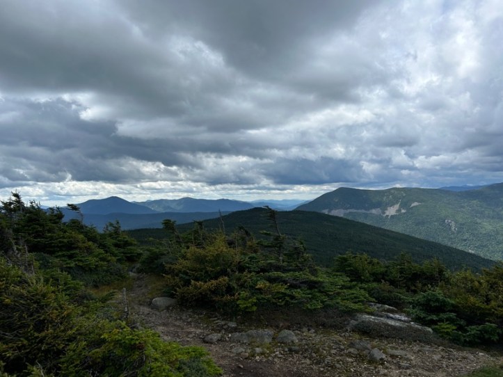
From Jackson, we headed over to Webster. Lots of butt scooching required here. The ladies did a great job, no one fell and no one’s pants/shorts ripped.
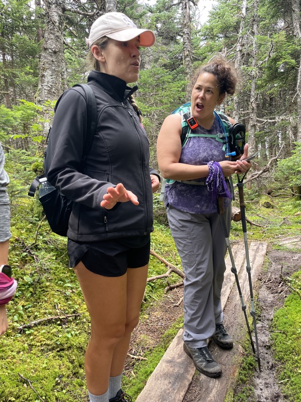
As we were heading south on the AT, we did come across a few thru-hikers. Of course it always seemed to be just as we were deep (and loudly) into a TMI-type conversation. Well, at least we gave them something to laugh about.
On the way to Webster, we saw a spruce grouse! So now let’s take a moment for some nature photos.
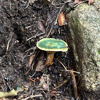

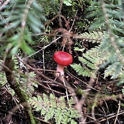
Red mushroom photo by Awestruck, other photos by me.


Greenland stitchwort (with hand for scale) and ghost pipe, which I previously said was a fungus on another post, but I now know it’s a plant that just doesn’t have chlorophyll.
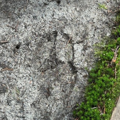
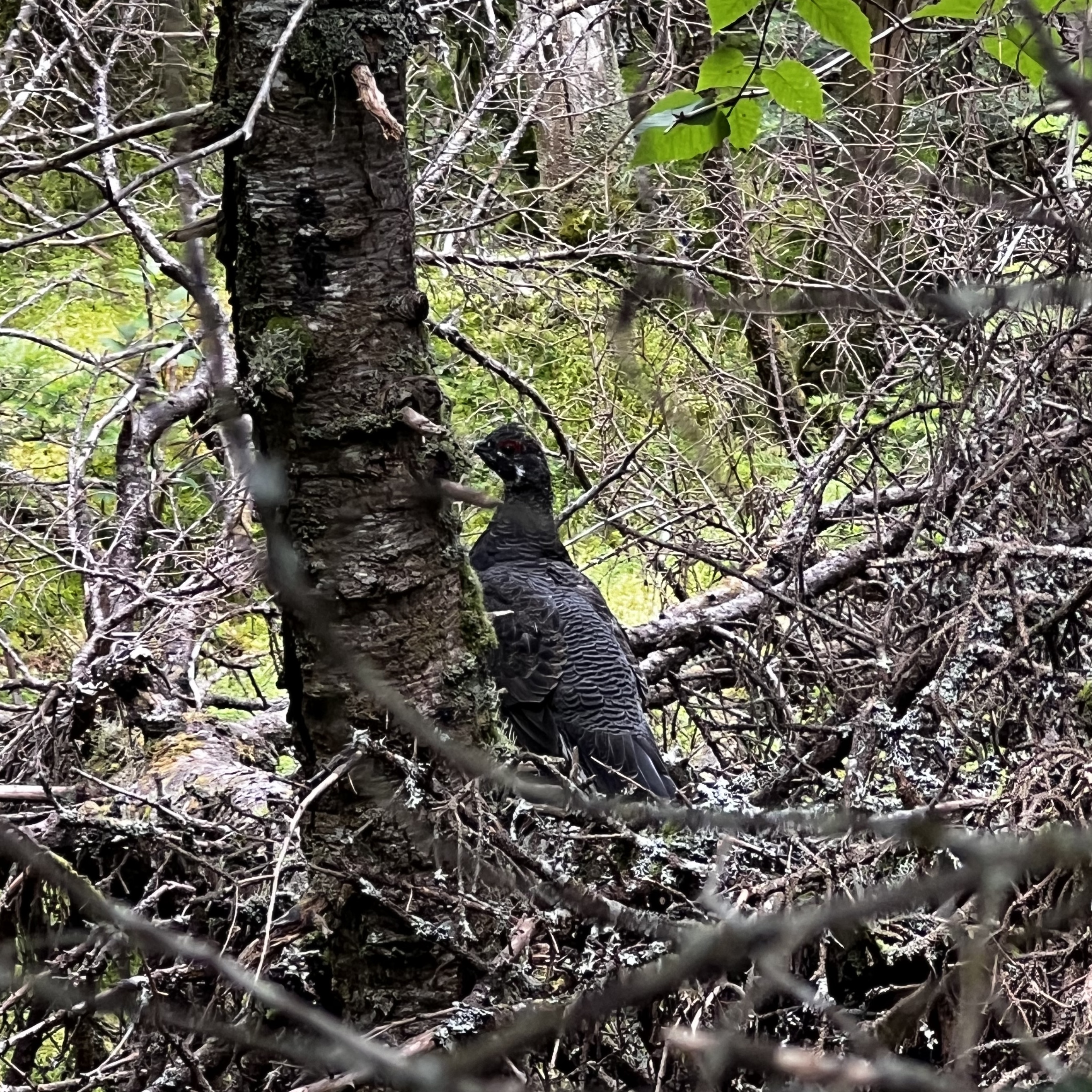
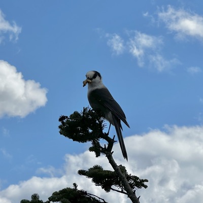
Left-side photo is a moose track! Upper right is the spruce grouse and lower right is a grey jay. (Bird photos credit to Awestruck).
The grey jays are often fed by hikers and have become fairly aggressive, sometimes even stealing food from people. (One even stalked Right Turn and I when we hiked the Hancocks). I put on my trailhead steward hat (figuratively) and told my squad, as well as a family on Webster, why you shouldn’t feed them. Not only do they become aggressive, trail mix isn’t exactly their natural food source.
Okay, back to your regularly scheduled blog post…
Webster! We reached Webster around 2:30.


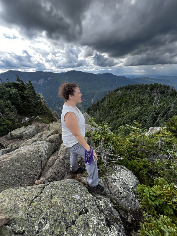
The squad, of course. Then me, trying to look chill and relaxed as I felt the wind push me sitting on the edge of a cliff and I gripped the rock next to me. And me, laughing at something Awestruck said as she took my photo.
We snacked, we had more photo shoots, we laughed. Then it got a bit dark, and the breeze was cool, so we figured it was time to go. Happily, the sun came back out and it was a momentary cloud.
We then hiked for 5 days. No wait, it just felt like that. As it always does on the descent. We finally got to the falls on Silver Cascade.
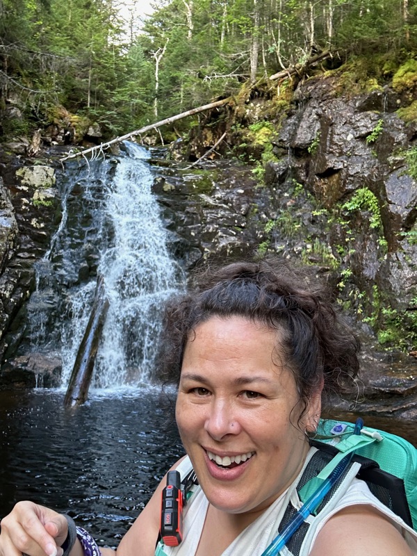
The ladies probably took a lot more photos. I’m pretty sure Awestruck said we should do a group photo, but where I am standing in this pic, is basically in the middle of a water crossing. You know, those things I’m not particularly fond of. So I took my own quick selfie and hustled across to the safety of the other side.
Shortly after that (a little before 5PM), we came to the junction where we had split left previously. A welcome site that meant *only* 2.4 more miles to the car. (Sadly, they’re rocky and rough miles).
As we descended, a dog walked up along side me. No one in sight. I called out “Hello?”. No answer. I tried a few more times. Nothing. Very loudly one more time, “Hello?!”. A response “Hello!”. I yelled, “Your dog is very far ahead of you”. They replied, “That’s OK, she’s fine.”. I (possibly angrily) yelled, “Other people might not be”. First, the dog was whimpering. Second, what if WE had a dog and the dog was reactive? Third, what if one of our group was afraid of dogs? Fourth, what if a wild animal was around that spooked the dog, or that the dog spooked. There have been reports lately of bear encounters in the Whites. Very selfish and irresponsible to have a dog off leash, that far away from you. They finally caught up to us and tried to make hiker banter with us. I didn’t really respond as I knew if I started talking, I’d just yell at them. Instead I chose to silently argue with them in my head for the next mile.
We were all getting tired and a bit loopy. Thoreau struggled to get under a blowdown with her poles sticking up from her pack. There were more than a few slips and yelps as we caught ourselves. I clung to a tree on one bit as my pole tripped me up while trying to climb down a steep bit.
Then, finally, we were back at the trailhead and the car. I present to you a story in 7 photos as we attempted to gather for a group photo and Thoreau’s poles nearly took Beth out. And thanks to our exhaustion, that was endlessly funny. We had a blast and somehow we all lost our voices from all the laughing and chatting.


And the most welcome site on any hike (and it has a sticker for our gym, which is where we all met):

- Total distance: 6.5 miles
- Elevation gain: 2,400 feet (or roughly the equivalent of climbing up and down the Empire State Building 1.7 times)
- Total time: 9 hours, 37 minutes
- Moving time: 6 hours, 31 minutes
- Trail names given: 2
