Another 4000 footer planned for the Bartender and Awestruck. Mt. Pierce was the plan. We had wanted to do it several weeks ago, but the weather wasn’t right for it. The summit is wide open and exposed, so you need a good weather day. And we got it! The forecast said 55 degrees at the base and 45 at the summit! Wind would build throughout the day. My biggest concern was that the snow would get very mushy and posthole-y. Spoiler alert: I was right.
We arrived at 9:30 and parked at the AMC Highland Center. While I know we could have parked in the Clinton Road lot, I also knew we would stop in the Highland Center anyway for the bathroom, so might as well pay and park there. We got a spot right next to the cut through that takes you to the trail and we were off at 9:50.
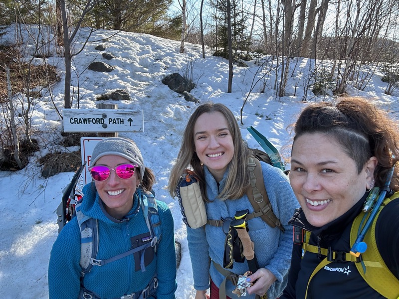
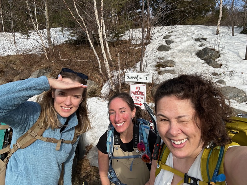
The Bartender, Awestruck, and myself ready to hike
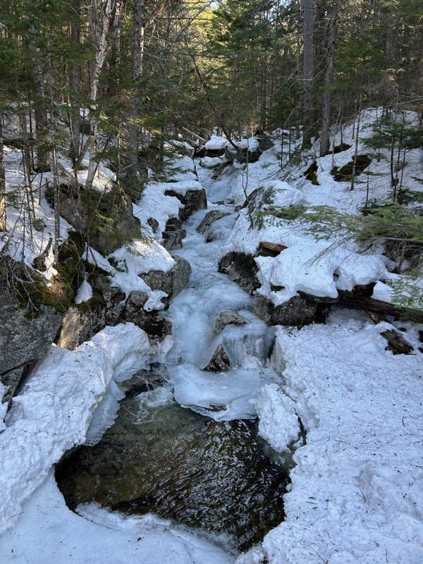
Up and over the road plowed snow pile, across the road, up and over another snow pile and we began on Crawford Path, considered to be the oldest continuously maintained hiking trail in the US. Just 0.2 miles in, there is a junction with the Crawford Connector, and a little bridge and a short falls/small pool.
From left to right: today, April 2019, and August 2018. It hasn’t changed in size, I just suck at getting the same perspective.

I’ve included this photo of the bridge because it is a nice demonstration of “the monorail”. In winter, when hikers walk on the trail, the snow becomes compacted. The compacted snow melts slower than the surrounding snow. So when it starts to warm up, the uncompacted snow melts and disappears, leaving behind the monorail.

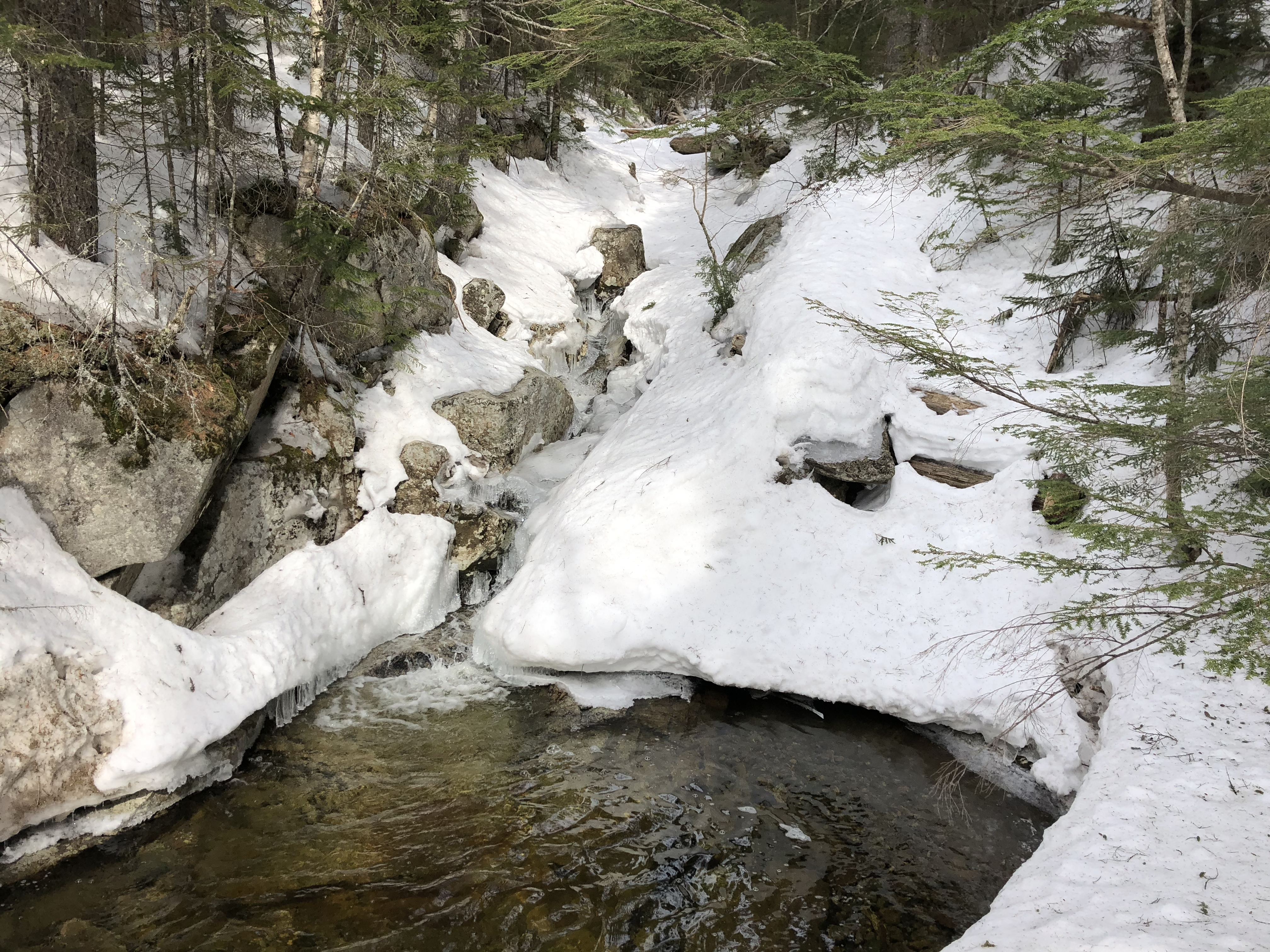
The trail wasn’t quite full monorail, meaning, the surrounding snow hasn’t yet melted. But there is definitely a compacted monorail of snow, surrounded by soft fluffy snow. What that means is if you step at all off the side of the monorail, that leg can sink down, sometimes several feet. The compacted part of the trail is very narrow, really only the width of two snowshoes, maybe 24 inches wide. This means you have to pay attention and step on the trail. It also means when people pass eachother, it is a very careful thing. How do you “step off the trail” without sinking to your hips? Very, very carefully.
We continued on to the short side path to Gibbs Falls. Unfortunately, I wasn’t willing to go far enough to get a good pic.
From there it was up, up, up. Not a terrible incline, but not many breaks in the terrain, just climb, climb, climb. Of course, there’s always opportunities for photos. “Keep walking, then turn around part way”. You know, totally candid, natural action shots.

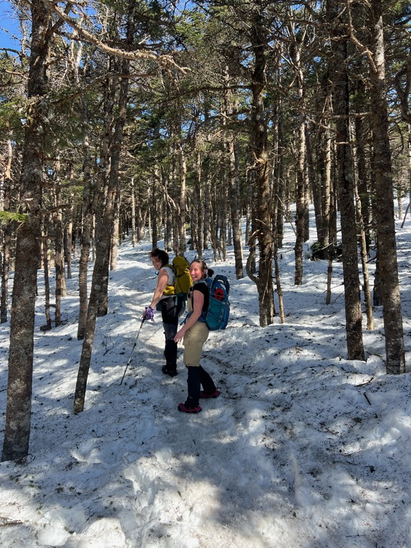
Photos courtesy of Awestruck. And yes, we are hiking in t-shirts and sleeveless shirts. The forecast was accurate, and it’s warm when you’re ascending. Given just the temps, I would have been in shorts, but knowing the potential for postholing, I wore leggings with gaiters.
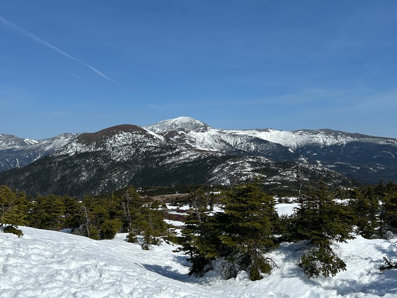
As we got closer to the summit, the trees began to shrink, and we started to get some views.

And then more views,

The round one closest is Eisenhower. Washington to the right of Eisenhower. And Adams and Jefferson to the left. Very cool to think that I walked from Jefferson to Washington.
Then I asked the ladies to take a group selfie, and was ignored.

At the junction to either go right and the summit of Pierce or go straight and head to Eisenhower, there was a large group of young men/boys. Their group leader seemed great as he instructed the boys to make sure they weren’t blocking the trail. They were heading off to Eisenhower, and he said they would be silent for 15 minutes while they took in the grandeur. Luckily for us, who could not possibly stay silent for 15 minutes, we were taking the right to get to the summit of Pierce.
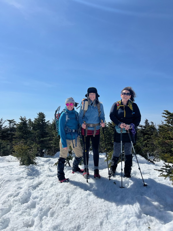
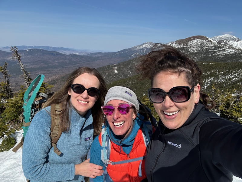
Photo courtesy of another hiker at the summit
After a few photos and a quick break, we headed back toward the junction, since it was a bit windy at the summit and the junction was more protected.
Facing the junction, that’s the Bartender ahead of me,

With the wind and exposure at the summit, there was some exposed rocks and the melt was creating this weird red stream. 100% looked like a blood sacrifice was happening. Or maybe I’ve been re-watching too much Supernatural. But look how the snow ahead is rusty-colored!

Back at the junction, we stopped for lunch and our traditional toast.


Also some goofing around, (photos courtesy of Awestruck)


And a “summit” selfie
Then it was time to head back down the way we came.
We saw a Grey Jay. He was hanging out and watching us. I told the ladies that they should not be fed, because they’ve become used to it and can actually be aggressive. But they can be tricked!
Video courtesy of the Bartender
I didn’t have any food in my hand, but just held it out. Obviously the Grey Jay figured that out pretty quickly and flew off.
The rest of the way down wasn’t too bad, except for the number of people passing us. Trail etiquette says that people ascending have the right of way. As we were descending, it meant we should move aside whenever people were coming up. As I said, the trail was very narrow. Many times, one of us would take a tentative step off, try to allow someone to go by, and then one leg would drop. Or other people would let us pass and they would posthole.
Having not postholed most of the day, it was apparently my turn. Now, the problem is not just that your foot sinks quickly into the snow, but that your other foot DOES NOT. So imagine you’re standing on an old wooden floor. And suddenly your left foot punches through the floor. Your body drops, but your RIGHT foot is still at floor level. Therefore your right leg folds up, perhaps unnaturally. And that is what happened to me. Left foot dropped so that my leg was buried in snow just above my knee. Right foot was still on the trail. Body, thanks to gravity and the fact that my left foot was now two feet lower, dropped to the ground. I don’t have amazing knee flexibility, but suddenly my right knee had to.
So. First, assess if anything is badly hurt. No. OK. Second, extricate the foot in the post hole. Next, see if the right leg still works. Yes. Lastly, try to get up on the narrow trail and not post hole again. Also yell at friends “don’t you dare take video of me trying to get up. Well, she didn’t take video at least. Photo “courtesy” of Awestruck.

The red circle is where my left leg tried to find the center of the earth. Note some one else’s much smaller post hole on the other side of the monorail, showing just how narrow the solid part of the trail is.
After that, it was pretty uneventful to the trailhead. We took off our spikes to cross the road, so this last bit was possibly the most challenging.


The Bartender did not fall, but was scooching down after watching myself and Awestruck both slip.
Finish selfie!
That’s #7 for Awestruck, possibly #4 for the Bartender (she still needs to check her records for previous hikes). And my second time on Pierce.
- Distance: 6 miles
- Elevation gain: 2,400 feet
- Mountain elevation: 4,312 feet
- Total time: 6 hours
- Moving time: 4 hours, 39 minutes

Try Mount Washington for size…Almost made it to the top when and unexpected wild windstorm shut the trail. Ranger kicked us out!
LikeLike
Yep! I’ve done Washington twice, once in great weather, once in not so great weather. It isn’t even so much the mountain, as it is the day, we did Tecumseh last month and winds were EPIC!
LikeLike