Rainbow and I decided to hike the Tripyramids on Wednesday. Since it’s fall, daylight hours are short, and hiking the Tripyramids is at least ten miles no matter which trails you take. For Rainbow and myself, ten miles likely means around ten hours. Sunrise was around 7 and sunset around 6. Which meant leaving home at 4:45, with a wake up time of 4AM. Neither of us wanted to do that. Unfortunately, October in New Hampshire is prime leaf peeping tourist time, so hotels are booked or overpriced. It’s also a little too cold for camping (for us). Enter Huttopia! Glamping! Actual beds, a refrigerator, and hopefully a bit warmer than regular camping. And a 5:45 morning alarm instead of 4AM.
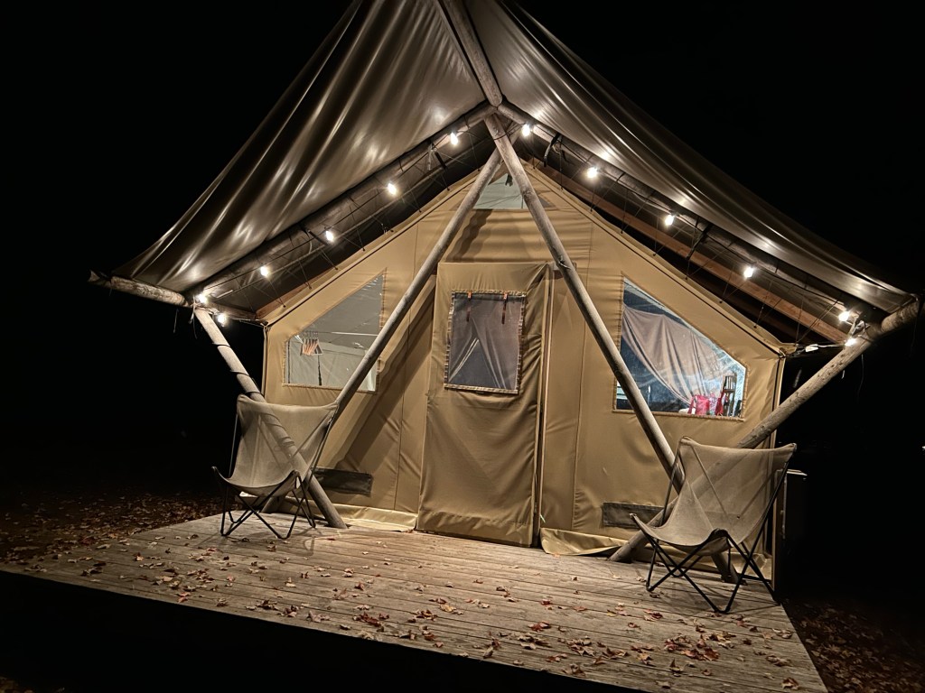
I would stay here again. I think it might be the only way to get my daughter camping. I was a bit bummed that we arrived so late and only stayed one night. It was chilly, but still warmer than camping would have been and much better than a 4:45 alarm.
Even still, it was freezing when we woke up. Actually freezing outside.
On the way to the trailhead…
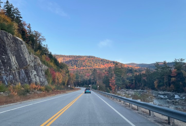
Despite staying closer to the trailhead, I guess the freezing temps in the morning slowed us down, so we didn’t get to the trailhead until 8AM.
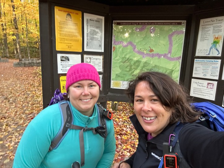
We were starting at the Sabbaday Brook Trail, up to the Tripyramids, and then back down via Pine Bend Brook Trail. That route would allow us up to Middle and North Tripyramid, while avoiding both the slides frequently taken on other trails. (Slides are rock slides that sometimes coincide with trails. They’re usually pretty scary with loose rocks and steep climbs. Both of the trails with the slides for the Tripyramids are on the Terrifying 25 list).
Like many a hike we’ve taken, the first two miles or so were relatively flat. However, the trail (aptly named after a brook) had many many water crossings, which slowed us down some.


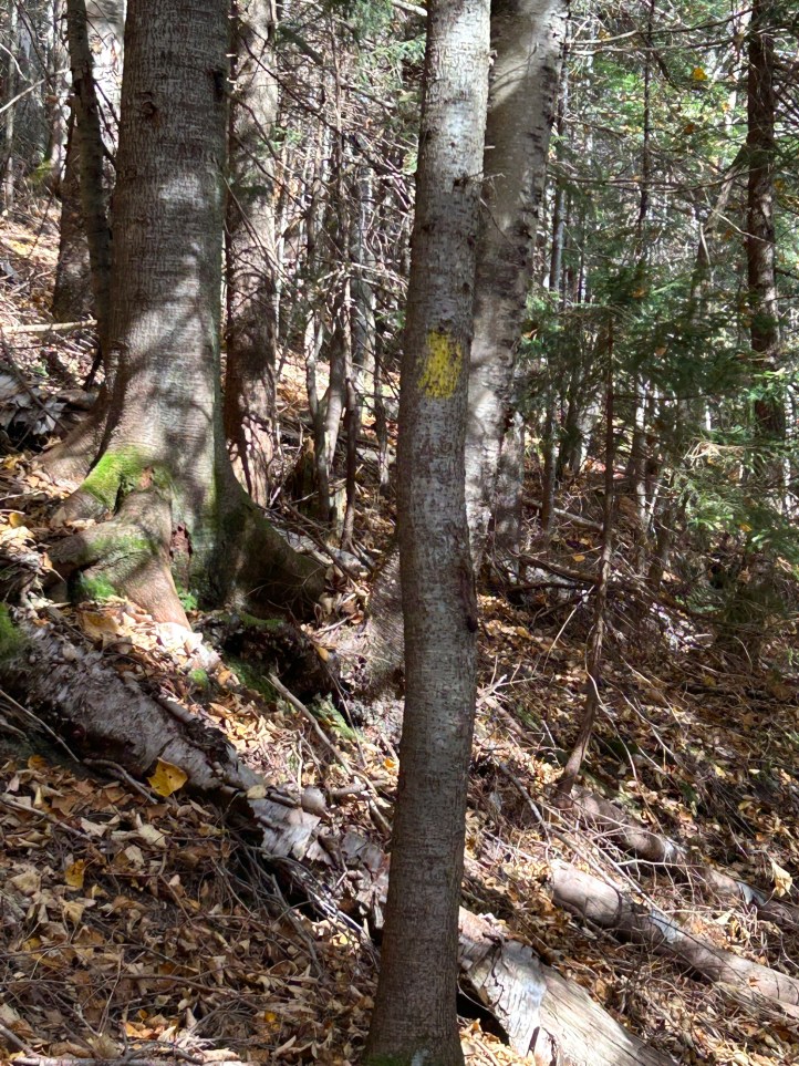
None of them were terribly difficult, but several required us to pay attention and slowed us down. Also slowing us down were all the leaves. Leaves covered the trail. The trail was very poorly marked. We hardly saw any blazes all day. They were so few and far between that we exclaimed when we actually saw one. The lack of blazes, and the leaves on the trail caused us to wonder if we were even on the trail several times. We had to stop and check our phone apps quite a few times.
This guy jumped onto the trail and scared the crap out of me.

As with many of the trails we take, the “easy grades” had to turn into a hard climb at some point. At around 2 miles, the trail started up. I knew we had 3,100 feet of elevation gain, and we weren’t getting it in the first 2 miles, which meant we had some difficult miles ahead. I was right, we gained roughy 2500 feet in a little over 2 miles.
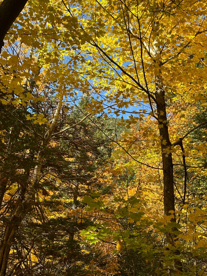
At one point, we got a glimpse of where we were headed. We could peep Middle Tripyramid through the tree tops.
And much of the elevation gain was via tall boulders. There was a lot of pulling yourself up to get up.
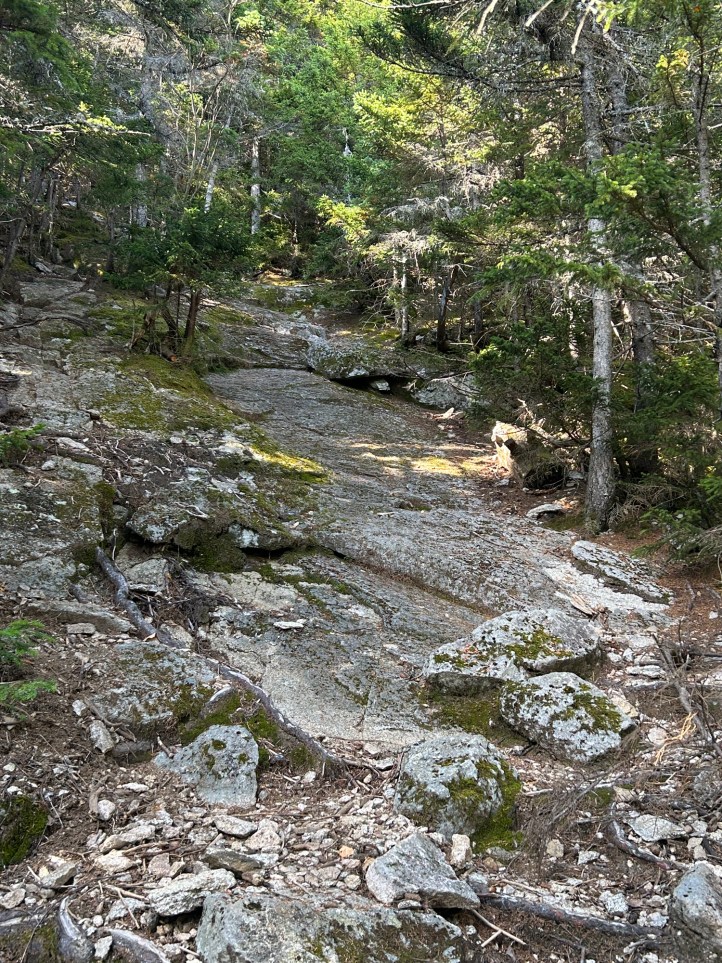
It’s always difficult to capture the steepness of the trail in photos. Note the angle of the trees growing up from the trail. The trail was probably at a 45 degree angle or steeper.
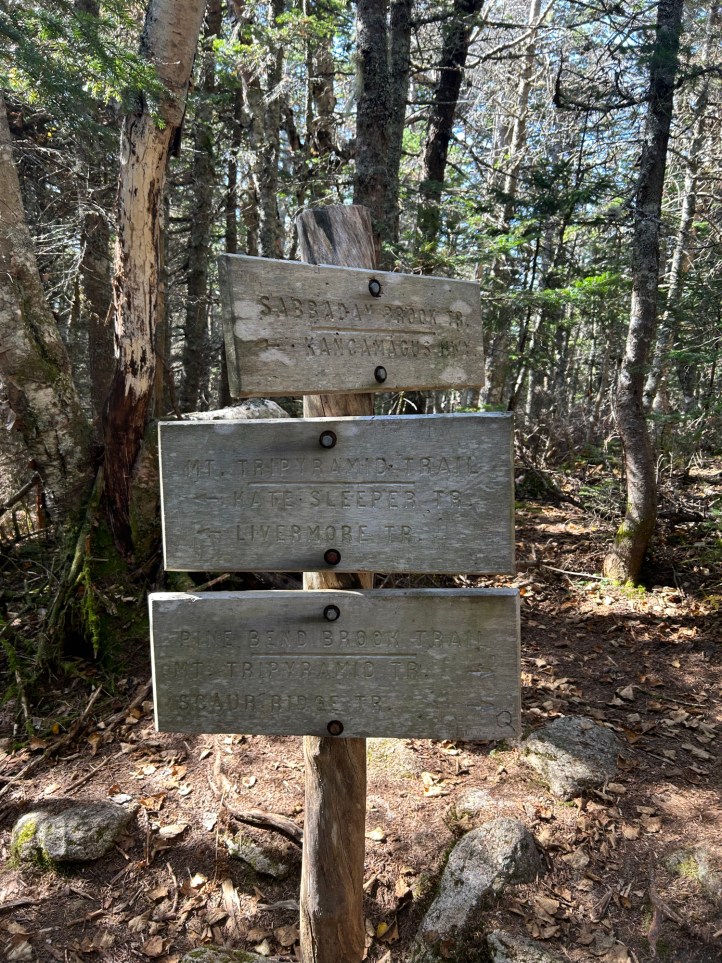
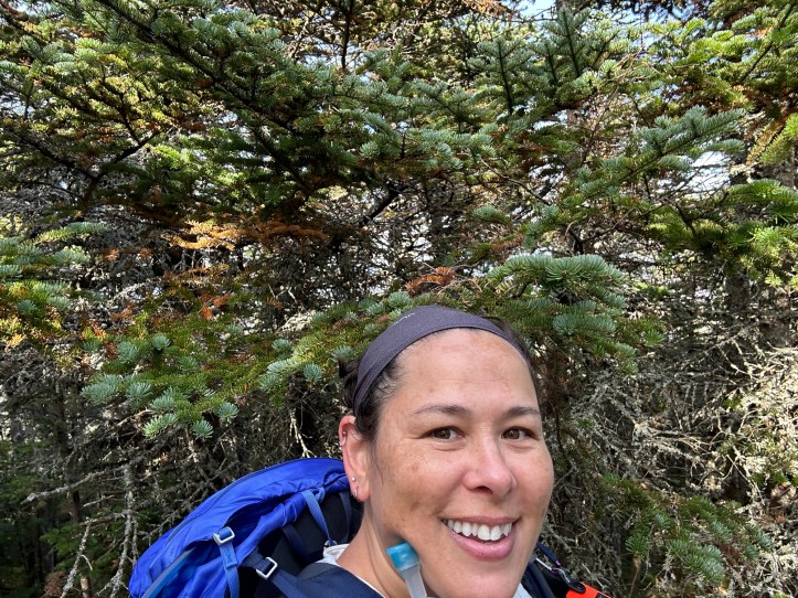
We finally reached the junction. This was also where we saw our first people! It was honestly a bit strange not to have seen anyone all day. We took a left at the junction and headed over a relatively easy hike to Middle Tripyramid (#31 for me and #19 for Rainbow).

We stopped for a snack and a stretch before heading back the way we came to the junction. At the junction instead of returning to Sabbaday Brook Trail, we continued on straight to North Tripyramid. #32 for me and #20 for Rainbow!
As you can see, there isn’t much view from North Tripyramid. We saw two hikers there who had come up from the north slide (Livermore Trail) and said there were some great views from the top of the slide. It meant a 0.1 mile (0.2 roundtrip) detour, and more importantly, we’d drop 150 feet and have to come back up 150 feet. We descended a short way, decided it wasn’t worth the extra mileage and descent/ascent, grabbed this lesser view, and returned to our original route.
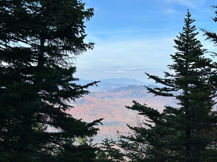
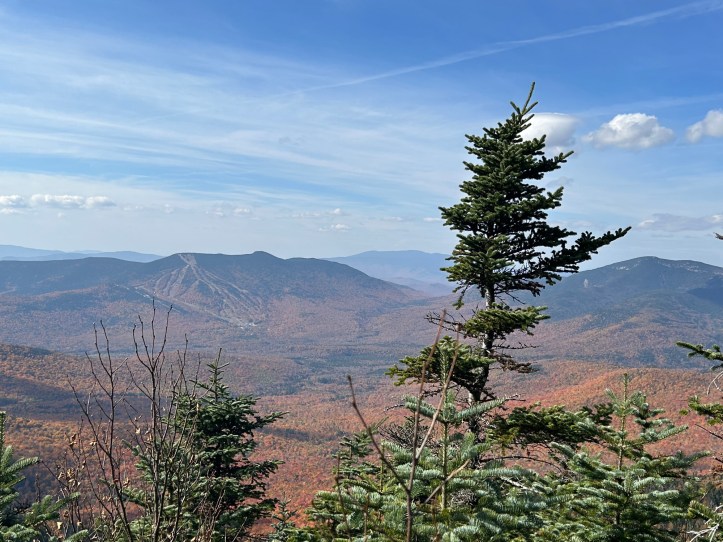
We then began our descent via Pine Bend Brook Trail. It seemed slightly less steep than Sabbaday had coming up, and was better blazed. We could occasionally peek some nice views between the trees.

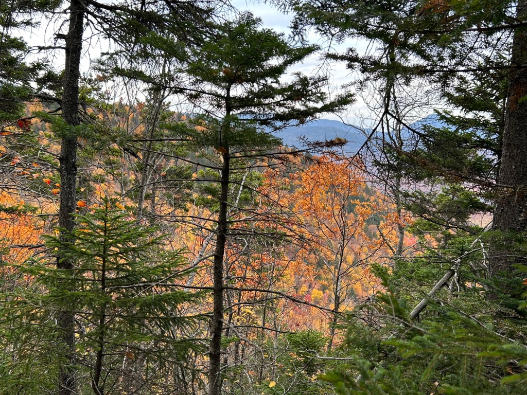
Photo credit on the left: Rainbow. Photo by me on the right.
Pine Bend Brook Trail still had its share of steepness though. Here I am doing my best “Mountain Women of New Hampshire” as I had to sit on this boulder to get down it and struggled to bring my leg over.

It was about this point we saw a trail runner. We mentioned that we hadn’t seen many people all day, and she said there was someone else coming up behind her. We didn’t see anyone for quite some time, and actually began to worry that their hiking partner had a mishap. Finally we ran into another trail runner. Apparently he had tried to come up Sabbaday Brook Trail and couldn’t find the trail. He eventually gave up, went back to the road and was now coming up Pine Bend Brook Trail. I imagine being a trail runner, he likely didn’t have the patience to stare around confused as we did until we found the trail.
We continued to descend. Slowly. The rocks were large and scattered, but also covered in leaves. It was very difficult to tell if you were about to step on a rock, or the ground, or just a pile of leaves that would compress down six inches when you step on them. We use trekking poles, and often you would place it on the ground only to have it sink down several inches, or skitter along the leaves. It was nerve wracking.
And then I fell.
My feet went out from under me. Thankfully I seemed to land on my back between rocks (rather than on a pointy rock, or on my head). Still, it hurt. And worse, it shook me. I was already proceeding slowly and cautiously and I fell anyway. I was only halfway down this particular stretch, I still had a lot to go. I took a moment and sat there. I finally got myself up. It hurt, but I got to the bottom of that bit and caught up to Rainbow, who was waiting for me, clearly concerned.
I stopped and I swore. A lot. And I yelled. And I said “motherf*cker, you are not going to cry”. And then I cried.
And then I sucked it up and kept hiking. It was slow going, which was worrisome, given that we had a tight window of sunlight, and we started an hour late. But there was just no way to rush. And even going slow, Rainbow fell too. She was fine. She didn’t yell or swear or cry, but her pole did go flying several feet.
It finally started to level out some, so we could at least shuffle our feet along in the leaves, so we could avoid tripping over unseen rocks or roots.
There were of course some lovely mushrooms that I had to appreciate.
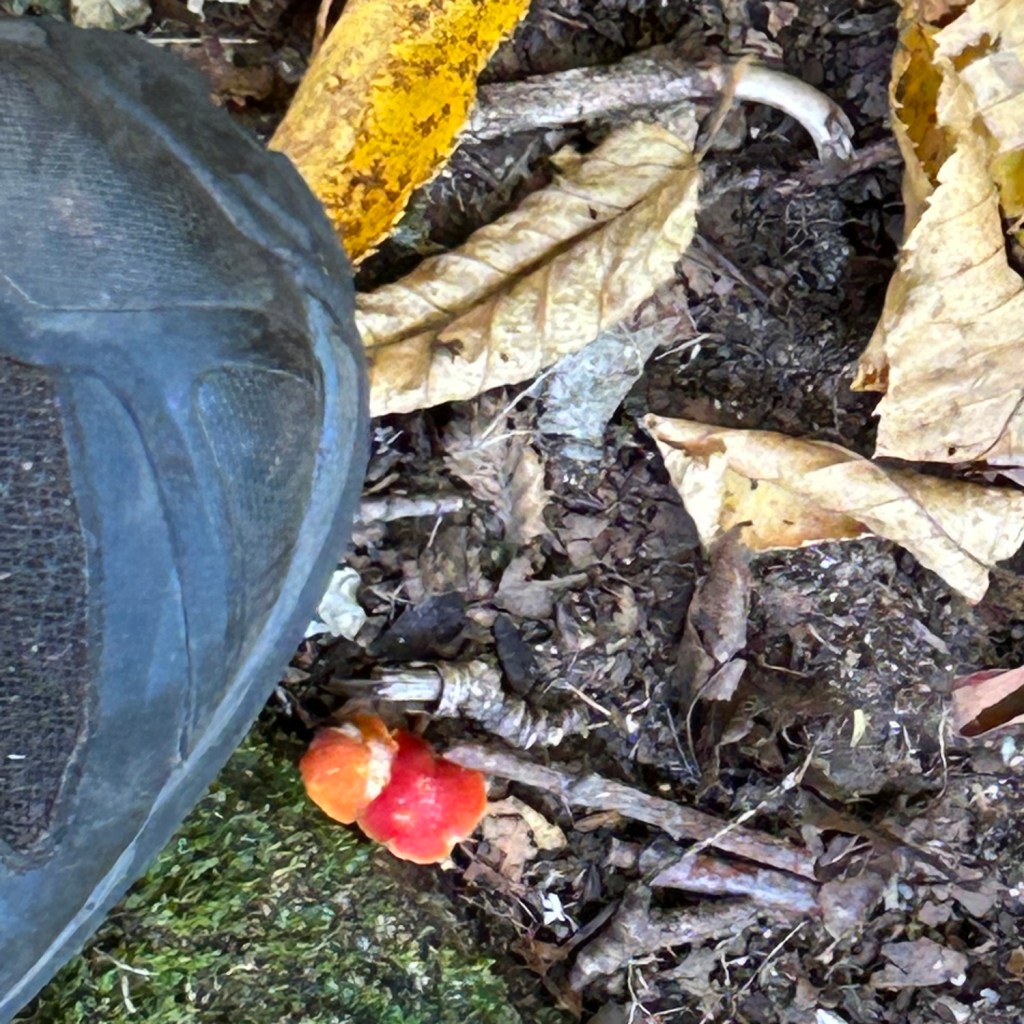
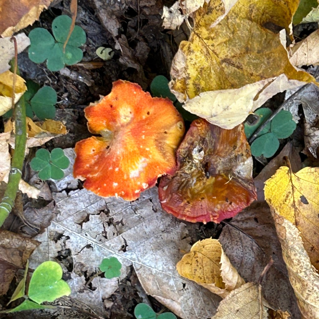

And the ones on the right were almost glowing in the dim dusk light.
Finally we reached the Sandwich Wilderness Range sign, which we knew meant the end of the really steep trail. We did have several water crossings to go, but the trail runner we saw earlier said they were all really easy. He was right, the Pine Bend Brook Trail crossings were much easier than the Sabbaday trail crossings. Please note, I was well aware of all of the water crossings. I also knew water levels were low. All of those water crossings can be very different and not at all easy at different times of the year. I would not have risked walking out in darkness when water levels are higher.
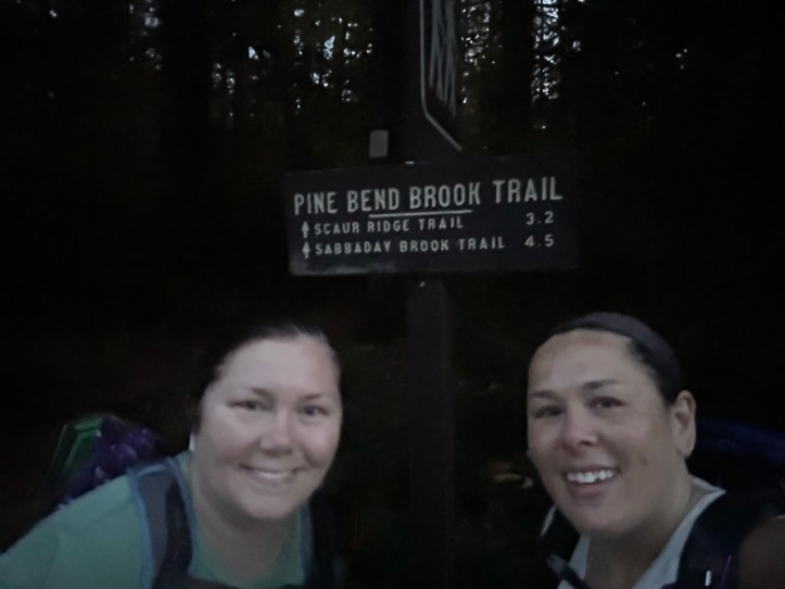
We were finally past the water crossings as the sun set, and darkness began to set into the trees. We continued to shuffle walk through the leaves. Even though we could still see without headlamps, the low light flattens everything out. Rocks, roots, ground, it all looks the same and at the same depth. We finally could hear cars on the road and got back to Rainbow’s car at the trailhead. My phone attempted to adjust the light so you could see us, but I think this still gives an idea of how dark it was getting when we finished. We may have to hold off on any more ten milers until spring and more daylight.
- Total distance: 10 miles
- Total elevation gain: 3100 feet
- Total time: 10 hours, 32 minutes
- Moving time: 7 hours, 59 minutes

I love following along on your travels – thanks 🙂
And I appreciate the tree picture to show the angle of the slope!
LikeLike