Next up, #33 of the NH 48 for me, East Osceola. Many people hike Mount Osceola and Osceola East Peak together. However, I had hiked Mt Osceola back in 2018 with my then 11-year-old son, and we weren’t up to both at that time. So that left me needing to get just East Osceola. Optimal hike would be both from Tripoli Road side. However, since I was only getting East, I chose the Greeley Ponds approach, even though it’s steeper, it’s shorter. I’m gearing up for some big stuff this summer, and I a) needed to summit East Osceola and b) wanted to have a successful hike. Hitting East from Greeley Ponds was just the right distance and elevation.
So as I said, shorter and steeper. Also East Osceola doesn’t have any views. AND Rainbow and Right Turn had already done East Osceola. I was fairly sure that meant a solo day for me. However, Rainbow figured it would be good to do to get ready for Isolation in two weeks, so Rainbow and I planned to meet at 10 at the Greeley Ponds Trailhead.

Excited to tackle #33 for me, we set off. Chugging along, excited for the start of a hike, full of momentum, and BAM water crossing. Now Friday night through Saturday it rained. I knew some water crossings might be high. We got to the biggest one and normally, it can be rock hopped. As we approached, we saw three people with socks and shoes off, crossing. On the other side, a large group was sitting down putting their shoes and socks back on. Rainbow went upstream a bit to see if there was a better crossing. There wasn’t. So off with our shoes and socks, and even stepping on the normal rock-hopping rocks, it was at least ankle deep.

The perspective on this photo (credit: Rainbow) doesn’t show the width of the stream, it was definitely wider than it appears here. You can see that I’m ankle deep. You can also see some folks in the background. While we crossed and after while we put our shoes and socks back on, several groups approached. Every single one went upstream to see if there was a better place, and every single one decided this was it. A few folks turned around and went back.
It was a bit of a motivational killer, but no matter, off we went!
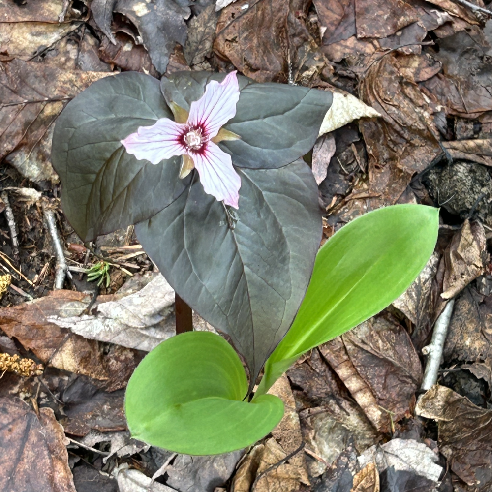
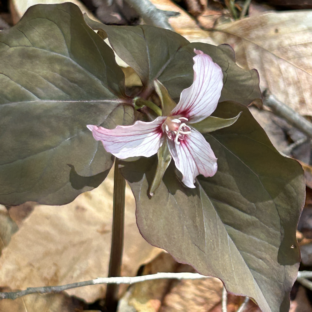
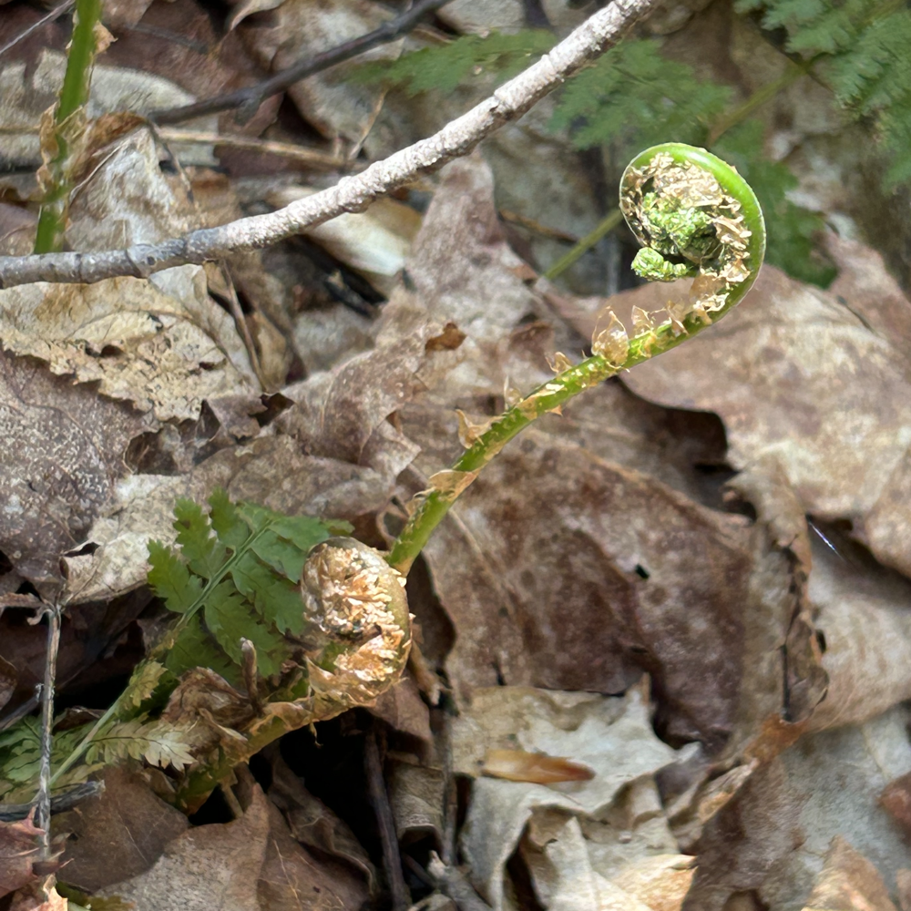
At lower elevation, spring is in effect and there was lots of trillium! And fiddleheads!

After a junction with the Mt Osceola Trail, the trail begins to get steeper.
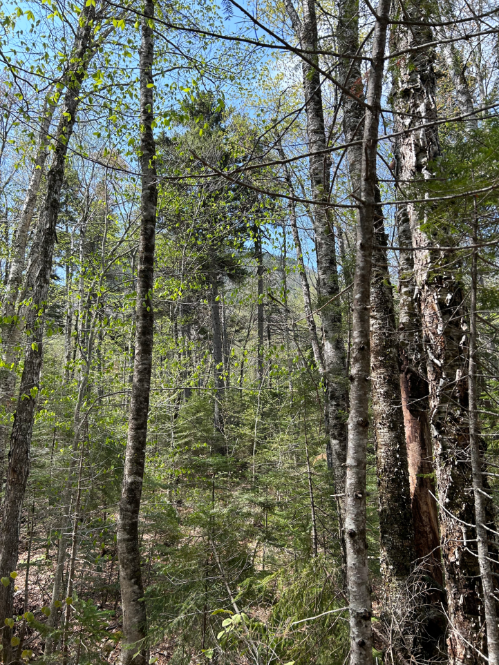
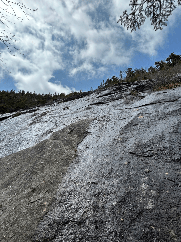
We had a glimpse through the trees of where we were headed.
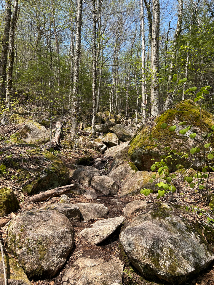
Again, the photos never to justice to the steepness of the trail, or the size of the boulders. But that photo above IS the trail. Not the view from the trail, but the actual trail. Good times.

Life finds a way.
I had brought my newly put together plein air painting kit, in hopes of trying it out. We scouted for a good spot. We thought we might stop for lunch at the bottom of this rock face (thankfully NOT the trail), but there wasn’t a comfy spot to sit.
There were several more water crossings, none like the one where we had to remove shoes and socks though.

Even though the summit is viewless, there are some nice views along the way if you turn around.

And there was a little outlook…


Then it gets steep(er).
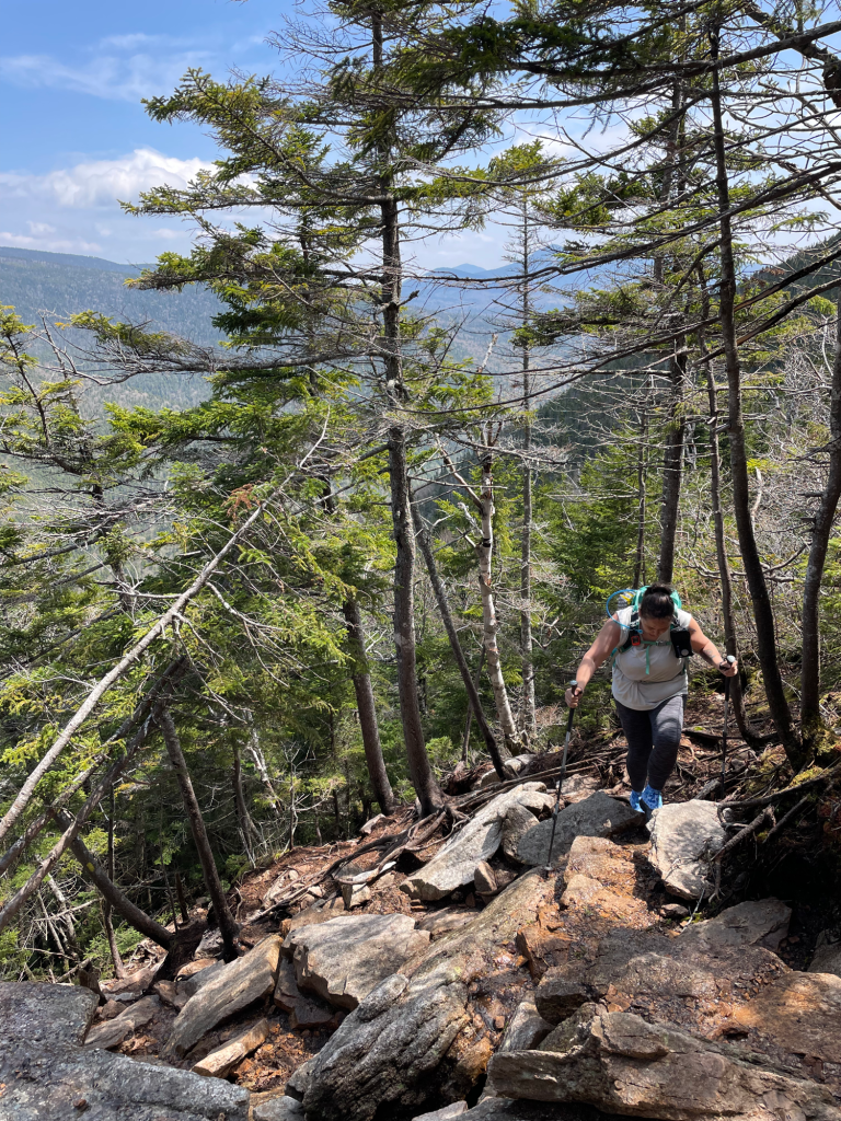

Photo credit: Rainbow. Note the chunk of ice in the foreground of the pic on the right.
As we got farther up, there was still some remaining monorail, but we didn’t need spikes at all.

Photo credit: Rainbow
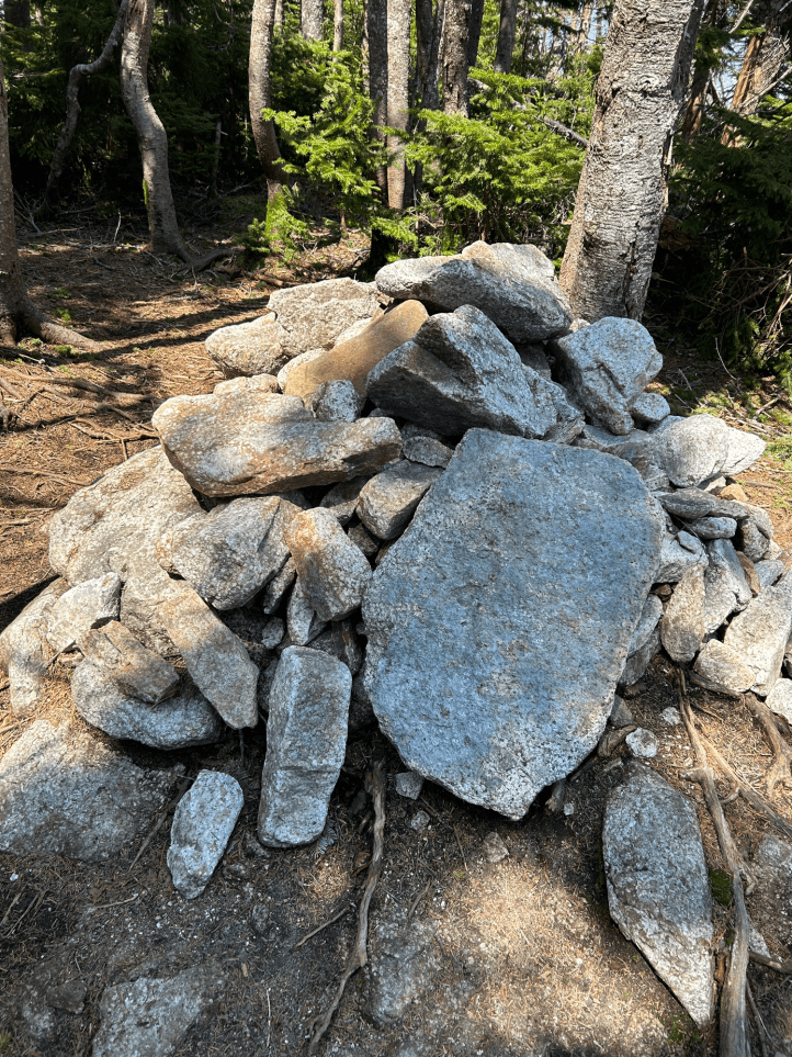
And finally, we made it to the viewless summit! #33 for me!
It was a bit of a slog back. The steep rocks. Lots of mud from the all the rain.
Struggle is an interesting thing. While you’re in it, it’s all you see. As we descended, I was my usual very slow self. My legs were tired. I was tired. I just wanted to be done. But I also wanted to be better. Be stronger. Be confident enough to go faster. Not just thinking about all the things that hurt.
And I realized, I AM better. I AM stronger. I AM more confident. But because it was still a struggle, that was all I could think about. I did notice that all the pulling myself up and lowering myself down that’s necessary on a steep trail were still difficult, but were WAY easier than they used to be.
We marked off the milestones we had noted on the way up, counting down the steep stretches down to the junction and the water crossing. We debated on the return water crossing, if we should take off our shoes and socks, or since it was so close to the trailhead if we should just cross. The water had gone down some, so we figured we’d attempt rock hopping. Did I mention I was wearing brand new shoes? Which by this point were nice and muddy. I think Rainbow made it across with just a wet toe. I managed to fully submerge both feet. It was a squishy final quarter mile back to the car. But hey, my shoes were clean.

- Distance: 5.6 miles
- Elevation gain: 2,216 feet
- Total time: 7 hours, 46 minutes
- Moving time: 4 hours, 56 minutes
