Owl’s Head – “This is the worst”
This is a long post, but a long hike deserves a long post. And you should suffer as much as I did.
We had planned (how many of these posts start with that?!) to do an overnight to Owl’s Head this weekend. After scrapping Isolation last time due to weather, we thought we could do Isolation this weekend if the forecast was nice, or Owl’s Head if it wasn’t nice. As we got closer to the date, the forecast was TERRIBLE for Saturday. Rainbow asked if I’d want to take off Monday and do Sunday-Monday. Sunday was starting to look sketchy, so we also made an option of hotel Sunday night in Lincoln and attempt to do Owl’s Head in a single day on Monday. Basically my contingency plans had contingency plans at this point.
Saturday morning, two of the sites I check for trail weather seemed to be in agreement. Rain ending Sunday morning and returning Monday afternoon. Our top option was start at noon on Sunday, hike into camp and set up. Monday we could get up, get the summit, come back down and pack up, then hike out.
Sunday morning, I woke up and it was raining, as expected. I drove to pick up Rainbow and the rain stopped just as the forecast said it would! Huzzah! We got to the trailhead a bit later than planned, but we had a lot of daylight left (sunset was at 8:30 PM). The hike in is long, but mostly “flat”, so we thought (hoped) we’d make good time. Maybe even get to camp early enough to get the summit on Sunday rather than Monday. (Please feel free to laugh at my optimism).
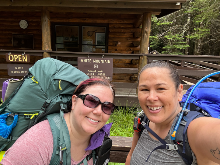
Trailhead selfie! Look how happy and energetic we look!
A volunteer at the ranger station came out to chat with us. Seeing our gear, she asked where we were going and if we were backpacking. We said Owl’s Head and that we were backpacking. She asked us about our food storage since there had been recent bear activity. We’ve got the necessary equipment and were prepared. (Side note, if you’re not prepared, the ranger station has bear canisters to loan out!). She also cautioned us on the water crossings. It’s rained for what feels like forever. I’d been monitoring the water levels (yes, there’s a website for that). And they had spiked, but were already going back down. We had water shoes and are risk averse. We assured her we’d be careful and turn back if it was bad.

Noon on Sunday, the water level was where the orange line is at 5.5 feet. A little over a foot higher than normal. This isn’t the same river, but a nearby one, and at least a good gauge of relative levels.
And so, we started off. The first 2.5 miles is on the Lincoln Woods trail. There is only about 350 feet of elevation gain. It’s a wide, level, packed dirt path along the river. Pleasant enough when you’re fresh and excited. (Foreshadowing) We saw lots families and people with dogs, enjoying a nice walk along the river.
We left Lincoln Woods trail for the Black Pond trail. By taking Black Pond trail, we could take what is known as the “Black Pond bushwhack”.

The red line is the actual trail starting at the bottom of the image, going up and then left. Blue up to the pond is Black Pond Trail. Blue from Black Pond up to the red is not an official trail. However, so many people have taken it, that it’s shown in apps like Gaia and AllTrails. It’s also very easy to see and follow in person. We were taking the bushwhack, not to shorten the hike (though that’s an added bonus), but because the bushwhack eliminates something like five water crossings.
Once we turned onto Black Pond trail, it was just us on the trail. More like a regular trail, it winds through the trees and bushes. At one point, a guy coming from the opposite direction thought it would be funny to growl like a bear. He scared the crap out of us. Not so much because we thought there was a bear, but because he startled us, and then thought it was funny. He also didn’t seem to realize that maybe a guy scaring two women in the woods wasn’t a great idea. Or that it would stick with us both and bother us for the rest of the trip. At least I hope he didn’t realize. The way he laughed as he passed us made me think he enjoys scaring people, which added to the creepy uneasy feeling I had for quite a while after.
Happily, as soon as we saw the pond, there was a friendly group of three taking a break. We were glad to see them and it helped shake off some of the unease. Also the pond was lovely.

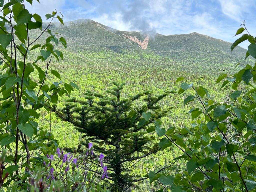
You can see some mountains in the clouds. Those are the Bonds, which I will hopefully be hiking next month! You can also see that although the rain had stopped, it was still overcast.
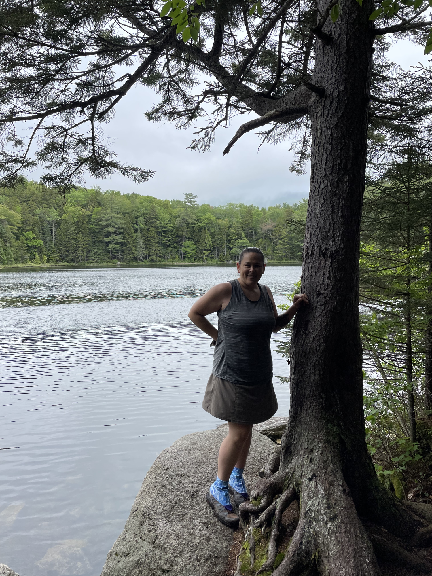

Rainbow and I posing at the pond.
From here, we were on the bushwhack. It was very easy to follow. At one point, we saw a couple coming back. We asked about the water crossing and they said they were do-able. Not rock hop-able, but cross-able. We ended up seeing some more people who reported the same.
We popped out on Lincoln Brook trail (not to be confused with the starting Lincoln Woods trail).
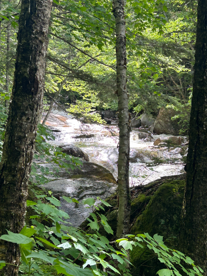
We got one of our first sightings of Lincoln Brook, which we would eventually need to cross three times.
Rainbow took this video of me on one of the three (not sure which). A few things here. One, we had water shoes. Knowing there would be high water crossings that we couldn’t just hop over rocks, we brought shoes. While you could just cross barefoot, I wouldn’t recommend it. Lots of rocks and bare feet on water covered rocks are slippery. Two, trekking poles are IMMENSELY helpful on water crossings. I know lots of people don’t like to hike with them, but I could not have crossed without them. The current is strong and pulls at you. Especially when you’re shin-deep. The poles kept me upright. Third, note that MY PACK IS UNBUCKLED. This is intentional. When crossing water that you have the potential to get knocked over and float, your pack should be unbuckled so it doesn’t weigh you down. Attempting to not drown and unbuckle your pack at the same time is hard. Don’t do it. Lastly, as an extra precaution, I moved my emergency beacon from my pack to my bra. If for some reason I do go floating down the river, I’d rather the rescue team find me and not my pack.
After the first crossing, we changed back into our hiking shoes. At the second crossing, we left our water shoes on until after the third. They were all high, but as others had said, cross-able. After the third crossing, we had about a half mile to the base of Owl’s Head Path, which is also where we planned to camp. It was also about this time that it started raining.

That’s the trail, the actual trail. To recap the day so far, we walked along a river, walked through mud, walked along another river and walked over many many little streams draining into said river. Crossed the river (or branches of the river) three times. Walked through mud and water pouring down the trail, in the rain, still along the river.
We were wet. Everything was wet.
We easily found a place to camp right across from the Owl’s Head Path cairns. While technically, the place we camped is against WMNF dispersed camping regulations, since so many people have camped there, the rangers frequently recommend camping there, rather than making a new spot and impacting nature worse than if you just camped in the already created spot.
So we set up in the rain/mist. It stopped enough once we were done that we could make and eat dinner. Fun fact, there was so much water on the trail, that we actually gathered our water to filter from the trail itself. That was a first.
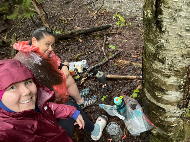
Try to contain your jealousy at how much fun we’re having.
After dinner, it was prep for bed and in bed by 9. I’m pretty sure I could still see light through the trees. But cold and wet and hiker midnight means bed at 9.
Day 1:
- Distance: 7.5 miles
- Elevation gain: 1,558 feet
- Total time (including some time setting up camp because I forgot to turn it off): 5 hours, 40
- Moving time: 4 hours, 14 minutes
Monday, we woke up shortly before 7 AM. While we chatted during breakfast, we realized that we had both woken up to pee in the middle of the night and BOTH had wondered for a moment if that weird guy that scared us might be in the dark waiting to murder us. (Spoiler alert: he didn’t murder us)
We were camped right next to the water, which was like having a very loud white noise machine next to you. So I occasionally woke up when a particularly loud drop of water hit my tarp, but was largely unbothered by forest noises, which can often spook people.

We decided to leave behind our tent and hammock, bedding, and stoves, so our packs would be lighter for the climb to the summit. I have heard about people finding “abandoned” gear and taking it away. So I left a note, “SUMMITTING BRB”.

The two cairns marking Owls Head Path. Not a bushwhack, but also not an official WMNF trail, which mostly means no signs or blazes or trail maintenance.
The trail to Owl’s Head is very different than the day before. Sunday we gained 1500 feet over 7.5 miles. We would now be gaining 1300 feet in half a mile. That’s a 49% grade. 49%. Oh yeah, and it’s up a rock slide. I didn’t take any photos because I WAS CLIMBING UP A ROCK SLIDE. As in, put down your foot and rocks move around. Some parts required hands and feet, but it wasn’t actually that bad. I think the worst part was not knowing how much farther it would be and if it might get worse. It also had some break spots so you could gather yourself before the next part. There were also a few views.

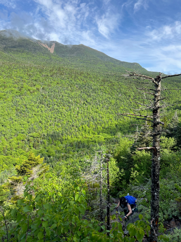
That’s Lincoln and Lafayette in the distance. It’s always cool to see mountains you’ve hiked and realize you walked across the tops. (Far right photo credit to Rainbow. I love that pic!)

I think this image (taken by Rainbow) helps show the steepness of this part of the trail.
It levels out near the summit, and there was a little outlook to the other side of the mountain

The Bonds again but from a higher perspective than Black Pond.
And finally, the summit.


We still had to get home. Ha.
On our way back down, before the slide, a group of hikers were heading up. They looked to be in their 60s or 70s. I’ve learned never to underestimate older hikers. While they may have older bodies, they also have way more time to hike and are pretty damned good at it.
Instead of descending down the slide, there is another bushwhack, the Brutus bushwhack (supposedly named for a dog that refused to do the slide and went around). We had talked to some folks that said the bushwhack was still steep, but not a rock slide, though it was very muddy. That turned out to be accurate intel. The Brutus bushwhack is slightly longer (and therefor less steep), but it was muddy. We both had several near falls. Once again, I think my trekking poles did a lot of the work here at keeping me upright. I’d still take the mud over trying to descend the slide.
One note here, MOST of both bushwhacks were very easy to follow. However, at one point the Brutus bushwhack comes up to a stream crossing. You can see a path on the other side. We even crossed over, but it was definitely going uphill, not down. So we checked the apps and it appeared the bushwhack was supposed to turn downhill just BEFORE the crossing. But we couldn’t see the path until we were on the far side, and it was covered in water so we weren’t sure. Instead of crossing, you need to turn right around a big bush, and essentially get in the stream for a second in order to see the path. Once we did that, it was again very clear we were on the right path.
The bushwhack comes out on the trail just before the water crossings, so unfortunately we had to go back to the base of the slide to pack up our stuff. If I were to ever do this again, which I absolutely won’t, I would camp near the Lincoln Brook crossing, so you could come out from the bushwhack right at your stuff. While we were hiking however, I was quoted as saying about repeating this hike “I’d rather be shrunken down and hike into Satan’s asshole”. So I don’t think I’ll be doing this one again.
Our stuff was still there and while we were packing up, a gentleman and his son approached us. They were backpacking and had apparently forgotten their water filter. Though there is literally water everywhere on this hike, I wouldn’t advise drinking it without filtering it. They asked if they could use ours to fill up their bottles. Of course, we said yes.
Packed up, we hoisted our once again heavy packs and set off. Mental milestones would be done with the water crossings, getting to Black Pond bushwhack, getting to Black Pond, getting to Lincoln Woods trail, THE CAR.
This was the longest 8 miles of my life. Before I write up the rest, let’s take a nature break.


Near Black Pond, we saw this amazing bunch of Chicken of the Woods. I was way too tired on the way out to grab some though. Some other mushrooms, and this cool looking slug.
That’s a cool looking slug, unlike the boring orange ones that seemed to be on every tree I used to hoist myself up. So gross.
So anyway, back to the long, trek out. Got to the water crossings. As expected, they were slightly lower than the day before. We still needed to change shoes, but still cross-able. However, the shoe change takes time. And when you just want to be done and back at your car, it’s time you REALLY don’t want to spend. However, walking 8 miles in squelching shoes would have been worse, so.
Not long after the last water crossing, the octogenarians passed us. PASSED us. As in were hiking out faster than us. In our defense, they had really small packs and looked very fit.
It was also around this point that the bugs stopped caring about my many lines of defense against them. I counted 15 bug bites when I got home and just stopped counting.
We got to the bushwhack…we got to Black Pond…we got to the Lincoln Woods Trail. And there, somehow time stood still. The trail magically went on and on, never ending. I saw what I thought was the end and started to cry. We got closer, it wasn’t the end. Rainbow thought she saw a sign for the end, turned out to be a birch tree. My feet hurt, my legs hurt, my hips hurt, my back hurt. My shoulder was screaming. I fantasized about throwing my pack in the river. I wondered if you use a wheelchair on the last mile, does the peak still count for the list? Could I take off my pack and hire someone to go back and get it? Something about that trail made me acutely aware of every part of my body that hurt. And every part of my body hurt.
And then finally, the bridge that leads to the ranger station, which is next to the parking lot. My beautiful chariot awaiting our return. Notice there is no finish selfie as we were too exhausted.
And I made a meme:

Day 2
- Distance: 10.5 miles
- Elevation gain: 1,763 feet
- Total time: 12 hours, 12 minutes
- Moving time: 7 hours, 37 minutes
Total
- Distance: 18 miles
- Elevation gain: 3,321 feet
- Total time: 32 hours
- Moving time: 12 hours

I enjoyed this post! Thank you for the details. It really paints a wonderful story of the hike.
LikeLike
Glad you liked it!
LikeLiked by 1 person