Since I had to bail on my Wildcats/Carters traverse, I didn’t get Carter Dome, Middle Carter or South Carter. I just so happen to be vacationing in the Conway area, and the weather was forecast to be good today, so Carter Dome was on the agenda.
There are a few ways to get Carter Dome. I chose to go up Nineteen-Mile Brook Trail, since I had come down it on my bail out and knew what to expect. Plus it goes right to the hut, where I had hoped to get a good photo (since I’ve been painting the huts) but forgot when I was there last time.
I got to the trailhead at 8AM. Just as I was getting out of the car, another car pulled up next to me. The driver jumped out and said “hey, where are you going today?”. My guarded response was “I’m not sure yet, I’m probably doing a loop.” Turns out he was hoping to do a traverse and wanted to do a car spot, if I was interested. First, I was definitely not interested as that was the traverse I just bailed on. Second, no way I’m hopping in a car with this dude. That coming from the woman who hopped in a car for a ride on said bailout trip. Anyway.
I was rattled and anxious to start, so no trailhead selfie.
It was nice going up Nineteen-Mile Brook. Since I had just done it recently, I was able to actually remember landmarks. One of which, is this enormous bridge on one of the water crossings.

Keep in mind, most water crossings are done via rocks, or maybe a fallen log. Then there is this thing. Which has to be someone’s architecture and engineering senior thesis. It’s all the overkill. The stairs CURVE toward the trail. I didn’t get a photo last time because I was just trying to get out. But I had to get one this time.
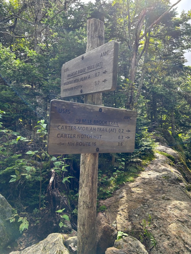
I made really good time (for me) and got to the junction in just over two hours. I was heading to the Carter-Moriah Trail, with a stop at the hut. The last time I went this direction on this trail, it was after my legs had seized up and it was sort of weird to be back.
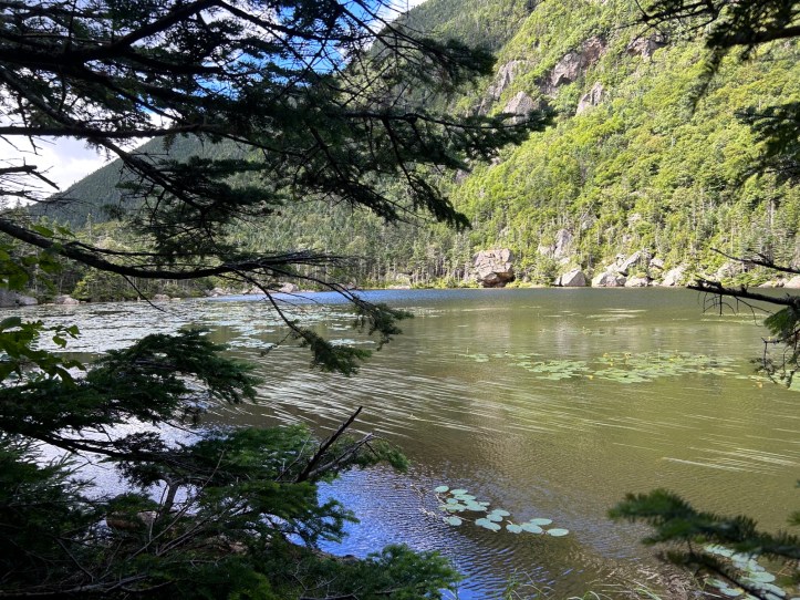
On the plus side, I was actually able to take some photos of Carter Lake this time and enjoy the view.

I also got the best photo I could of the hut. Carter Notch Hut is small and nestled in. Oddly, no one was at the hut except one croo member. (I had seen two croo members earlier on the trail as they packed stuff out on their huge boards!) I don’t think I’ve ever gone in a hut when no one else was there unless it was winter and they were closed. I guess 10:15 is that magic time when everyone has left for the morning and no one yet has arrived. I did see two hikers approach as I left. I was in and out pretty quickly. I bought a piece of apple cake, used the bathroom, and refilled one of my water bottles.

I believe that’s Pulpit Rock (the pointy boulder sticking out right of center), I would be heading there next.
But not before I had to ascend the “very steep climb”.

As always, the photos don’t do the steepness justice.

And here’s Pulpit Rock. (The sticky outy rock).
Finally, the summit. There were a couple of cairns, so I took selfies with both to be sure.


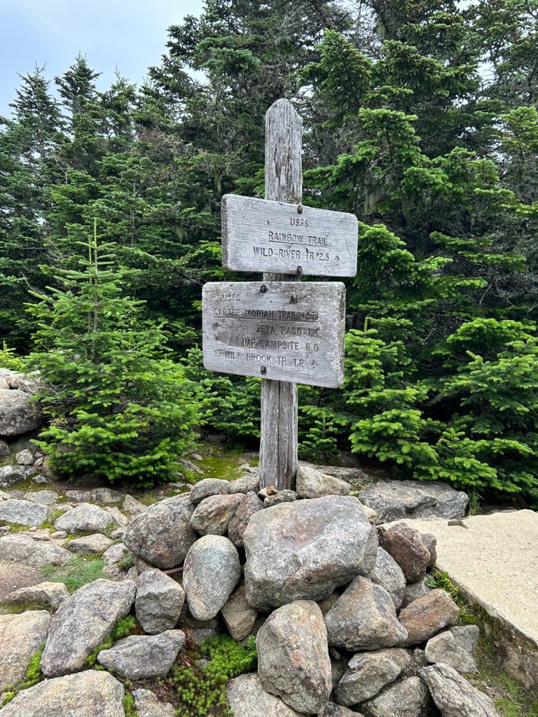


There used to be a firetower. All along the trail at the summit you can see the bottoms of posts in concrete slabs. Over in the woods, you can see what must be the posts from the firetower. Also please note the sign for the Rainbow Trail! We’ll have to get Rainbow there soon!
I was doing a loop at the top, so rather than head back, I was continuing on to Mt. Hight.


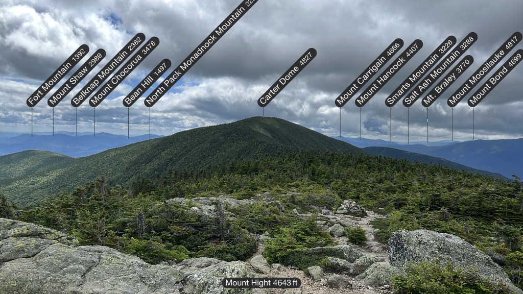
360 degree views, and as you can see, you can see a lot of mountains. It’s always cool to me when I can see mountains I’ve hiked (Kearsarge North, Boott Spur, Waumbek, Shaw, Chocorua, Carter Dome, Carrigain,Hancock, Moosilauke, Bond). And some I’ll be hiking soon (Middle Carter, Madison, Adams, Jefferson, Washington).
I continued on to Zeta pass, then Carter Dome Trial, which met back up with Nineteen-Mile Brook trail. The trail was pretty quiet, although it was a Monday.
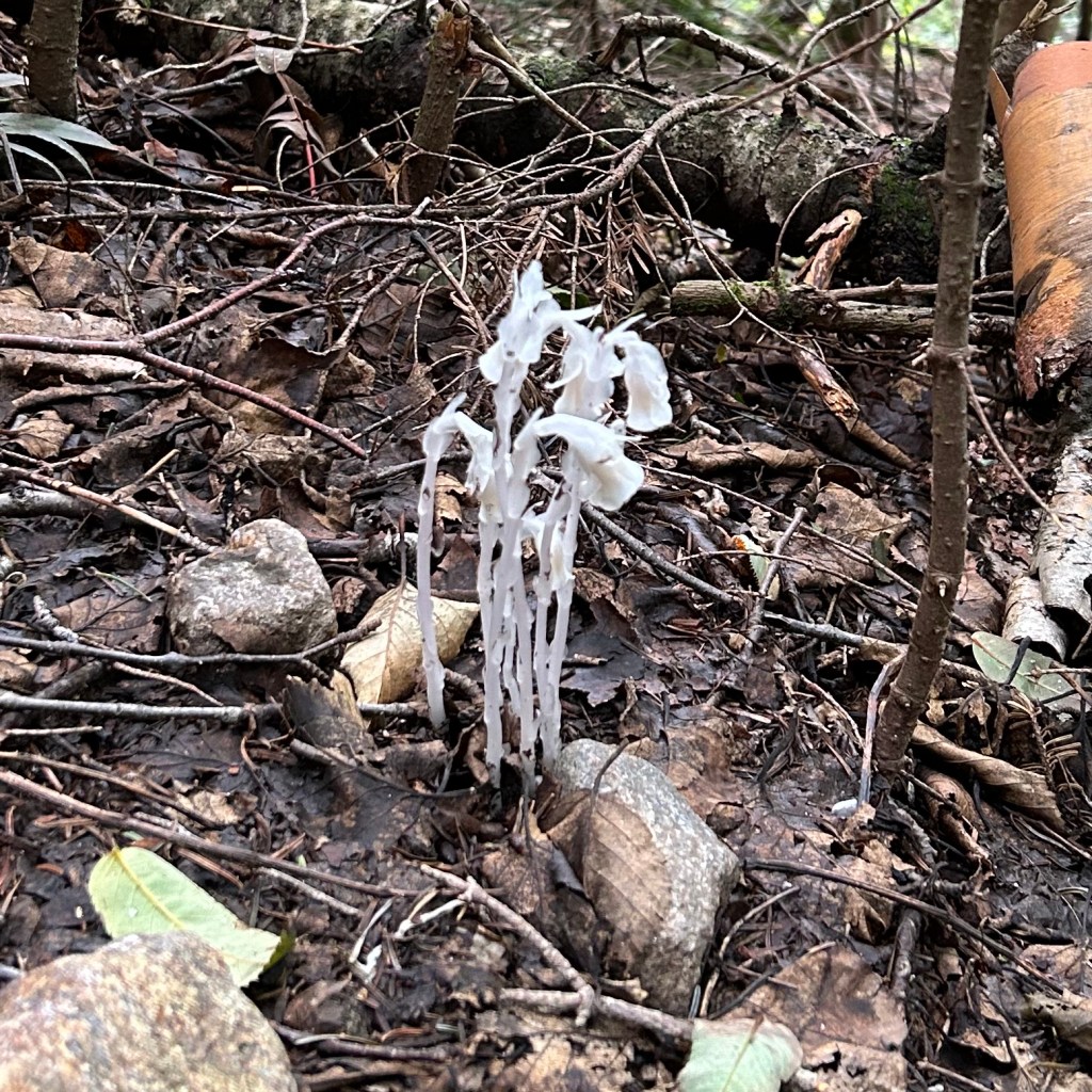


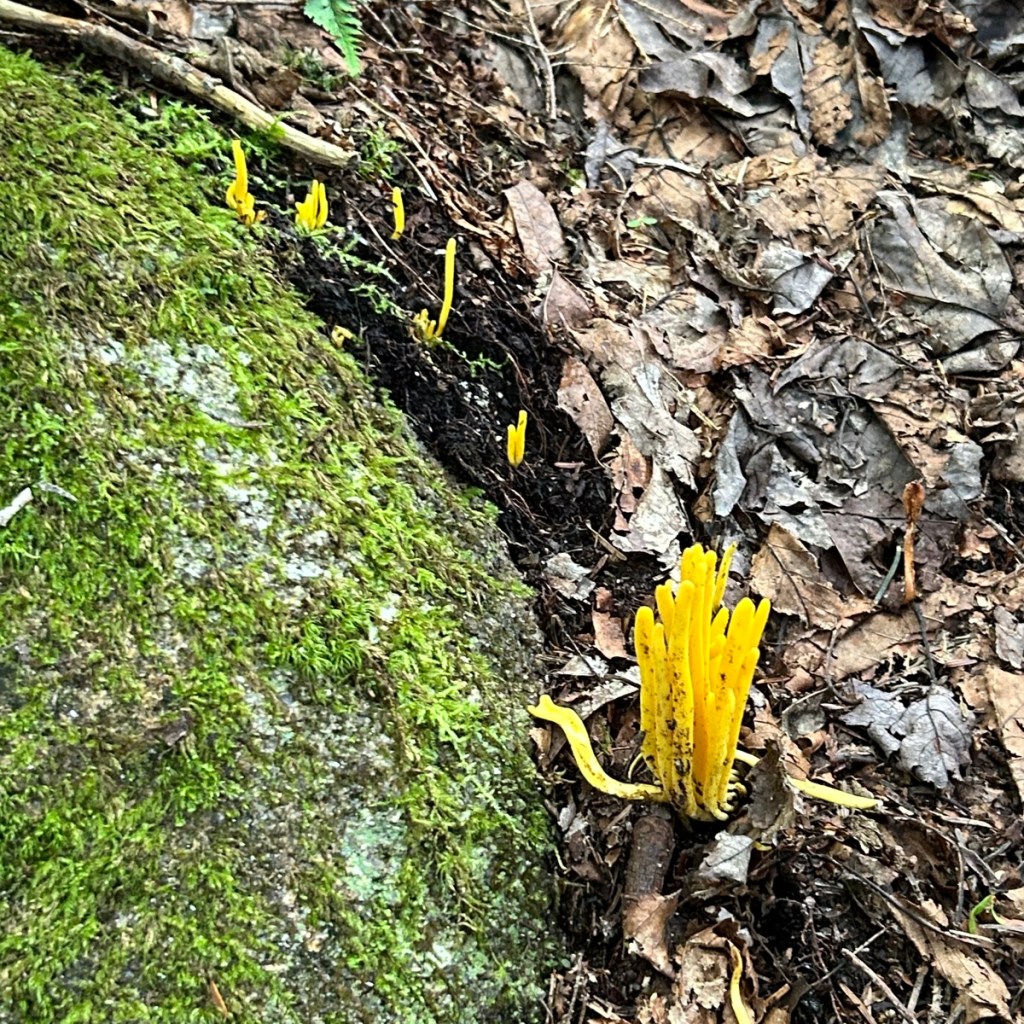

Top left, another ghost pipe! Top middle I think is elephant ear. The other two fungus, I don’t know. And of course bottom right, is a catepillar!
42 down, six to go!
- Total distance: 10.2 miles
- Elevation gain: 3600 feet
- Total time: 9 hours, 53 minutes
- Moving time: 8 hours, 16 minutes
