Last month, Rainbow and I planned to go on a hike. We were going to do Hedgehog again, since it’s a nice, relatively easy winter hike, with nice views. We had done it before, back in March, 2020 (so long ago! Pre-Covid!). So, March, 2023 we planned to meet at the trailhead and hike Hedgehog again. Only I managed to leave my snowshoes and my poles at home by the door. In my defense, I HAVE A LIST. That I meticulously check off before every hike. And for the first (and now last) time ever, I checked off my poles and snowshoes the night before since they were BY THE DOOR. Only, I have a new cat and she was lurking while I packed up the car that morning and so I rushed out the door and drove off, leaving my poles and snowshoes behind. I didn’t realize until I met up with Rainbow at the trailhead.
We thought we’d give it a shot and see how conditions were. Sometimes a trail can be so packed down that people “bare boot” it. We went in the first 1/4 mile until the first junction and it got too mushy after that (and I didn’t have my poles, which would have been worse than not having my snowshoes), so we turned around and went for a nice 3 mile walk over at Lincoln Woods, which was mostly flat and completely packed down.
Fast forward a month, and Rainbow and I decided to meet and try again. This time I brought my snowshoes and my poles! Hooray!
We met at 10AM. Longer daylight and not needing to worry about parking on a Monday meant we could start later. Weird side note about Hedgehog… AllTrails has “UNH Trail to Hedgehog Mountain” listed, which is correct. Usually, you can click Directions, and Open in Google maps, and it puts the coordinates for the trailhead, and off you go. Which it does. But about 10 minutes into my two hour drive, Google suddenly tells me it’s 15 minutes less time. And when I “arrive”, I’m not at the trailhead. The trailhead is off the Kancamangus highway. For whatever reason, it will change the destination to somewhere on Route 16 around Ossippee. Luckily, I’ve been there before so I knew that was wrong. But it’s done it multiple times now, both a month ago and today.
Anyway, excited to be on the trail, and have all of my equipment, we started off. We came to a junction and I checked my little notecard that I make for every hike, that has highlights of the hike. Usually things like “turn left at the junction” or “water crossing at 1.2 miles”. The hike is a “lollipop” so it goes out, then has a loop. I wanted to confirm we’d be going clockwise. It said left at the junction, so that’s what we did.
We came to two water crossings, which weren’t bad, but I didn’t remember water crossings last time. I didn’t remember writing about water crossings on my card. They weren’t bad, however, so we crossed and continued.
A bit further on, we saw a gentleman coming towards us. We asked how it was. He replied “flat”, which seemed a bit odd. He continued that he’d gone the wrong way and missed a junction, since he came out at the next parking area/trailhead over. We pulled out our phones to check and see where the trail was that he missed. Only to realize, that junction wasn’t THE junction. We were supposed to go right. We weren’t supposed to have had any water crossings. Oops. So we went back the way we came. Having added an extra 3/4 of a mile or so to our hike. We joked that we were channeling Right Turn, since she wasn’t with us.
Now that we were on the right trail, I was in the lead when I was startled seeing what I thought was a snake.
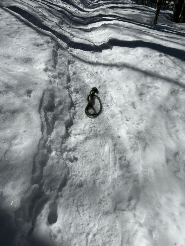
The snake was just a dog leash. We had seen a hiker with their dog (off leash) in the parking lot. We guessed this was theirs and left it so she would see it on her descent and grab it.
We continued on. We discovered that not hiking all winter, apparently makes you out of shape for hiking. And decided we both need to be hiking more if we’re going to be ready for our summer plans.
We had stopped for a snack on the trail. Literally, on the trail. It was a Monday and thus far we’d only seen two people. Of course, sitting on the trail eating our snack is the only time we saw anyone else, a couple descending the trail.
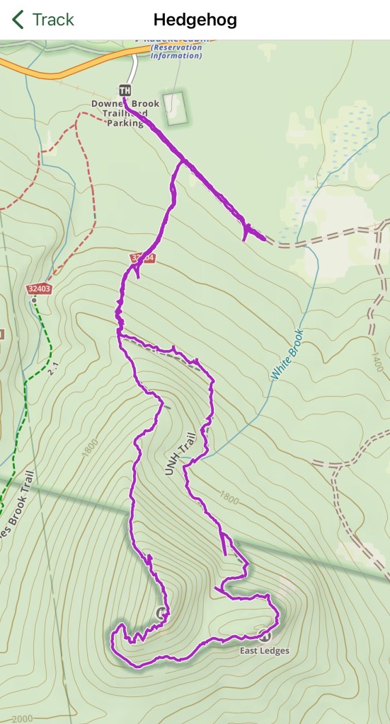
Snack complete and we kept going. Hedgehog is different than many of the summits in New Hampshire. It’s sort of two summits. Since we were going clockwise, we headed up to the East Ledges. Which you can see on the below image means we sort of go up and around to the ledges. There is a lot of up and down, and it feels like you’re going away from the summit for much of the hike. Of course, because you are going away from the summit. An amusing note about the map, since I’ve included it. The green line is the line between the White Mountain National Forest and the Sandwich Range Wilderness. It cracks me up that it’s a straight line until the trail for Hedgehog and then it looks like the WMNF just said “Nope, that’s ours, you can’t have it”. Additional amusing note, you can see the extra out and back we did before we were supposed to turn right.
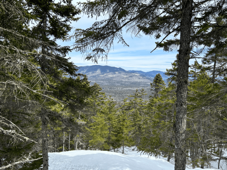
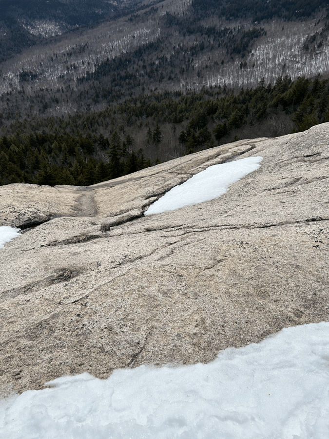
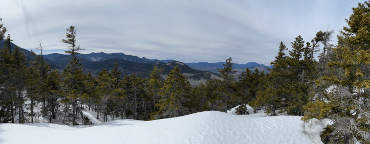
As we did that curve around before the ledges, there were some occasional nice views.
Before popping out onto the ledges, we found a nice little sheltered area under a tree where we stopped for lunch. We could see just a few feet out to the ledges, where the wind REALLY picked up. Like lean forward so you can keep walking kind of picked up. After lunch, we crossed the ledges. Not too many photos here, as I said it was windy and much colder than the rest of the hike had been.
My view off the ledge.
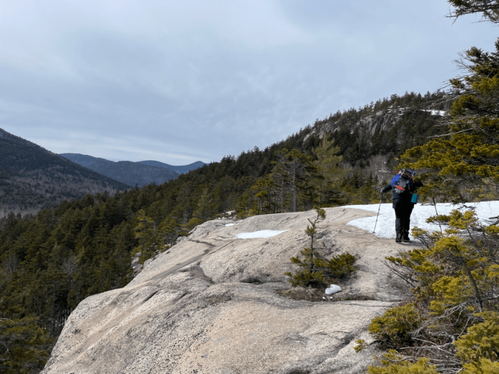
Rainbow’s view (and photo) of me crossing part of the ledges.
Ledge selfie.
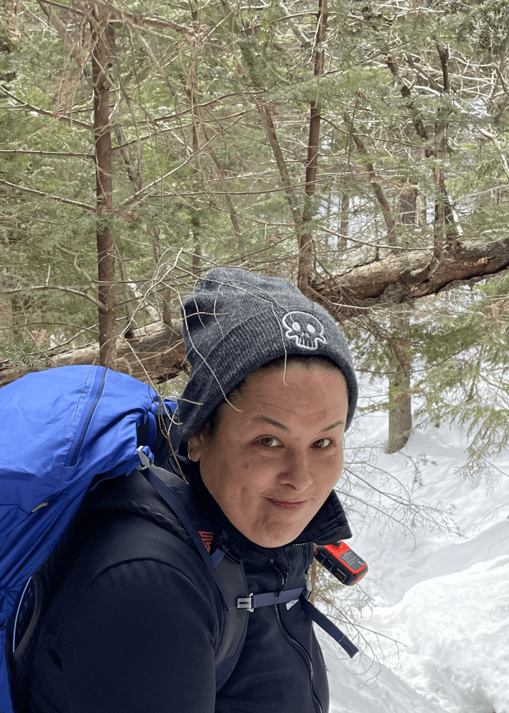
Back into the trees (and out of the wind!) and time to loop all the way around to get to the actual summit. It’s hard to see in this photo taken by Rainbow, but I have no less than three twigs/branches stuck to my hat.
Just before the summit, there is another nice viewpoint.
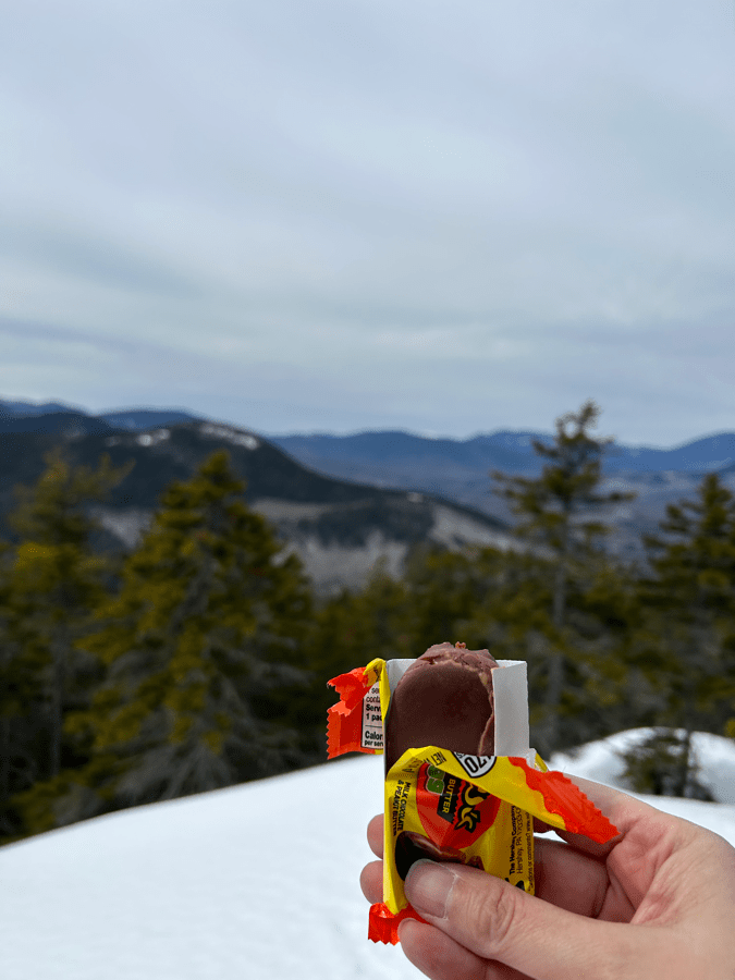
And my almost summit snack (can’t have these in summer because they melt!)
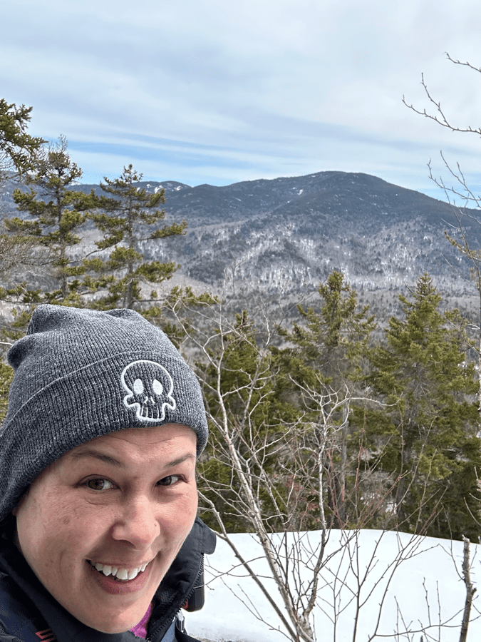
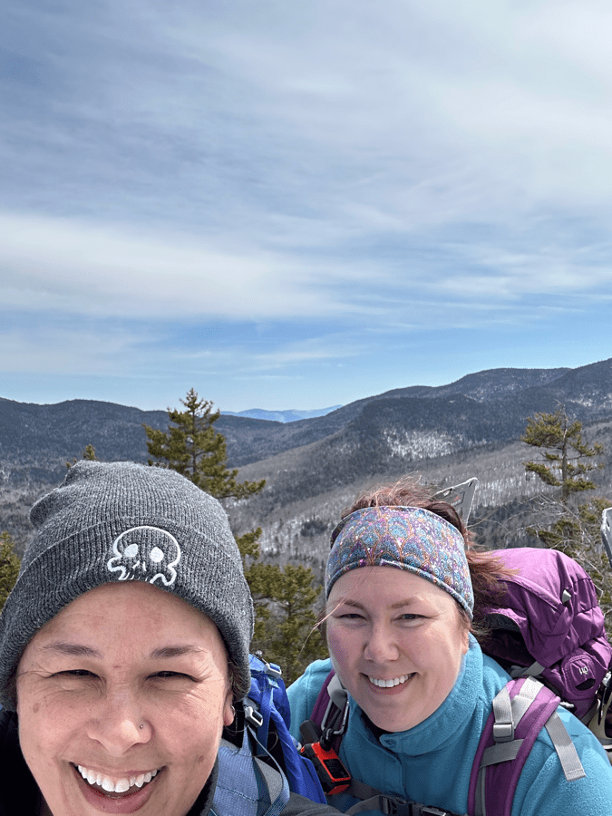
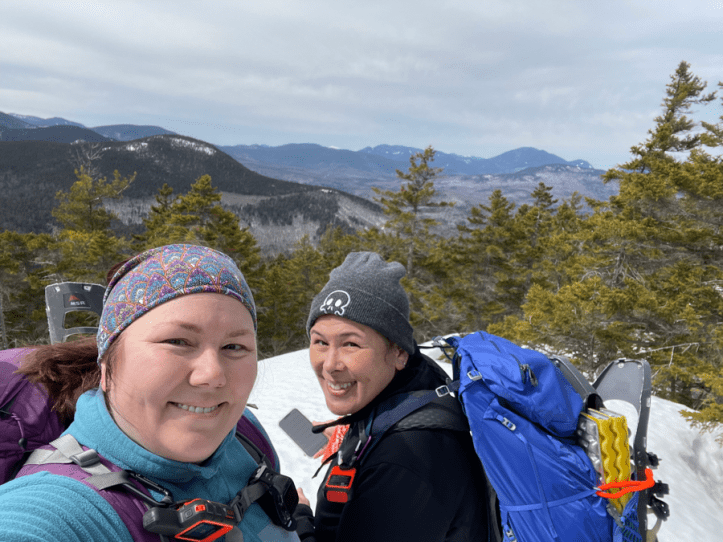
Almost summit selfie with Rainbow (photo credit Rainbow)…
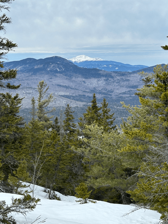
And a great view of Mount Washington. If all goes according to plan, we’ll be up there this August!
After that, it was time to descend. The descent was fairly easy. One little steep bit that someone else had clearly butt slid down, so we did the same. Other than that it was on our feet for the descent.
Stats, including the “bonus” hike in the wrong direction:
- Distance: 5.9 miles (usually 4.7)
- Elevation: 1,512 feet (usually 1,400)
- Total time: 5 hours, 12 minutes
- Moving time: 3 hours, 57 minutes
